Maps of Indiana tend to be an invaluable part of ancestors and family history research, especially if you live far from where your ancestor lived. Because Indiana political boundaries oftentimes changed, historic maps tend to be important in assisting you find out the exact location of your ancestor’s hometown, exactly what land they owned, who their neighbors were, and more.
Maps of Indiana are likely to be an exceptional source for getting started with your research, since they provide considerably beneficial information and facts instantly. Indiana Maps can be a major source of substantial amounts of information on family history.
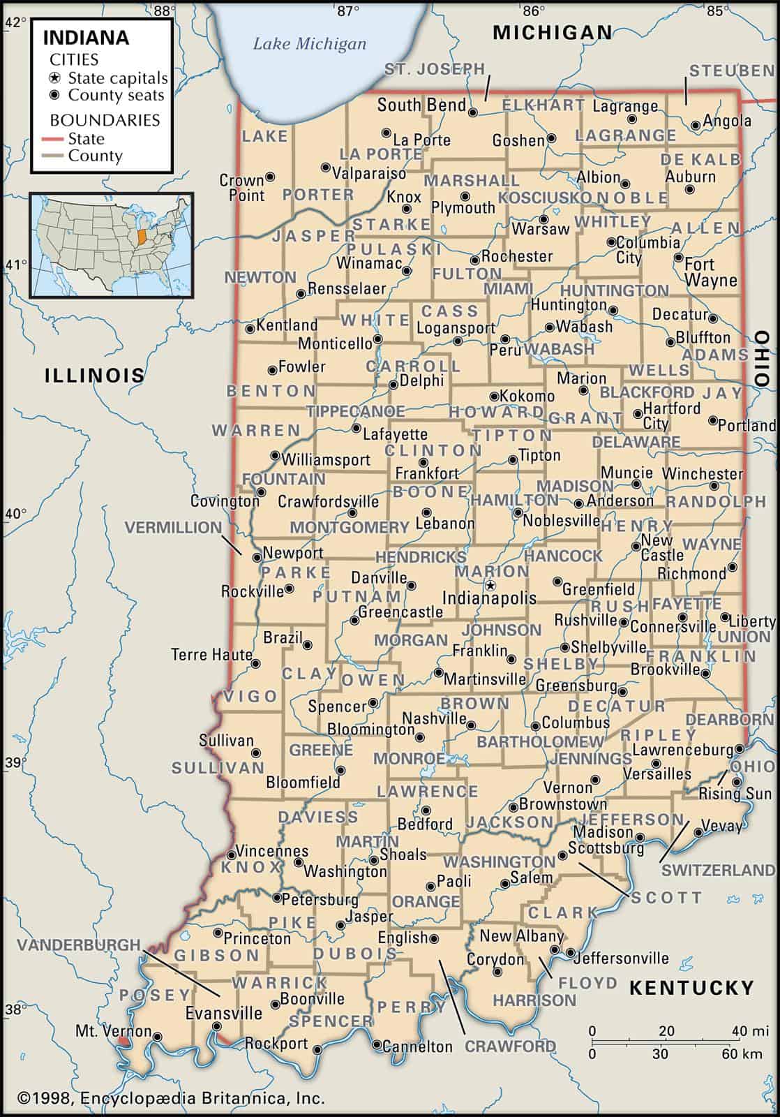
Indiana borders Michigan, Illinois, Ohio and Kentucky. Indiana’s 10 largest cities are Indianapolis, Fort Wayne, Evansville, South Bend, Hammond, Bloomington, Gary, Carmel, Fishers and Muncie.
Learn more about Historical Facts of Indiana Counties.
Interactive Map of Indiana County Formation History
-
Old Antique Atlases & Maps of Indiana
Disclaimer: All Indiana maps are free to use for your own genealogical purposes and may not be reproduced for resale or distribution. Source: David Rumsey Historical Map Collection
Indiana Map Links
- Indiana State Parks Map (mapofus.org)
- Indiana Lakes and Rivers Map (mapofus.org)
- Indiana Map With Cities and Highways (mapofus.org)
- Historical Maps of Indiana(alabamamaps.ua.edu)
- Indiana Digital Map Library (usgwarchives.net
- Historic Indiana Atlases (indiamond6.ulib.iupui.edu)
- Illinois Maps, Atlases & Gazetteers
(ancestry.com)
- Indiana Maps – The Perry-Castañeda Library Map Collection (lib.utexas.edu)
- U.S., Indexed County Land Ownership Maps, 1860-1918
- American Memory Map Collection: 1500-2004 (memory.loc.gov)
- Indiana Map Books (amazon.com)