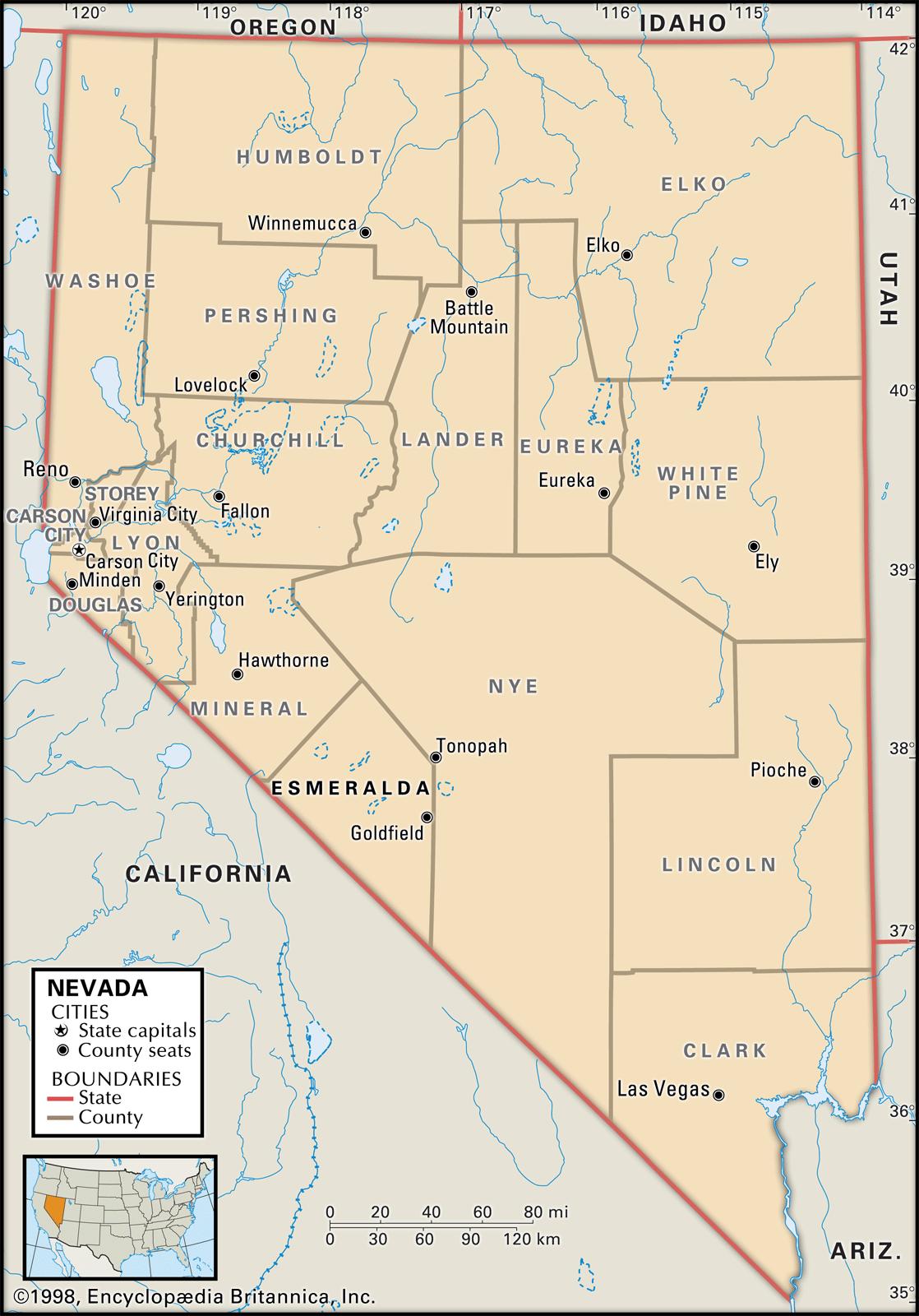
Maps of Nevada are a very helpful part of ancestral and family history research, particularly in the event that you live far away from where your ancestor lived.
Given that Nevada’s political borders have often changed over the years, historic maps are extremely valuable in helping you uncover the exact location of your ancestor’s hometown, just what land they owned, who their neighbors happen to be, and much more besides.
Maps of Nevada are an outstanding resource when it comes to getting started with your own research because they give important information and facts right away and present them in a clear and understandable format.
Nevada borders Arizona in the southeast, California, Idaho, Oregon, and Utah. Nevada’s 10 largest cities are Las Vegas, Henderson, Reno, Paradise, North Las Vegas, Sunrise Manor, Spring Valley, Enterprise, Sparks, and Carson City.
Learn more historical facts about Nevada counties here.
Interactive Map of Nevada County Formation History
AniMap Plus 3.0, with the permission of the Goldbug Company
List of Every Nevada County
Carson City
Established in 1861, Carson City is the capital of Nevada and an independent city that is not part of any county. Its population was estimated to be 55,414 in 2020.
Churchill County
Founded in 1861, Churchill County is located in western Nevada and has a population of approximately 24,877 as of 2020.
Clark County
Established in 1909, Clark County is the most populous county in Nevada, with a population of around 2.38 million as of 2020. It is home to the city of Las Vegas and many popular tourist destinations.
Douglas County
Douglas County is located in western Nevada and was founded in 1861. It has a population of approximately 49,456 as of 2020.
Elko County
Established in 1869, Elko County is situated in northeastern Nevada and has approximately 53,856 residents as of 2020. It is known for its mining and ranching industries.
Esmeralda County
Founded in 1861, Esmeralda County is located in southwestern Nevada and is home to around 739 people as of 2020. It is the least populous county in Nevada.
Eureka County
Established in 1873, Eureka County is situated in central Nevada and has a population of approximately 2,020 as of 2020. It is famous for its mining industry.
Humboldt County
Founded in 1856, Humboldt County is located in northern Nevada and has approximately 17,497 residents as of 2020. It is well-known for its mining and ranching industries.
Lander County
Lander County is located in central Nevada and was established in 1861. It has a population of around 5,461 as of 2020. It is known for its mining and ranching industries.
Lincoln County
Established in 1866, Lincoln County is situated in southeastern Nevada and is home to approximately 6,842 people as of 2020. It is much loved for its outdoor recreation opportunities, such as hiking and camping.
Lyon County
Founded in 1861, Lyon County is located in western Nevada and has a population of roughly 59,279 as of 2020. It is celebrated for its mining and agricultural industries.
Mineral County
Mineral County is situated in southwestern Nevada and was established in 1911. It has a population of approximately 4,369 as of 2020. It is acclaimed for its mining industry.
Nye County
Founded in 1864, Nye County is located in southern Nevada and has around 48,703 residents as of 2020. It is known for its mining and outdoor recreation opportunities, such as hiking and off-roading.
Pershing County
Established in 1919, Pershing County is situated in northern Nevada and is home to approximately 6,745 people as of 2020. It is valued for its mining and ranching industries.
Storey County
Storey County was established in 1861 and is located in western Nevada. It has a population of roughly 4,583 as of 2020. It is known for its mining industry and its historic town of Virginia City.
Washoe County
Founded in 1861, Washoe County is located in western Nevada and has a population of approximately 479,269 as of 2020. It is home to the city of Reno and is known for its outdoor recreation opportunities, such as skiing and hiking.
White Pine County
White Pine County is situated in eastern Nevada and was established in 1869. It has around 9,376 residents as of 2020. It is known for its mining and outdoor recreation opportunities, such as camping and fishing.
Lake County
Established in 1861, Lake County was dissolved in 1871 and absorbed into Washoe County.
Ormsby County
Founded in 1861, Ormsby County was dissolved in 1969 and merged with Carson City.
Roop County
Roop County was established in 1861. It was dissolved in 1864 and split between Washoe and Lassen Counties.
St. Clair County
Established in 1861, St. Clair County was renamed Lyon County in 1862.
Lake Tahoe County
Founded in 1861, Lake Tahoe County was dissolved in 1864 and split between Ormsby, Douglas, and Carson Counties.
Pah-Ute County
Pah-Ute County was established in 1866. It was dissolved in 1871 and split between Mohave County in Arizona and Lincoln County in Nevada.
Bullfrog County
Founded in 1987, Bullfrog County was never fully organized and was dissolved in 1989.
Old Antique Atlases & Maps of Nevada
Disclaimer: All Nevada maps are free to use for your own genealogical purposes and may not be reproduced for resale or distribution.
Source: David Rumsey Historical Map Collection
-

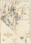
1866 Map of the State of Nevada
-

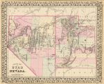
1880 County map of Utah and Nevada
Nevada Map Links
- Nevada State Park Map (mapofus.org)
- Nevada Lakes and Rivers Map (mapofus.org)
- Nevada Map With Cities and Highways (mapofus.org)
- Nevada Digital Map Library (usgwarchives.net)
- Old Historical Maps of Nevada (alabamamaps.ua.edu)
- Nevada Maps, Atlases & Gazetteers (ancestry.com)
- Nevada Maps – The Perry-Castañeda Library Map Collection (lib.utexas.edu)
- U.S., Indexed County Land Ownership Maps, 1860-1918 (ancestry.com)
- American Memory Map Collection: 1500-2004 (memory.loc.gov)
- Nevada Map Books (amazon.com)

