In the heart of the arid deserts and shimmering landscapes of the Silver State lies a paradox – Nevada’s rivers and lakes, which seem like ethereal oases in the midst of its rugged terrain. Known for its vibrant entertainment and desert allure, Nevada unveils a hidden facet – a network of waterways that defy expectations and reveal a different kind of beauty.
Like secrets whispered in the desert winds, Nevada’s rivers and lakes carry tales of scarcity, survival, and the undeniable allure of life-giving water. In this article, we embark on an exploration that navigates the courses of Nevada’s rivers and contemplates the quiet depths of its lakes.
Join us as we uncover the significance of these aqueous mysteries, unveiling their ecological importance, recreational potential, and their role as enigmatic symbols within the Silver State’s narrative – a narrative that sparkles not only with the lights of Las Vegas but also with the reflective surfaces of Nevada’s waterways.
Printable Nevada Lakes and Rivers Map
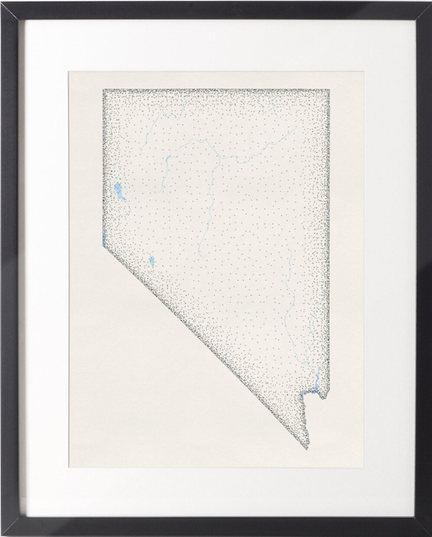
Rivers
Humboldt River

The Humboldt River is an extensive river drainage system located in north-central Nevada and is the only major river system wholly contained within the state of Nevada. It extends in a general east-to-west direction from its headwaters in the Jarbidge, Independence, and Ruby Mountains in Elko County, to its terminus in the Humboldt Sink, approximately 225 direct miles away in northwest Churchill County.
The river has historically provided a route for westward migration, and two major railroad routes loosely follow its path, while Interstate 80 follows the river’s course from its source to its mouth.
Virgin River
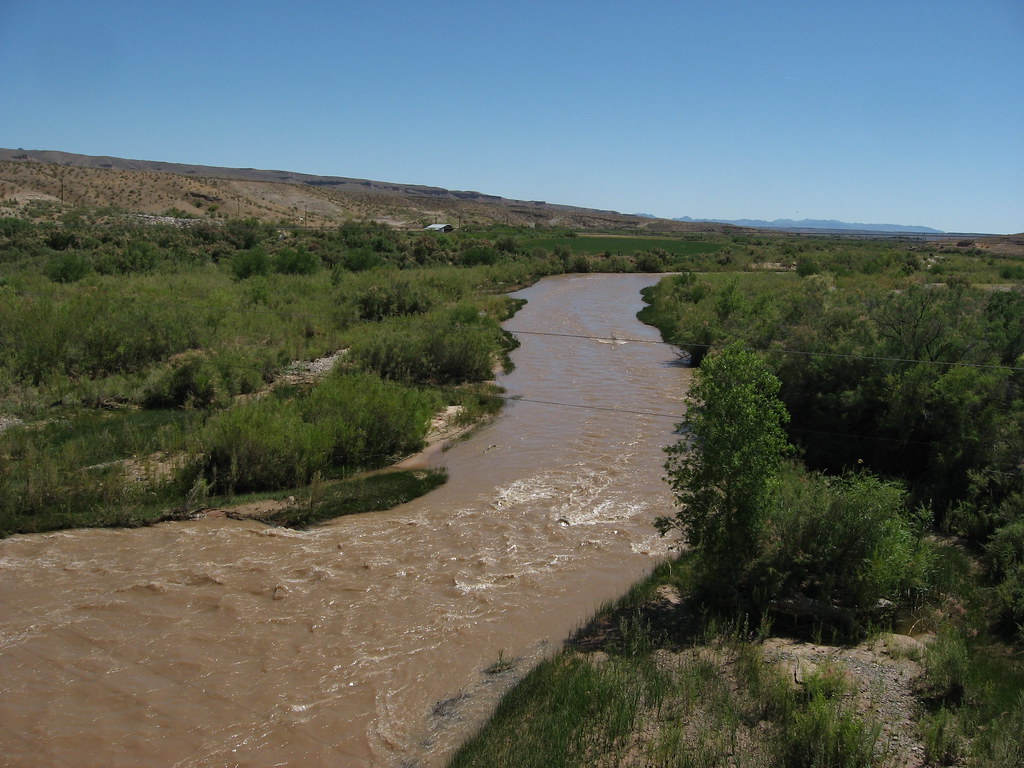
The Virgin River is a 162-mile-long tributary of the Colorado River in the U.S. states of Utah, Nevada, and Arizona, and was designated Utah’s first wild and scenic river in 2009, during the centennial celebration of Zion National Park.
Its origin is in Southwestern Utah, at the Navajo Reservoir in the Dixie National Forest, north of Zion National Park, and is formed by the confluence of the East Fork Virgin and the North Fork Virgin River.
The river then flows across the northwestern corner of Arizona through the Virgin River Gorge and past the towns of Beaver Dam and Littlefield before entering southern Nevada near the town of Mesquite and emptying into Colorado at the Lake Mead reservoir, approximately 40 miles east of Las Vegas, with the last 30 miles forming the north arm of Lake Mead.
Reese River
The Reese River is a 181-mile-long tributary of the Humboldt River, located in central Nevada in the western United States, and is named after John Reese, who explored the area in 1854 as part of the expedition of Colonel Edward Steptoe, and who later served as a guide to Captain James H. Simpson’s survey of a military road through central Nevada.
The Reese rises in the southern section of the Toiyabe Range, on the flanks of Arc Dome, and in its upper reaches, it is a fast-flowing mountain stream surrounded by relatively lush growth.
However, once it exits the Toiyabe Range, it becomes a slow, muddy stream, and its waters are used for irrigation by scattered farms and ranches along its lower reaches, with Nevada State Route 305 paralleling the lower, usually dry portion of the channel from the Austin area to Battle Mountain.
Quinn River
The Quinn River, once known as the Queen River, is an intermittent river in the desert of northwestern Nevada, approximately 110 miles long, and drains an enclosed basin inside the larger Great Basin.
It rises in northeastern Humboldt County, on the west side of the Santa Rosa Range, just south of the Oregon state line, and its course flows southwest, through the main Nevada lands of the Fort McDermitt Paiute and Shoshone Tribes, and then south and southwest, receiving the Kings River flowing south from Kings River Valley. The Quinn River evaporates in a sink at the Black Rock Desert, south of the Black Rock Range.
Truckee River

The Truckee River is a 121-mile-long river in the U.S. states of California and Nevada and is the sole outlet of Lake Tahoe, draining part of the high Sierra Nevada and emptying into Pyramid Lake in the Great Basin.
Its source is the outlet of Lake Tahoe, at the dam on the northwest side of the lake near Tahoe City, California, and it flows generally northeast through the mountains to Truckee, California, then turns sharply to the east and flows into Nevada, through Reno and Sparks and along the northern end of the Carson Range, with its waters being an important source of irrigation along its valley and adjacent valleys.
It empties into the southern end of Pyramid Lake, a remnant of prehistoric Lake Lahontan, in northern Washoe County in the Pyramid Lake Indian Reservation.
Carson River
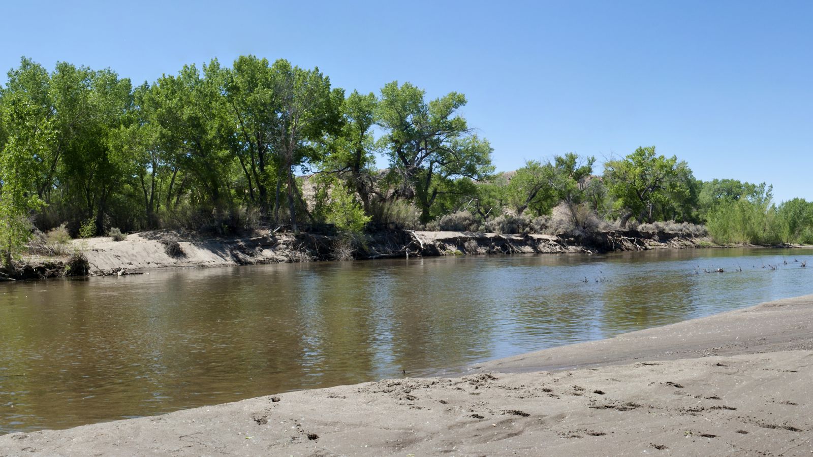
The Carson River is a 131-mile-long northwestern Nevada river that empties into the Carson Sink, an endorheic basin, although the addition of the East Fork makes the total length 205 miles, traversing five counties and the Consolidated Municipality of Carson City.
The river is named for Kit Carson, who guided John C. Frémont’s expedition westward up the Carson Valley and across Carson Pass in the winter of 1844. However, the river made the National Priorities List (NPL) on October 30, 1990, as the Carson River Mercury Superfund site (CRMS) due to investigations that showed trace amounts of mercury in the wildlife and watershed sediments.
White River
The White River is a small and discontinuous 138-mile-long river located in southeastern Nevada, notable for several endemic species of fish, and was named for F. A. White, a 19th-century explorer.
It begins at the Great Basin Divide in the White Pine Range near Ely, where it is fed by snowmelt and springs from Currant Mountain, passing by the towns of Preston and Lund, flowing south through the White River Valley for about 40 miles, and providing water for a string of reservoirs along its course in the Sunnyside area.
It then flows again in the Pahranagat Valley for about 30 miles, passing close by Alamo, feeding Upper Pahranagat Lake and the marshes between it and the lower lake, and continues into Coyote Springs Valley, becoming the Pahranagat Wash, which in turn connects to the Muddy River and thence to Lake Mead.
Muddy River

The Muddy River, formerly known as the Moapa River, is a short river located in Clark County, in southern Nevada, United States, and is approximately 32 miles long. It begins as a series of thermal springs in the Moapa Valley before continuing on its course to Lake Mead, where it drains into the northern arm of the lake near Overton, Nevada.
Before the Hoover Dam’s construction, the Muddy River flowed into the Virgin River. The river collects the flow from the Meadow Valley Wash near the town of Glendale, forming the principal drainage system for southeastern Nevada.
Walker River
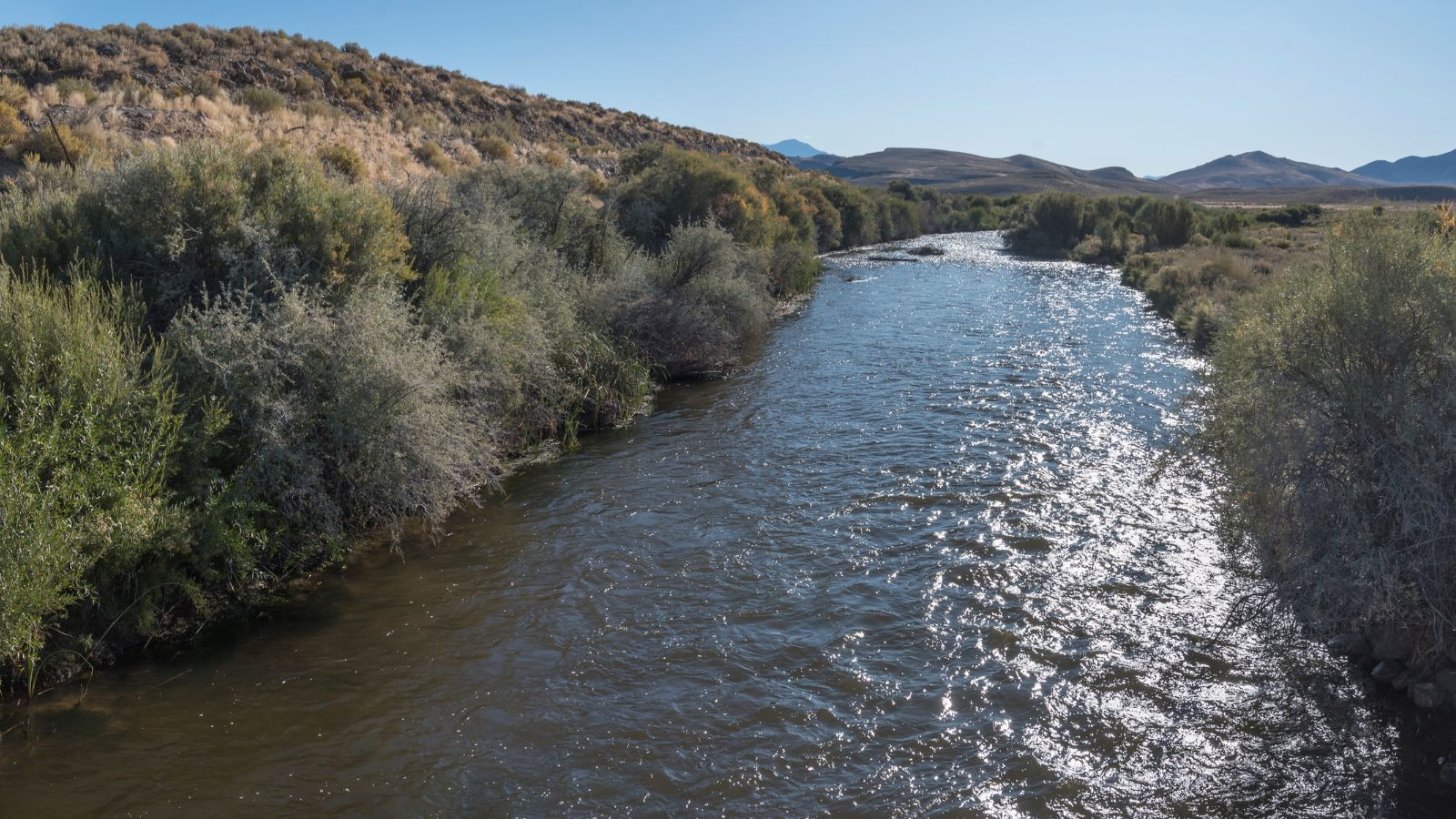
The Walker River is a 62-mile-long river in west-central Nevada, fed principally by snowmelt from the Sierra Nevada of California, and drains an arid portion of the Great Basin southeast of Reno and flows into the endorheic basin of Walker Lake.
The river is an important source of water for irrigation in its course through Nevada, and water diversions have reduced its flow such that the level of Walker Lake has fallen 160 feet between 1882 and 2010. The river was named for explorer Joseph Reddeford Walker, a mountain man and experienced scout who is known for establishing a segment of the California Trail.
The Walker River is formed in southern Lyon County, 9 miles south of Yerington, by the confluence of the East Walker and West Walker rivers, with the West Walker River originating at Tower Lake in Mono County, California, and flowing north through a rugged canyon which provides the route for U.S. Route 395.
Owyhee River
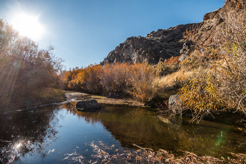
The Owyhee River is a 280-mile-long tributary of the Snake River located in northern Nevada, southwestern Idaho, and southeastern Oregon in the United States, and its drainage basin is 11,049 square miles in area, one of the largest sub-basins of the Columbia Basin.
The river rises in northeastern Nevada and flows generally northward near the Oregon-Idaho border to the Snake River, draining a remote area of the arid plateau region immediately north of the Great Basin, and its watershed is very sparsely populated. The Owyhee River and its tributaries flow through the Owyhee Plateau, cutting deep canyons, often with vertical walls and in some places over 1,000 feet deep.
Bruneau River

The Bruneau River is a 153-mile-long tributary of the Snake River, in the U.S. states of Idaho and Nevada, and runs through a narrow canyon cut into ancient lava flows in southwestern Idaho. The Bruneau Canyon, which is up to 1,200 feet deep and 40 miles long, features rapids and hot springs, making it a popular whitewater trip.
The Bruneau River’s drainage basin is bounded by the Jarbidge Mountains to the southeast, the Owyhee Mountains and Chalk Hills to the west, and the Bruneau Plateau to the east, and most of the watershed is characterized by high plateaus through which the Bruneau and its tributaries cut deep, sheer canyons, especially along the middle Bruneau River and the lower reaches of the Jarbidge River, Sheep Creek, and the East Fork Bruneau.
Lakes
Pyramid Lake

Pyramid Lake is the biggest remnant of ancient Lake Lahontan, the colossal inland sea that once covered most of Nevada, and is approximately 27 miles long and 11 miles wide, with a perimeter of 71 miles, covering 112,000 acres entirely enclosed within the Pyramid Lake Paiute Tribe Reservation.
It is the geographic sink of the basin of the Truckee River, 40 miles northeast of Reno, Nevada, and is fed by the Truckee River, which is mostly the outflow from Lake Tahoe. Pyramid Lake is an endorheic lake, with no outlet, and has about 10% of the area of the Great Salt Lake, but it has about 25% more volume.
Lake Tahoe

Lake Tahoe is a freshwater lake in the Sierra Nevada of the Western United States, straddling the border between California and Nevada, and is the largest alpine lake in North America. At 122,160,280 acre⋅ft, it trails only the five Great Lakes as the largest by volume in the United States.
The lake was formed about two million years ago as part of the Lake Tahoe Basin, and its modern extent was shaped during the ice ages. Lake Tahoe is a major tourist attraction in both Nevada and California and is home to winter sports, summer outdoor recreation, and scenery enjoyed throughout the year.
Walker Lake

Walker Lake is a natural lake in the Great Basin in western Nevada in the United States, and is 11 miles long and 5 miles wide, in northwestern Mineral County along the east side of the Wassuk Range, about 75 miles southeast of Reno. The lake is fed from the north by the Walker River and has no natural outlet except absorption and evaporation.
However, more than a century of upstream irrigation diversions of the Walker River have left Walker Lake in a state of ecological collapse, and as inflows have decreased and more water evaporated, the concentration of salts in the lake has increased dramatically, causing Walker Lake to no longer support fish life.
Lake Mead
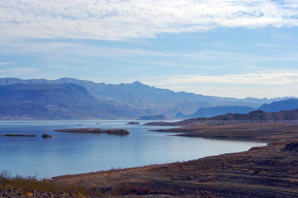
Lake Mead is a reservoir formed by Hoover Dam on the Colorado River in the Southwestern United States and is located in the states of Nevada and Arizona, 24 miles east of Las Vegas. It is the largest reservoir in the US in terms of water capacity, providing water to the states of Arizona, California, and Nevada as well as some of Mexico, providing sustenance to nearly 20 million people and large areas of farmland.
However, the lake has remained below full capacity since 1983 owing to drought and increased water demand, and as of May 31, 2022, Lake Mead held 26.63% of full capacity at 7.517 million acre-feet, having dropped in June 2021 below the reservoir’s previous all-time low of 9.328 million acre-feet recorded in July 2016, and never returning to that level.
Lake Mohave

Lake Mohave is a reservoir on the Colorado River between the Hoover Dam and Davis Dam in Cottonwood Valley defining the border between Nevada and Arizona in the United States, and encompasses 28,260 acres of water with a maximum width of 4 miles wide and an elevation of 647 feet.
This 67-mile stretch of the Colorado River flows past Boulder City, Nelson, Searchlight, Cottonwood Cove, Cal-Nev-Ari, and Laughlin to the west in Nevada and Willow Beach and Bullhead City to the east in Arizona. Lake Mohave and adjacent lands forming its shoreline are part of the Lake Mead National Recreation Area administered by the U.S. National Park Service, as Lake Mead lies to the north of the Hoover Dam.
Lake Lahontan
Lake Lahontan is a reservoir on the Carson River in northwest Nevada in the United States, formed by the Lahontan Dam, built in 1905 by the Bureau of Reclamation as part of the Newlands Reclamation Act and is located between Fallon, Nevada, and Carson City, Nevada.
The flows from the Carson River are augmented by the diversions from the Truckee River, and the reservoir is maintained by the Truckee-Carson Irrigation District. The lake is named after ancient Lake Lahontan, which covered much of northwestern Nevada during the last ice age.
It is situated within the Lahontan State Recreation Area, offering recreational uses such as fishing, pleasure boating, and camping, although consumption of fish from the lake should be limited as it is contaminated with mercury from the Comstock and other mines.
Rye Patch Reservoir
Rye Patch Reservoir is a reservoir on the Humboldt River in the U.S. State of Nevada, located about 22 miles northeast of the town of Lovelock, and is managed by the Pershing County Water Conservation District.
The reservoir stores water for the agricultural area surrounding Lovelock, which is at the far downstream reach of the Humboldt, near the Humboldt Sink. Due to the Lovelock area’s low annual rainfall of 5.76 inches, agriculture requires irrigation, but the high variability of the Humboldt River, which often runs completely dry, means that water storage is necessary for irrigation to be feasible.

