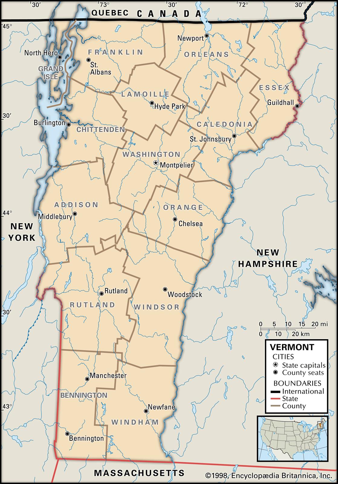
Maps of Vermont are an important tool when it comes to researching your family history, especially if you live far from where your ancestor resided.
Due to the fact that Vermont’s political borders often changed, historic maps are significant in helping you find out the precise location of your ancestor’s hometown, exactly what land they owned, just who his or her neighbors had been, and a great deal more.
Maps of Vermont are an excellent source of research since they give valuable information and facts quickly and display them in a clear and easily understandable form. Vermont Maps can be a major resource for significant amounts of data on family history.
Vermont borders Massachusetts, New Hampshire, New York, and Canada. Vermont’s 10 largest cities are Burlington, Essex, South Burlington, Colchester, Rutland, Bennington, Brattleboro Milton, Hartford, Springfield, Barre, Williston, and Middlebury.
Learn more historical facts about Vermont counties here.
Vermont County Formation Map
AniMap Plus 3.0, with the permission of the Goldbug Company
List of Every Vermont County
Addison County
Established in 1785, Addison County has a population of approximately 37,000 people. It is located in the western part of the state and is known for its scenic beauty and agricultural heritage.
Bennington County
Founded in 1779, Bennington County has a population of around 35,000 residents. Located in the southwestern part of Vermont, it is home to the town of Bennington, which played a significant role in the American Revolution.
Caledonia County
Established in 1792, Caledonia County has a population of about 30,000 people. It is located in the northeastern part of Vermont and is famous for its natural beauty and outdoor recreation opportunities.
Chittenden County
Founded in 1787, Chittenden County is the most populous county in Vermont with a population of approximately 165,000 people. It is located in the northwestern part of the state and is home to the city of Burlington, Vermont’s largest city.
Essex County
Established in 1792, Essex County is the least populous county in Vermont with a population of around 6,000. It is located in the northeastern part of the state and is acclaimed for its pristine natural areas and wildlife.
Franklin County
Founded in 1792, Franklin County has a population of approximately 49,000 residents. It is situated in the northwestern part of the state and is known for its rich agricultural history and outdoor recreation opportunities.
Grand Isle County
Established in 1802, Grand Isle County has a population of about 7,000 people. It is located in the northwestern part of Vermont and is celebrated for its beautiful waterfront areas and picturesque islands.
Lamoille County
Founded in 1835, Lamoille County has a population of around 25,000 residents. It is located in the north-central part of the state and is known for its scenic beauty and outdoor recreation opportunities.
Orange County
Established in 1781, Orange County has approximately 29,000 residents. It is located in the central part of Vermont and is well-known for its historic towns and covered bridges.
Orleans County
Founded in 1792, Orleans County has a population of around 25,000. It is situated in the northeastern part of the state and is much loved for its scenic beauty and outdoor recreation opportunities.
Rutland County
Established in 1781, Rutland County has a population of approximately 58,000 people. It is located in the central part of the state and is known for its natural beauty and historic towns.
Washington County
Founded in 1810, Washington County is home to around 58,000 residents. It is located in the central part of Vermont and is valued for its diverse economy and historic sites.
Windham County
Established in 1781, Windham County has a population of approximately 42,000 people. It is located in the southeastern part of the state and is known for its natural beauty and historic towns.
Windsor County
Founded in 1781, Windsor County has around 55,000 residents. It is located in the central part of Vermont and is famous for its scenic beauty and rich agricultural heritage.
Antique Atlases & Maps of Vermont
David Rumsey Historical Map Collection
- 1795 Map of Vermont
- 1804 Atlas Map of Vermont
- 1814 Map of Vermont
- 1822 Geographical, Historical, And Statistical Map Of Vermont
- 1827 Map of Vermont, New Hampshire, and Maine
- 1836 Atlas Map of Vermont and New Hampshire
- 1845 Map of Vermont and New Hampshire
- 1856 Vermont Map
- 1880 County and township map of the states of New Hampshire and Vermont
Vermont Map Links
- Vermont State Park Map (mapofus.org)
- Vermont Lakes and Rivers Map (mapofus.org)
- Vermont Map With Cities and Highways (mapofus.org)
- Vermont Digital Map Library (usgwarchives.net)
- Old Historical Maps of Vermont (alabamamaps.ua.edu)
- Vermont Maps, Atlases & Gazetteers
(ancestry.com)
- Vermont Maps – The Perry-Castañeda Library Map Collection (lib.utexas.edu)
- U.S., Indexed County Land Ownership Maps, 1860-1918
(ancestry.com)
- American Memory Map Collection: 1500-2004 (memory.loc.gov)
- Vermont Map Books (amazon.com)

