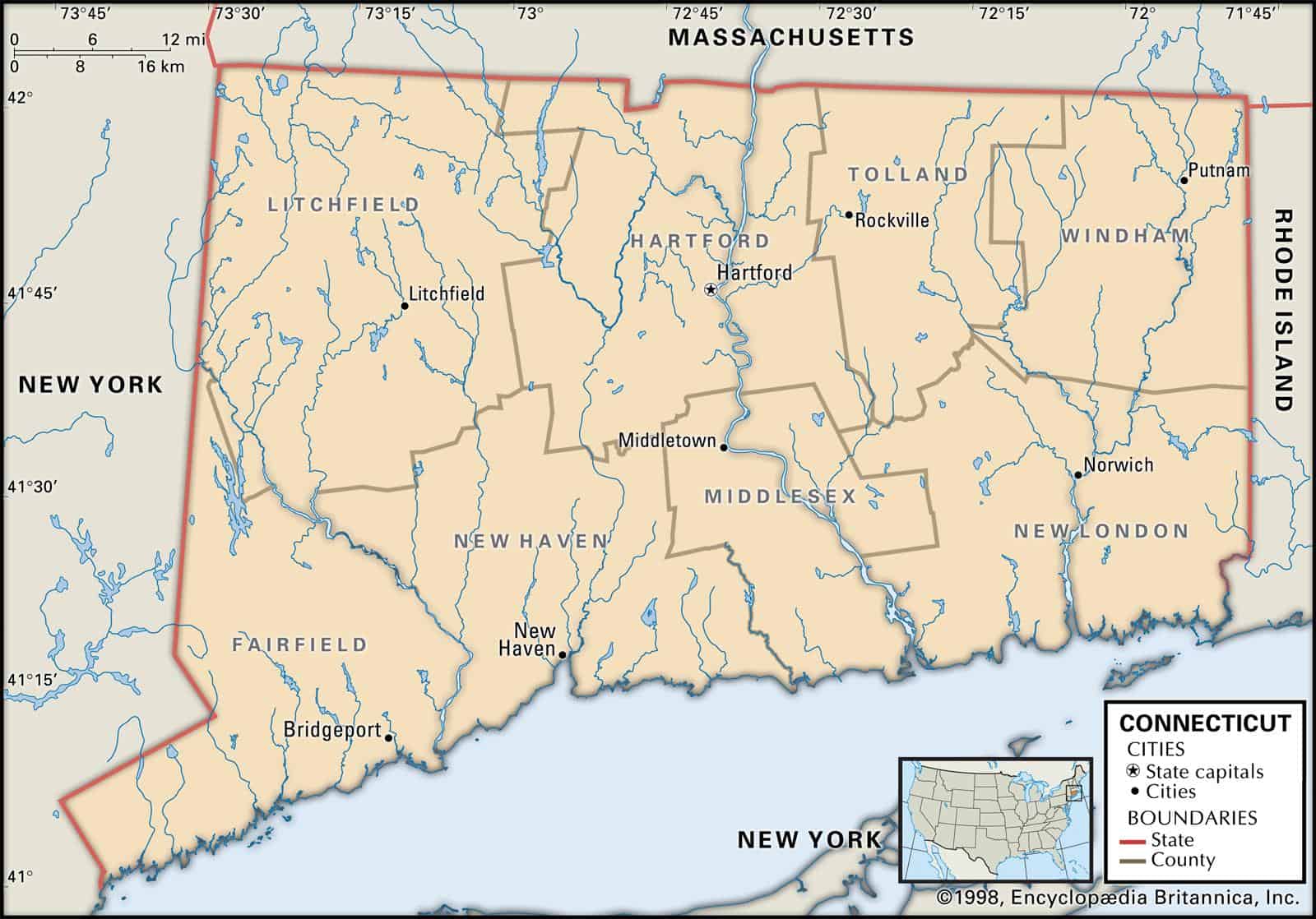
Maps of Connecticut are a vital part of family history research, particularly if you live far from where your ancestor resided.
Because Connecticut’s political boundaries have frequently changed over the years, historic maps are an excellent way to find out the precise location of your ancestor’s hometown, what land they owned, who their neighbors happened to be and much more besides.
Maps of Connecticut are an exceptional tool for getting started with your research, given that they provide accurate information and facts instantly and present them in a clear and easily understandable format.
Connecticut’s 10 largest cities are Bridgeport, New Haven, Hartford, Stamford, Waterbury, Norwalk, Danbury, New Britain, Meriden, and Bristol.
Learn more historical facts about Connecticut counties here.
Interactive Map of Connecticut County Formation History
AniMap Plus 3.0, with the permission of the Goldbug Company
List of Every Connecticut County
Fairfield County
Established in 1666, Fairfield County is located in the southwestern part of the state and is the most populous county with a population of over 943,000.
Hartford County
Founded in 1666, Hartford County is located in north-central Connecticut and has over 892,000 residents. The capital city of Hartford sits within this county.
Litchfield County
Litchfield County is situated in northwestern Connecticut and was established in 1719. It is home to over 182,000 people.
Middlesex County
Established in 1785, Middlesex County is located in the central part of Connecticut and has a population of over 162,000.
New Haven County
Founded in 1666, New Haven County is located in the southern part of the state and has over 854,000 residents. The city of New Haven sits within this county.
New London County
New London County is situated in the southeastern part of Connecticut and was established in 1666. It has a population of over 269,000.
Tolland County
Founded in 1785, Tolland County is located in the northeastern part of Connecticut and is home to over 151,000 people.
Windham County
Established in 1726, Windham County is situated in the eastern part of the state and has over 116,000 residents.
Old Antique Atlases & Maps of Connecticut
Disclaimer: All Connecticut maps are free to use for your own genealogical purposes and may not be reproduced for resale or distribution.
Source: David Rumsey Historical Map Collection
Connecticut Map Links
- Connecticut State Parks Map (mapofus.org)
- Connecticut Lakes and Rivers Map (mapofus.org)
- Connecticut Map With Cities and Highways (mapofus.org)
- Connecticut Digital Map Library (usgwarchives.net)
- Old Historical Maps of Connecticut (alabamamaps.ua.edu)
- Connecticut Maps, Atlases & Gazetteers (ancestry.com)
- Connecticut Maps – The Perry-Castañeda Library Map Collection (lib.utexas.edu)
- U.S., Indexed County Land Ownership Maps, 1860-1918 (ancestry.com)
- American Memory Map Collection: 1500-2004 (memory.loc.gov)
- Connecticut Map Books (amazon.com)