Tucked away in the northeastern corner of the United States, Connecticut boasts a heritage that intertwines seamlessly with its natural allure. While the state is often lauded for its historic significance and charming towns, its aquatic treasures remain a hidden delight.
The rivers and lakes that gracefully traverse Connecticut’s terrain not only provide a scenic spectacle but also tell a tale of tenacity, ingenuity, and interconnectedness. In this article, we embark on an expedition that winds through the watercourses of the state, delving into the narratives that have sculpted its unique character and recognizing the contemporary importance of these aqueous marvels.
Join us in this exploration as we follow the historical currents and immerse ourselves in the reflective stories of Connecticut’s rivers and lakes, uncovering the captivating essence that flows through the Constitution State.
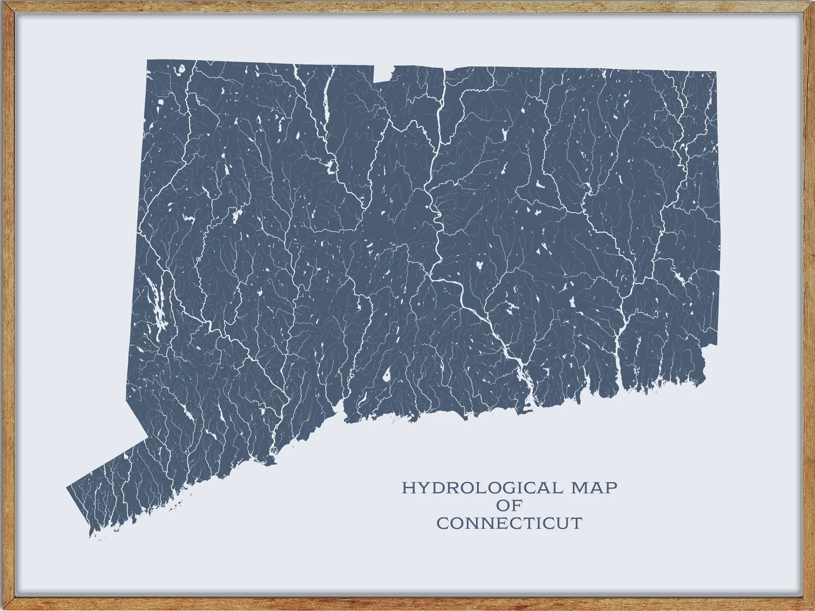
Printable Connecticut Lakes and Rivers Map

Rivers
Connecticut River

The Connecticut River is the longest river in the New England region of the United States, flowing southward for 406 miles through four states and discharging at Long Island Sound. Its watershed covers parts of five U.S. states and one Canadian province, encompassing 11,260 square miles and 148 tributaries, 38 of which are major rivers.
The Connecticut River Valley is known for its productive farmland and is home to the Hartford-Springfield Knowledge Corridor, a metropolitan region of approximately two million people surrounding Springfield, Massachusetts, and Hartford, Connecticut. The river produces 70% of Long Island Sound’s fresh water, discharging at 18,400 cubic feet per second.
Housatonic River

The Housatonic River is a 149-mile-long river that flows through western Massachusetts and western Connecticut, draining about 1,950 square miles of southwestern Connecticut into Long Island Sound. The river flows south to southeast and its watershed is located just to the west of the watershed of the lower Connecticut River.
The Housatonic River is a popular destination for fishing, boating, and other recreational activities, with a diverse range of wildlife living in and around the area. The river is also an important source of hydroelectric power and provides drinking water for many communities in the region.
Thames River

The Thames River is a short river and tidal estuary located in the state of Connecticut, flowing south for 15 miles through eastern Connecticut from Norwich to New London and Groton, where it meets Long Island Sound.
The Thames River watershed includes a number of smaller basins and the 80-mile-long Quinebaug River, which rises in southern Massachusetts and joins the Shetucket River about four miles northeast of Norwich. The river is an important source of water for the region, and its estuary is home to a diverse range of plant and animal life, making it a popular destination for fishing, boating, and other recreational activities.
Quinebaug River

The Quinebaug River is a river that flows through south-central Massachusetts and eastern Connecticut, with its watershed extending into western Rhode Island. The river is about 69 miles long, originating from East Brimfield Lake and ponds northwest of Sturbridge, Massachusetts, and flowing generally southeast and south through Connecticut before joining the Shetucket River northeast of Norwich.
The Quinebaug River is one of the namesake rivers in the Quinebaug and Shetucket Rivers Valley National Heritage Corridor, and it is dammed in its upper reaches for flood control, as well as numerous mill dams which powered mills along the river’s course, some of which still provide hydroelectric power today.
Shetucket River

The Shetucket River is a 20.4-mile-long tributary of the Thames River in eastern Connecticut, formed at Willimantic by the junction of the Willimantic and Natchaug Rivers. The river flows southeast and south, receiving the Quinebaug River approximately 4 miles northeast of Norwich before broadening into a wide estuary that joins the Thames estuary on the south side of Norwich.
Despite the historical presence of industry in the surrounding region, the river flows through a rural section of New England and has been designated by the federal government as part of the Quinebaug and Shetucket Rivers Valley National Heritage Corridor. The National Park Service describes the river valley as the “last green valley” in the Boston-to-Washington megalopolis, with the valley appearing distinctively dark amidst the lights of the surrounding urban and suburban regions in nighttime satellite photos.
Willimantic River

The Willimantic River is a 25-mile-long tributary of the Shetucket River in northeastern Connecticut, formed in northern Tolland County by the confluence of Middle River and Furnace Brook. The river flows south to the city of Willimantic, where it joins the Natchaug River to form the Shetucket.
The river-powered textile mills from Stafford Springs to Willimantic, including the American Thread Company mill, but none of these mills are operating as of 2007, having all been destroyed or converted to other uses such as apartment space. The Willimantic River is also a popular long paddling route, with access points at various bridges along its course.
Farmington River

The Farmington River is a 46.7-mile-long river located in northwest Connecticut with major tributaries extending into southwest Massachusetts, and its watershed covers 609 square miles. The river’s East Branch and West Branch have their headwaters in southwestern Massachusetts, with the West Branch officially beginning north of the Connecticut border.
The river played an important role in small-scale manufacturing in towns along its course, but it is now mainly used for recreation and drinking water. The upper reaches of the river generally flow southward, but the river turns northward in Farmington, Connecticut, and runs mostly north and east until it flows into the Connecticut River in Windsor.
Naugatuck River

The Naugatuck River is a 40.2-mile-long river in Connecticut that flows generally due south and eventually empties into the Housatonic River at Derby, Connecticut, and thence 11 miles to Long Island Sound. The river’s waters carved out the Naugatuck River Valley in the western reaches of the state, and the area was settled by English colonists in the 17th century.
The Naugatuck Valley became an industrialized area in the 19th century, associated with the brass and copper industries, due to its rocky soil and high potential for water power. The Plume and Atwood Dam in Thomaston, completed in 1960 following the Great Flood of 1955, creates a reservoir on the river and is the last barrier to salmon and trout migrating up from the sea.
Shepaug River

The Shepaug River is a 26.0-mile-long river in western Connecticut that originates at the south end of the Shepaug Reservoir in the town of Warren. The river runs south through Washington, Roxbury, and Southbury, where it joins the Housatonic River at Lake Lillinonah dammed by the hydroelectric Shepaug Dam.
The river’s watershed area comprises approximately 150 square miles and encompasses several towns, including Cornwall, Goshen, Torrington, Warren, Litchfield, Washington, Morris, New Milford, Roxbury, Bridgewater, and Southbury. The Shepaug River is also a primary source of drinking water for the city of Waterbury and has been the subject of regional litigation over how much water may be removed from the river.
Quinnipiac River

The Quinnipiac River is a 45.5-mile-long river located entirely in the state of Connecticut. The river rises in West Central Connecticut from Dead Wood Swamp near the city of New Britain and flows roughly southward to Plainville, Southington, and Cheshire, west of the city of Meriden, through Wallingford and Yalesville, North Haven, and flows into New Haven Harbor, an inlet of Long Island Sound, east of downtown New Haven.
The Quinnipiac River has a diverse range of wildlife and is home to many species of fish, such as striped bass, alewife, and blueback herring. The river has also been the subject of restoration and conservation efforts in recent years.
Scantic River

The Scantic River is a 40.6-mile-long river that flows through the states of Massachusetts and Connecticut and is tributary to the Connecticut River. The Scantic River’s tributaries rise in the towns of Hampden, Wilbraham, East Longmeadow, and Monson in Massachusetts, and in Stafford and Somers, Connecticut, forming the river in the town of Hampden, Massachusetts, southeast of Springfield.
The Scantic River flows through several towns and communities in Massachusetts and Connecticut, including Enfield, East Windsor, and South Windsor, and has inspired the names of various organizations, roads, and communities in the area, such as the Scantic River Valley YMCA and the Scantic River Watershed Association.
Lakes
Candlewood Lake

Candlewood Lake is the largest manmade lake in Connecticut, located in Fairfield and Litchfield counties of Western Connecticut, and covering an area of 8.4 square miles. The lake is bordered by the city of Danbury and the towns of Brookfield, New Fairfield, New Milford, and Sherman, and is the largest lake within a 60-mile radius of New York City.
The lake’s picturesque shores are home to some of the most expensive real estate in the Greater Danbury area and are a popular destination for boating, fishing, and other recreational activities.
Mansfield Hollow Lake

Mansfield Hollow Lake is a reservoir located on the border of Windham County and Tolland County, Connecticut, entirely contained within Mansfield Hollow State Park and the Mansfield Hollow Wildlife Area. The reservoir provides drinking water for Willimantic and helps control flooding in the 159-square-mile Thames River watershed.
The Mansfield Hollow Dam was designed and constructed by the United States Army Corps of Engineers, which substantially reduces flooding along the Quinebaug, Shetucket, and Thames rivers. The dam site, listed on the National Register of Historic Places in 2003, is accessible from US Route 6 and State Route 195 and covers an area of 25 acres.
Lake Gaillard

Lake Gaillard is a man-made reservoir located in North Branford, Connecticut, which began construction in 1926 by the New Haven Water Company (now South Central Connecticut Regional Water Authority). The lake, finished in 1933, is over 1.5 miles long and over a mile wide at its largest points and covers over 20% of the town area.
Lake Gaillard provides drinking water for more than 500,000 customers of the Regional Water Authority, and the stored water is sent to designated water treatment plants for processing before distribution into the RWA’s public water line system.
Lake Waramaug

Lake Waramaug is a 656-acre lake located in parts of the towns of Kent, Warren, and Washington in Litchfield County, Connecticut. The lake, named after Chief Waramaug, has a maximum depth of 40 feet and is fed by Sucker Brook, numerous small streams, and groundwater.
The shoreline development of Lake Waramaug is moderate and includes houses, seasonal cottages, and boat houses, with few commercial establishments, and public access to the lake is available only within Lake Waramaug State Park. The lake is home to various fish species, including largemouth, smallmouth, and calico bass, lake and rainbow trout, yellow and white perch, pickerel, alewives, sunfish, and bullheads.
Bantam Lake

Bantam Lake is the largest natural lake in Connecticut, covering 947 acres in the towns of Morris and Litchfield. The northern end of the lake, including the peninsula of Marsh Point, is protected by the White Memorial Foundation and is home to a diverse range of bird species.
The lake is popular for water sports and is lined with campgrounds and camps for kids, and also has two public beaches, Morris Town Beach and Sandy Beach. Additionally, Bantam Lake is home to the Bantam Lake Ski Club, the oldest continuously operating water ski club in the United States, and the Litchfield Hills Rowing Club, which offers Summer and Fall programs for high school and Masters.
Gardner Lake

Gardner Lake is a natural lake located at the junction of the towns of Salem, Montville, and Bozrah, Connecticut. The lake, named after the Gardner family who owned a large portion of the surrounding land, covers an area of 529 acres and has been expanded in size with the construction of a 168-foot earthen dam.
The lake is surrounded by dozens of private homes, four campgrounds, and a marina, and it is home to three state parks: Minnie Island State Park, Hopemead State Park, and Gardner Lake State Park.

