Nestled in the heart of the American West, Wyoming is a land of rugged landscapes and breathtaking natural wonders. While its towering peaks and expansive plains often steal the spotlight, there’s a watery world waiting to be discovered across the state.
Wyoming’s lakes and rivers, glistening like hidden gems amidst the vast wilderness, offer not only stunning vistas but also a diverse range of recreational opportunities. Whether you’re an avid angler, a water sports enthusiast, or simply seeking tranquility by the water’s edge, Wyoming’s aquatic wonders beckon.
In this comprehensive guide, we dive deep into the waters of Wyoming, unveiling a map that will be your compass to explore the state’s pristine lakes and meandering rivers. So, grab your paddle, fishing rod, or camera, and let’s embark on a journey to uncover the natural splendor of Wyoming’s aquatic treasures.
Printable Wyoming Lakes and Rivers Map
Rivers
Bighorn River

The Bighorn River is a tributary of the Yellowstone, flowing approximately 461 miles through Wyoming and Montana. It was named in 1805 by fur trader François Larocque for the bighorn sheep he saw along its banks.
The upper reaches of the Bighorn, south of the Owl Creek Mountains in Wyoming, are known as the Wind River, and the two rivers are sometimes referred to as the Wind/Bighorn. The river flows through the Bighorn Basin in north central Wyoming, passing through Thermopolis and Hot Springs State Park, and eventually ends where it joins the Yellowstone, approximately 50 miles downriver from the Little Bighorn River.
Powder River

Powder River is a 375-mile-long tributary of the Yellowstone River, flowing through northeastern Wyoming and southeastern Montana. It rises in three forks in north central Wyoming, with the North and Middle forks rising along the eastern slope of the Bighorn Mountains and the South Fork rising on the southern slopes of the Bighorn Mountains west of Casper.
The three forks meet on the foothills east of the Bighorns near the town of Kaycee, and the combined stream flows northward, joining the Yellowstone approximately 50 miles downriver from Miles City, Montana. The river was named because the sand along a portion of its banks resembles powder or dust.
Sweetwater River

The Sweetwater River is a 238-mile-long tributary of the North Platte River, located in Wyoming and eventually flowing into the Mississippi River system and reaching the Gulf of Mexico.
The river rises at the continental divide near South Pass Wyoming, on the southern end of the Wind River Range, and flows ENE along the north side of the Antelope Hills before passing between the Granite Mountains to the north and the Green Mountains to the south. It then passes Devil’s Gate and Independence Rock along the Oregon, California, and Mormon Trails before emptying into the North Platte as the Sweetwater arm of Pathfinder Reservoir.
North Platte River
The North Platte River is a major tributary of the Platte River, flowing approximately 716 miles through Colorado, Wyoming, and Nebraska. The river’s head is essentially all of Jackson County, Colorado, whose boundaries are the continental divide on the west and south and the mountain drainage peaks on the east.
The North Platte and South Platte Rivers join to form the Platte River in western Nebraska, which flows to the Missouri River and eventually to the Gulf of Mexico. The river provides the major avenue of drainage for northern Colorado, eastern Wyoming, and western Nebraska, and is only navigable over most of its length at high water by canoes, kayaks, and rubber rafts.
Green River

The Green River is the chief tributary of the Colorado River, flowing 730 miles through Wyoming, Utah, and Colorado. The river begins in the Wind River Mountains of Wyoming and flows through the arid Colorado Plateau, carving some of the most spectacular canyons in the United States.
The Green River is slightly smaller than the Colorado River when the two rivers merge, but typically carries a larger load of silt. The river’s status as a tributary of the Colorado River came about mainly for political reasons, with the renaming of the Grand River to the Colorado River in 1921.
Shoshone River

The Shoshone River is a 100-mile-long river in northern Wyoming, with headwaters in the Absaroka Range in Shoshone National Forest and ending when it runs into the Big Horn River near Lovell, Wyoming. Cities it runs near or through are Cody, Powell, Byron, and Lovell.
The river flows through a volcanically active region of fumaroles known as Colter’s Hell near Cody, which contributed to the river being named on old maps of Wyoming as the Stinking Water River. The Buffalo Bill Dam, created as part of the Shoshone Project, impounds the river in Shoshone Canyon west of Cody and is one of the nation’s first water conservation projects.
Greybull River
The Greybull River is a 90-mile-long tributary of the Big Horn River, located in northern Wyoming. The river reportedly got its name from a white buffalo that was seen on its banks, which is considered a powerful omen by Native Americans.
The river rises near Francs Peak in the Absaroka Mountains and joins with the Wood River before flowing into the Big Horn River near Greybull. The upper river is considered a top trout stream, hosting the best genetically pure populations of Yellowstone cutthroat trout in the region, and a colony of black-footed ferrets was discovered on the Pitchfork Ranch near Meeteetse in 1981.
Wind River
The Wind River is a 185-mile-long river in Wyoming, sometimes referred to as the Wind/Bighorn. Its headwaters are at Wind River Lake in the Rocky Mountains, near the summit of Togwotee Pass, and it flows southeastward across the Wind River Basin and the Wind River Indian Reservation.
The river joins the Little Wind River near Riverton and is known locally as the Big Wind River. It flows northward through a gap in the Owl Creek Mountains, where the name of the river becomes the Bighorn River and is dammed to form Boysen Reservoir in the Owl Creek Mountains. The Wind River officially becomes the Bighorn River at the Wedding of the Waters, located on the north side of the Wind River Canyon.
Snake River

The Snake River is the largest tributary of the Columbia River, flowing through the Snake River Plain of southern Idaho, the rugged Hells Canyon on the Oregon-Idaho border, and the rolling Palouse Hills of Washington before emptying into the Columbia River at the Tri-Cities in the Columbia Basin of Eastern Washington.
The Snake River drainage basin encompasses parts of six U.S. states and is known for its varied geologic history, including the creation of the Snake River Plain by a volcanic hotspot in Yellowstone National Park and the carving out of canyons, cliffs, and waterfalls along the middle and lower Snake River by gigantic glacial-retreat flooding episodes during the previous Ice Age, including the Missoula Floods and Bonneville Flood.
Medicine Bow River
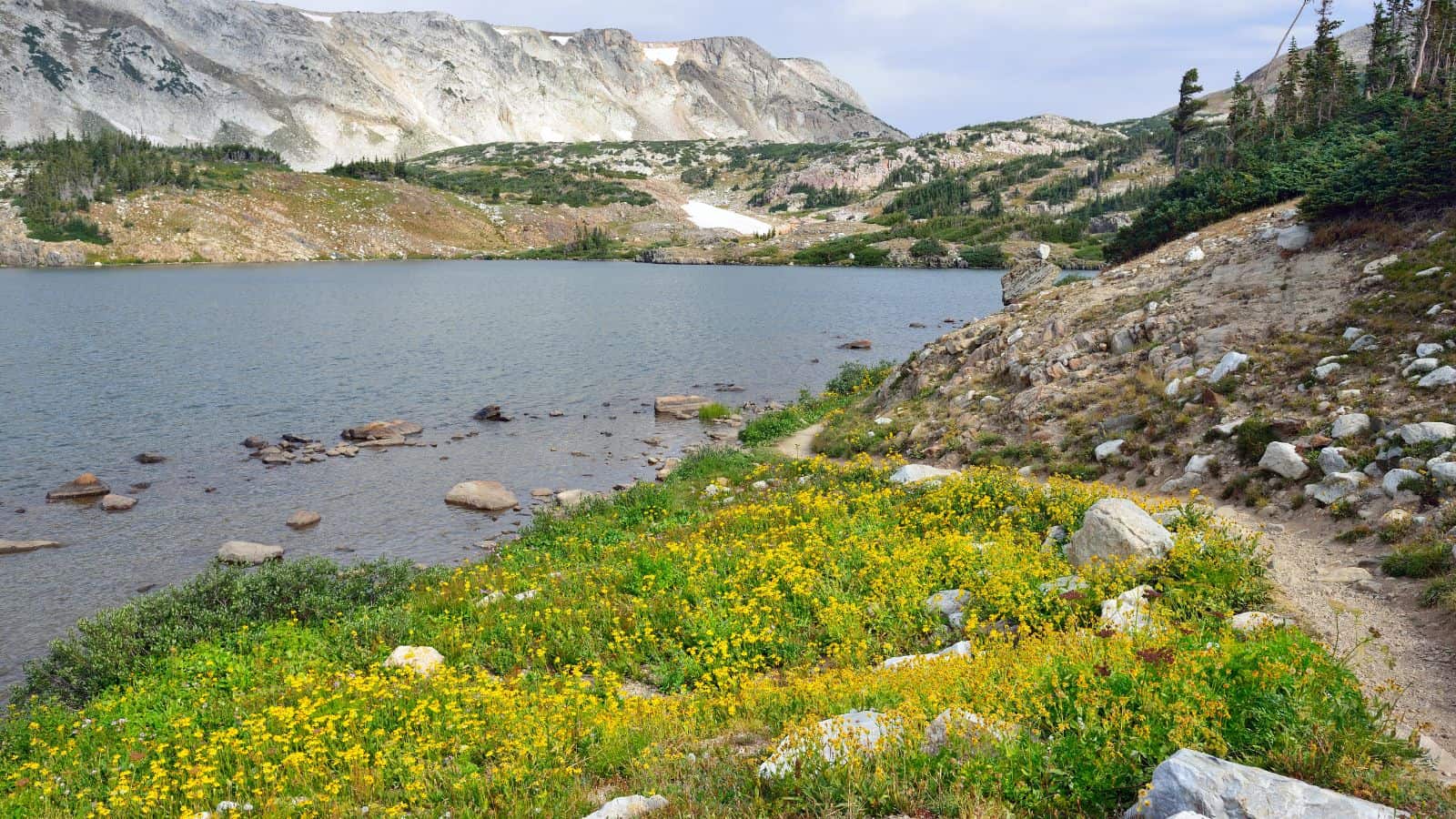
The Medicine Bow River is a 167-mile-long tributary of the North Platte River in southern Wyoming. It rises in the Snowy Range, flowing out of the North Gap Lake in southeastern Carbon County, and flows north past Elk Mountain before turning northeast and then northwest past the town of Medicine Bow.
The river is joined by its two largest tributaries, Rock Creek and the Little Medicine Bow River, near the town of Medicine Bow, before joining the North Platte in the Seminoe Reservoir. The lower 10 miles of the river form an arm of the reservoir.
Laramie River

The Laramie River is a 280-mile-long tributary of the North Platte River that flows through Colorado and Wyoming. The river was named after Jacques La Ramie, a fur trapper who visited the area in the early 19th century, and several geographical entities in the region have “Laramie” in their names.
The river rises in northern Colorado in the Roosevelt National Forest and flows north-northwest into Wyoming, along the east side of the Medicine Bow Mountains, past Jelm and Woods Landing, and then northeast through Laramie and the Laramie Plains. It is joined by the Little Laramie River and continues north through the Laramie Mountains, receiving the North Laramie River and Chugwater Creek before joining the North Platte opposite the town of Fort Laramie.
New Fork River
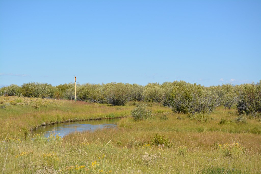
The New Fork River is a 70-mile-long tributary of the Green River in Wyoming, flowing entirely within Sublette County. It rises at Lozier Lake in the Wind River Range and flows southwest through a steep and narrow glacial canyon before coming out of the mountains and briefly widening into the New Fork Lakes.
The river is considered an excellent spot for inner-tube floating and canoeing, and it also offers good fishing opportunities, especially in the upper reaches. The New Fork meanders generally southwest between low bluffs and joins the Green River about 6 miles east of Big Piney.
Big Sandy River
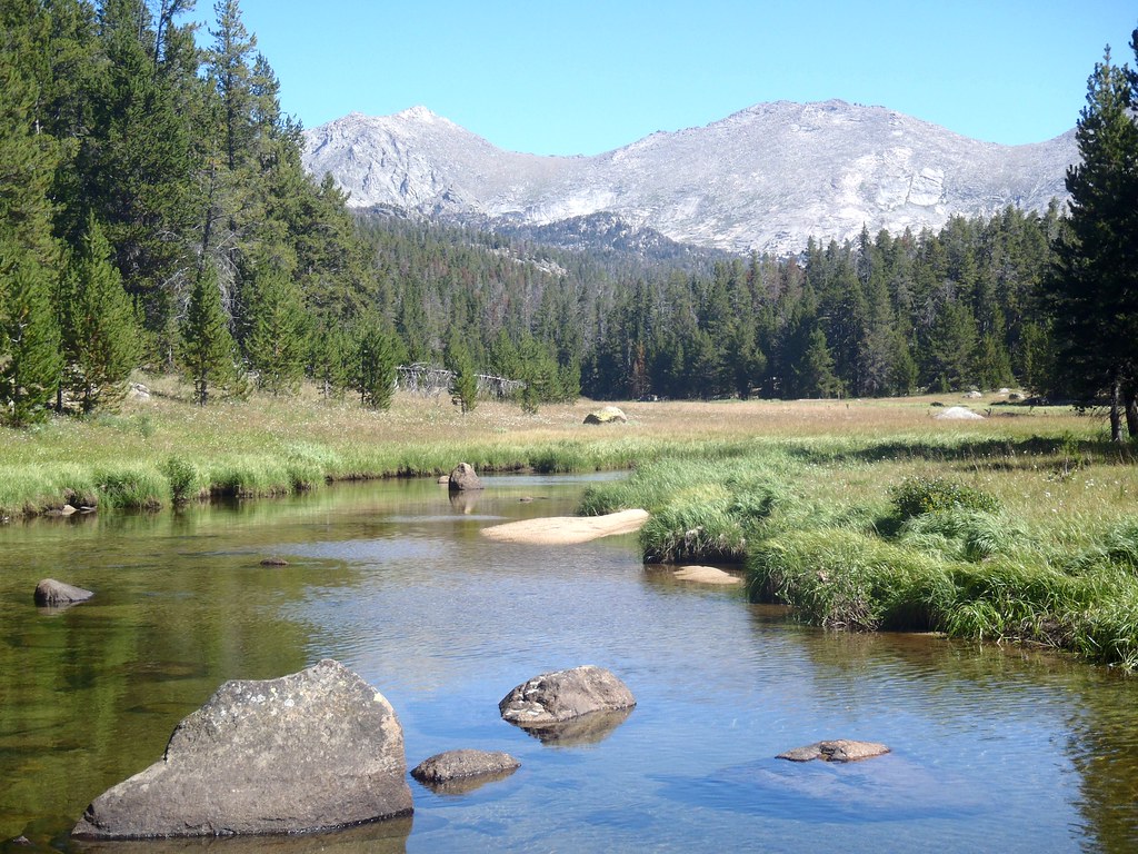
The Big Sandy River, a 141-mile-long tributary of the Green River, rises in the Bridger Wilderness Area of the Bridger-Teton National Forest on the west side of the continental divide in the southern Wind River Range.
It flows south, southwest, southeast, and then southwest, past the town of Farson before joining the Green River in western Sweetwater County. The river is dammed above Farson to form the Big Sandy Reservoir.
Nowood River
The Nowood River, also known as Nowood Creek, is a 95-mile-long river in Wyoming that rises in the Bridger Mountains on the southeastern side of the Bighorn Basin. The river runs north through the foothills of the Bighorn Mountains and past the town of Ten Sleep, where it is joined by Tensleep Creek.
It then flows out of the Bighorn Mountains to join the Big Horn River near Manderson. According to local tradition, the river got its name from a group of men who arrived and found no wood to construct a fire.
Lakes
Yellowstone Lake

Yellowstone Lake is the largest body of water in Yellowstone National Park, covering 136 square miles with 110 miles of shoreline and reaching a depth of at least 394 ft. It is also the largest freshwater lake above 7,000 ft in North America.
In winter, much of the lake is covered in nearly 3 ft of ice, except where shallow water covers hot springs, and it can remain frozen until late May or early June.
Jackson Lake

Jackson Lake is a large natural lake in Grand Teton National Park in northwestern Wyoming, enlarged by the construction of the Jackson Lake Dam. It is one of the largest high-altitude lakes in the United States, up to 15 miles long, 7 miles wide, and 438 feet deep, with an elevation of 6,772 feet above sea level.
The lake is primarily fed by the Snake River, which flows in from the north, and is home to numerous species of fish, including non-native brown and lake trout and the native Snake River fine-spotted cutthroat trout and mountain whitefish. The lake’s eastern shore is dotted with marinas and lodges, while the western shore is primitive, with only hiking trails and a few primitive campsites.
Flaming Gorge Reservoir

Flaming Gorge Reservoir is the largest reservoir in Wyoming, located on the Green River and impounded behind the Flaming Gorge Dam. The reservoir stores 3,788,900 acre-feet of water and is mainly in southwest Wyoming and partially in northeastern Utah, straddling the Utah-Wyoming border.
Visitors can enjoy hiking, boating, fishing, windsurfing, camping, backpacking, cross-country skiing, and snowmobiling within Flaming Gorge National Recreation Area, which is operated by Ashley National Forest, and there are many available fish species in the reservoir and surrounding lakes, including Colorado River Cutthroat trout, Brown trout, Rainbow trout, Lake trout, Kokanee salmon, Smallmouth bass, Burbot, and Common carp.
Pathfinder Reservoir

Pathfinder Reservoir is a large reservoir located on the North Platte River in Wyoming, between Casper and Rawlins, with a storage capacity of 1,016,000 acre-feet and a shoreline of 117 miles.
It is the site of the only established population of the Macedonian Ohrid Trout in the United States, and much of the reservoir is included in the Pathfinder National Wildlife Refuge. The water in the reservoir is used to serve the 335,000-acre North Platte Project, and some of it is released to satisfy other water rights and operate power plants downstream.
Boysen Reservoir
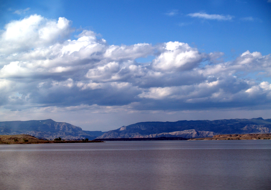
Boysen Reservoir is a large reservoir formed by Boysen Dam, an earth-fill dam on the Wind River in Wyoming, near the town of Shoshoni in Fremont County.
The dam was constructed between 1947 and 1952 at the mouth of Wind River Canyon, just upstream from a previous dam built by Asmus Boysen in 1908 on land he had leased from the Shoshone and Arapaho tribes. The dam and much of the reservoir are physically located on the Wind River Indian Reservation.
Glendo Reservoir
Glendo Reservoir is a popular reservoir located on the North Platte River in Platte County and Converse County in Wyoming, formed by Glendo Dam, an earth-fill dam that is 2,096 feet long and 190 feet high and contains two hydroelectric turbines capable of generating 38 megawatts of power.
The reservoir retains a maximum of 1,170,505 acre-feet of water used primarily for irrigation and flood control and is popular for water sports and fishing. It is completely located within Glendo State Park.
Shoshone Lake

Shoshone Lake is a large backcountry lake located in the southwest section of Yellowstone National Park, Wyoming, with an area of 8,050 acres and an elevation of 7,795 feet.
It sits at the headwaters of the Lewis River, a tributary of the Snake River, and is believed to be the largest backcountry lake in the lower 48 states that cannot be reached by a road, according to the U.S. Fish and Wildlife Service. The Yellowstone Caldera is also located within the lake, making it a unique and fascinating geological feature.
Fontenelle Reservoir
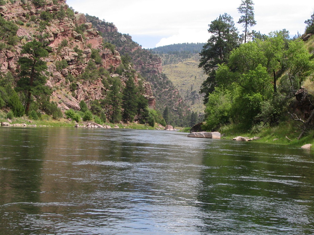
Fontenelle Reservoir is an artificial reservoir located in southwest Wyoming, primarily in Lincoln County, but with a small portion in Sweetwater County. It acts mainly as a storage reservoir for the U.S. Bureau of Reclamation’s Colorado River Storage Project, retaining Wyoming water in the state as a means of asserting Wyoming’s water rights, with a secondary purpose of power generation.
Although plagued by chronic leakage problems at the dam, the reservoir has facilities for recreation, with boat launching ramps and campgrounds, and fishing available for brown, cutthroat, and rainbow trout.
Wheatland Reservoir

Wheatland Reservoir is the collective name for three reservoirs located near Wheatland in Wyoming. Wheatland Reservoir Number 1 is located closest to the town and was formed by impounding Canal No 3 fed by Sybille Creek from the eastern slope of the Laramie Mountains.
Wheatland Reservoir Number 2 is located on the western side of the Laramie Mountains and was formed by impounding the Laramie River. Wheatland Reservoir Number 3 is fed by a canal from Reservoir Number 2 and the Laramie River.
Ocean Lake
Ocean Lake is a significant wildlife habitat located in Wyoming, about 17 miles northwest of Riverton, residing within the 11,505-acre Ocean Lake Wildlife Habitat Management Area.
It is a crucial breeding ground for thousands of migratory waterfowl, and efforts have been made to enhance wildlife in the area with the construction of man-made ponds and nests. The lake is an important ecological resource for the region, providing a home for a diverse range of wildlife.

