Amid the towering peaks and the vast prairies of the Mount Rushmore State lies a narrative as grand as the sculptures that grace its landscape – a tale that unfolds not only in its historic landmarks but also in the meandering courses of its rivers and the tranquil expanse of its lakes.
South Dakota, celebrated for its natural wonders and pioneering spirit, cradles within its embrace a treasure as enduring as the Black Hills – a network of waterways that mirror its legacy of resilience and heritage. Like whispered conversations around a campfire, South Dakota’s rivers and lakes carry stories of exploration, trade, and the unwavering relationship between its people and the land. In this article, we embark on a journey that traces the pathways of South Dakota’s rivers and reflects upon the mirrored depths of its lakes.
Join us as we unveil the significance of these aqueous narratives, uncovering their role in shaping the state’s identity, culture, and livelihoods, and revealing how water has carved its mark onto the very essence of the Mount Rushmore State.
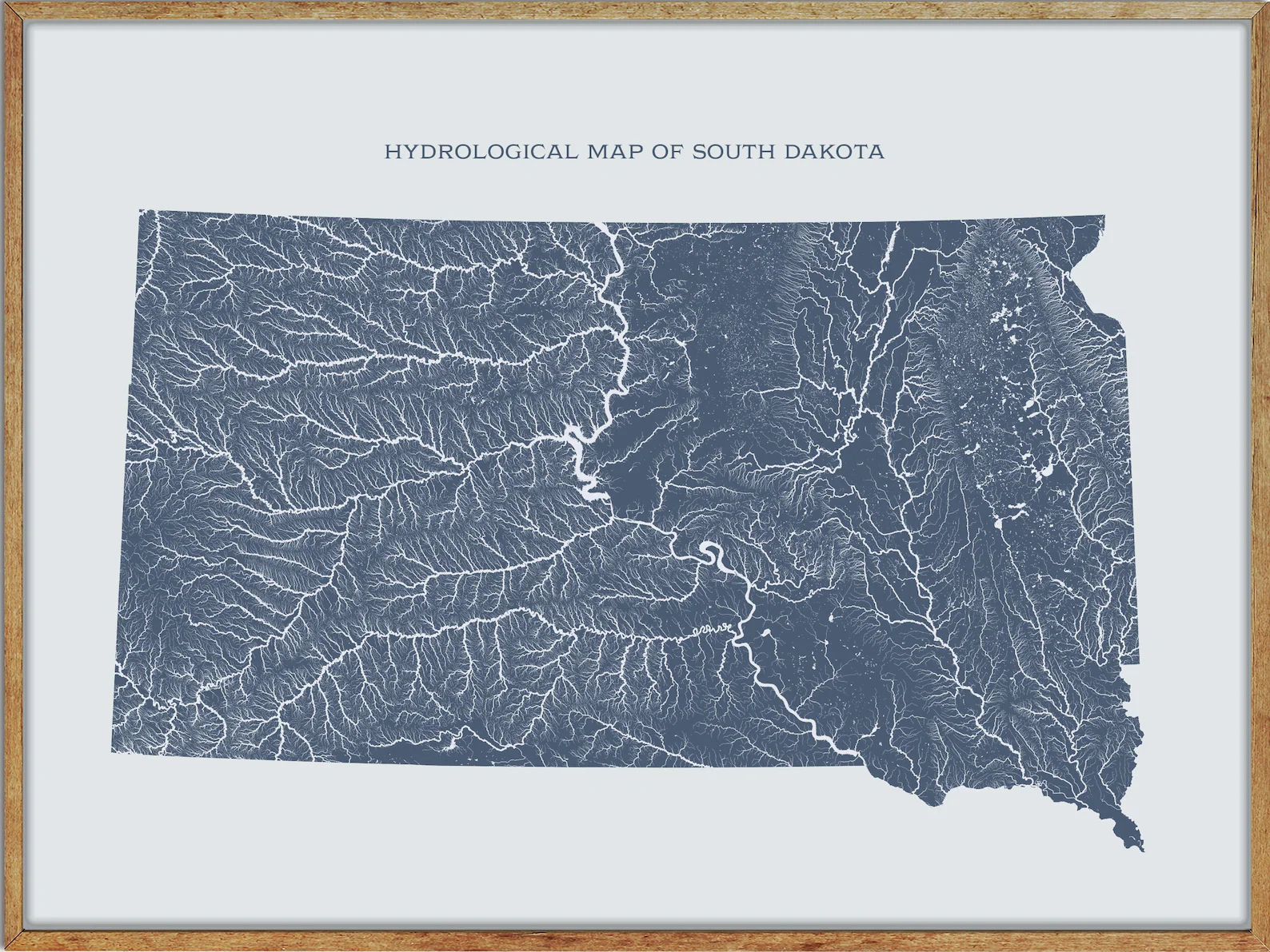
Printable South Dakota Lakes and Rivers Map

Rivers
Cheyenne River

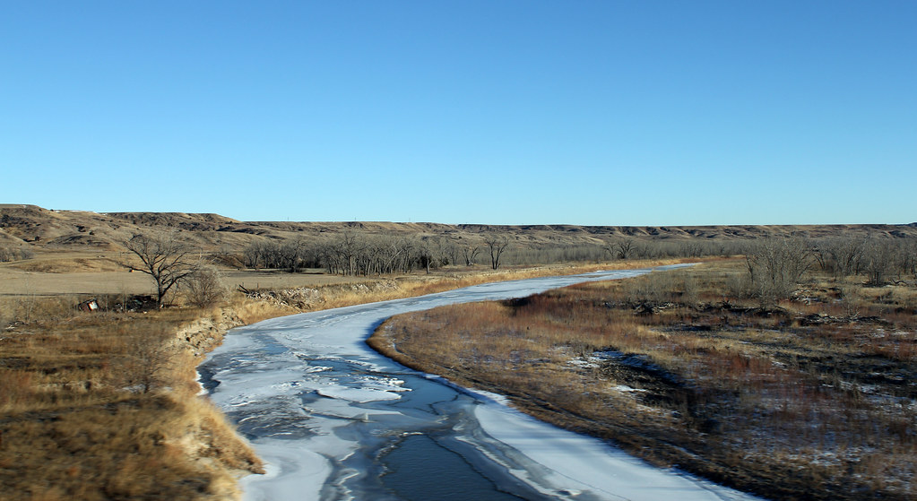
The Cheyenne River is a 295-mile-long tributary of the Missouri River in Wyoming and South Dakota that drains an area of 24,240 square miles. The river is formed by the confluence of Antelope Creek and Dry Fork Creek in Wyoming, rising in northeastern Wyoming in the Thunder Basin National Grassland in Converse County, flowing east into South Dakota, passing Edgemont, and skirts the southern end of the Black Hills, passing through Angostura Reservoir.
On the east side of the Black Hills, it flows northeast, past Oral, the Buffalo Gap National Grassland, and along the northwestern boundary of the Pine Ridge Indian Reservation and Badlands National Park, and is joined by Rapid Creek, passes Wasta and is joined by the Belle Fourche River in eastern Meade County, after which it flows ENE along the southern boundary of the Cheyenne River Indian Reservation.
James River

The James River is a tributary of the Missouri River, approximately 710 miles long, draining an area of 20,653 square miles in the U.S. states of North Dakota and South Dakota. The river arises in Wells County, North Dakota, flows briefly east towards New Rockford, then generally SSE through eastern North Dakota, past Jamestown, where it is first impounded by a large reservoir (the Jamestown Dam), and then joined by the Pipestem River.
It enters northeastern South Dakota in Brown County, where it is impounded to form two reservoirs northeast of Aberdeen, and flows southward across eastern South Dakota, passing Huron and Mitchell, where it is joined by the Firesteel Creek, and joins the Missouri just east of Yankton.
Big Sioux River

The Big Sioux River is a 419-mile-long tributary of the Missouri River in eastern South Dakota and northwestern Iowa that flows generally southwardly, with a watershed of 9,006 square miles. The river was named after the Lakota people (Sioux Natives) and was known by them as Tehankasandata or Thick Wooded River.
It rises in Roberts County, South Dakota on a low plateau known as the Coteau des Prairies and flows past many communities, including Watertown, Castlewood, Bruce, Flandreau, Egan, Trent, Dell Rapids, and Baltic to Sioux Falls, where it passes over a waterfall in Falls Park, which gives that city its name. The Big Sioux River joins the Missouri River from the north at Sioux City, Iowa, and has a mean annual discharge of approximately 3,793 cubic feet per second at the USGS station in Sioux City.
Moreau River
The Moreau River is a 200-mile-long tributary of the Missouri River in South Dakota that rises in two forks in northwestern South Dakota, in the Badlands of Butte and Harding Counties.
The river generally parallels its neighbor, the Grand River, running from west to east to join the Missouri, and has a drainage basin of approximately 5,400 square miles. The Moreau River also has Sand Creek as a source, along with the North and South Forks, and claims several tributaries, such as the Little Moreau, Deep, Red Earth, Antelope, and Thunder Butte Rivers, with an average flow of 296 cubic feet per second at Promise.
Grand River
The Grand River is a tributary of the Missouri River in South Dakota that is approximately 200 miles long with a combined branch of 110 miles. It is formed by the confluence of the North Fork and the longer South Fork near Shadehill in Perkins County, and flows east through the Standing Rock Indian Reservation before joining the Missouri in Lake Oahe.
The river drains about 5,200 square miles of the northern plateaus of the state, receiving most of its water from snowmelt and having a mean annual discharge of 275 cubic feet per second at Wakpala.
Belle Fourche River
The Belle Fourche River is a 290-mile-long tributary of the Cheyenne River in Wyoming and South Dakota that is part of the Mississippi River watershed via the Cheyenne and Missouri rivers. The river was known as the North Fork of the Cheyenne River in the latter part of the 19th century and derives its name from the French term “beautiful fork”. The Belle Fourche River is pronounced bel FOOSH, and its Lakota name is Šahíyela Wakpá.
Bad River
The Bad River is a 161-mile-long tributary of the Missouri River in central South Dakota that is formed at Philip by the confluence of its North and South forks. The river basin is about 3,000 square miles and is located south of the Cheyenne River in the Pierre Hills and Southern Plateaus, noted for deposits of manganese and fuller’s earth.
The Bad River was named after an incident around the spring of 1738 when a flash flood caused a large loss of life, including all their horses, and carries hard water of generally poor quality, with a mean annual discharge of 176 cubic feet per second at Fort Pierre.
Vermillion River
The Vermillion River is a 96-mile-long tributary of the Missouri River in eastern South Dakota that is formed by the confluence of the East Fork Vermillion River and West Fork Vermillion River. The river’s name is derived from Waséoyuze, Lakota for “place where vermilion is obtained”.
The Vermillion River drains about 2,180 square miles of the southwestern edge of the Coteau des Prairies, and its tributaries include White Stone Creek and Baptist Creek, situated between the Big Sioux River and James River, and approximately once per 3.5 years, the Vermillion runs dry.
Little White River
The Little White River is a 234-mile-long tributary of the White River in south central South Dakota that rises on the Pine Ridge Indian Reservation in southeastern Oglala Lakota County and flows east past Martin and north of Lacreek National Wildlife Refuge.
The river flows into the Rosebud Indian Reservation and turns northeast, passing north of Rosebud and west of the town of White River before joining the White approximately 12 miles SSE of Murdo, with a stream measurement of approximately 150 cubic feet per second at White River. The Little White River was formerly known as the South Fork of the White River and its Lakota name is Makhízita Čík’ala.
Bois de Sioux River
The Bois de Sioux River is approximately 41 miles long and drains Lake Traverse, the southernmost body of water in the Hudson Bay watershed of North America. It is a tributary of the Red River of the North, defining part of the western border of Minnesota and the eastern borders of North Dakota and South Dakota. The name Bois de Sioux is derived from French, meaning “Woods of the Sioux”.
Lakes
Lake Sharpe

Lake Sharpe is a large reservoir impounded by Big Bend Dam on the Missouri River in central South Dakota, with an area of 56,884 acres and a maximum depth of 78 ft. The lake is approximately 80 miles long, with a shoreline of 200 miles, and is the 54th largest reservoir in the United States, stretching upstream to Oahe Dam, near Pierre.
Species of fish in the reservoir include walleye, sauger, smallmouth bass, channel catfish, flathead catfish, northern pike, white bass, yellow perch, black crappie, and rainbow trout, and there are over 80,000 acres of public land and water associated with Lake Sharpe.
Lake Francis Case

Lake Francis Case is a large reservoir impounded by Fort Randall Dam on the Missouri River in south-central South Dakota with an area of 102,000 acres and a maximum depth of 140 ft.
The lake is approximately 107 miles long, with a shoreline of 540 miles, and is the eleventh-largest reservoir in the United States, stretching from Pickstown upstream to Big Bend Dam and located within the counties of Charles Mix, Gregory, Lyman, Brule, and Buffalo. The reservoir is named after former United States Senator Francis Higbee Case of South Dakota.
Lake Traverse

Lake Traverse lies along the border between the U.S. states of Minnesota and South Dakota and is the southernmost body of water in the Hudson Bay watershed of North America. The lake’s name is derived from Lac Traverse, meaning “across the lake” in French, and is an Anglicization of the original name.
The lake is drained at its north end by the northward-flowing Bois de Sioux River, a tributary of the Red River of the North, and a low continental divide separates the land at the southern shore of Lake Traverse from Big Stone Lake, the headwaters of the south-flowing Little Minnesota River, which is part of the Mississippi River System.
Big Stone Lake

Big Stone Lake is a long, narrow freshwater lake and reservoir on the border between western Minnesota and northeastern South Dakota, covering 12,610 acres and stretching 26 miles from end to end. It is South Dakota’s lowest point and the source of the Minnesota River, with flow regulated by the Big Stone Lake Dam at the lake’s southern end.
The lake is fed by the Little Minnesota River at its north end and is named after nearby rock outcroppings, with two state parks, picnic, boat launching, trail, and camping facilities, and several vacation resorts along its shores. Big Stone Lake is especially popular for fishing, with walleye, northern pike, and bluegills among the game fish and over 30 other species present.
Lake Poinsett
Lake Poinsett is one of the largest lakes in the state of South Dakota, located northeast of the town of Arlington. The lake is named after the U.S. Secretary of War, Joel Poinsett, and was first visited by the expedition of Joseph Nicollet and John Fremont in 1838, who camped on the lake’s north shore. The census-designated place of Lake Poinsett comprises shoreside housing developments along the lake.
Lewis and Clark Lake

Lewis and Clark Lake is a 31,400-acre reservoir located on the border of the U.S. states of Nebraska and South Dakota on the Missouri River. The lake has over 90 miles of shoreline and a maximum water depth of 45 feet, and it is impounded by Gavins Point Dam, managed by the U.S. Army Corps of Engineers, Omaha District.
The lake is located within Cedar and Knox Counties in Nebraska and Bon Homme and Yankton Counties in South Dakota, with Lake Yankton located immediately downstream of Gavins Point Dam and the Santee Sioux Reservation along the southwestern shore in Knox County.
Angostura Reservoir
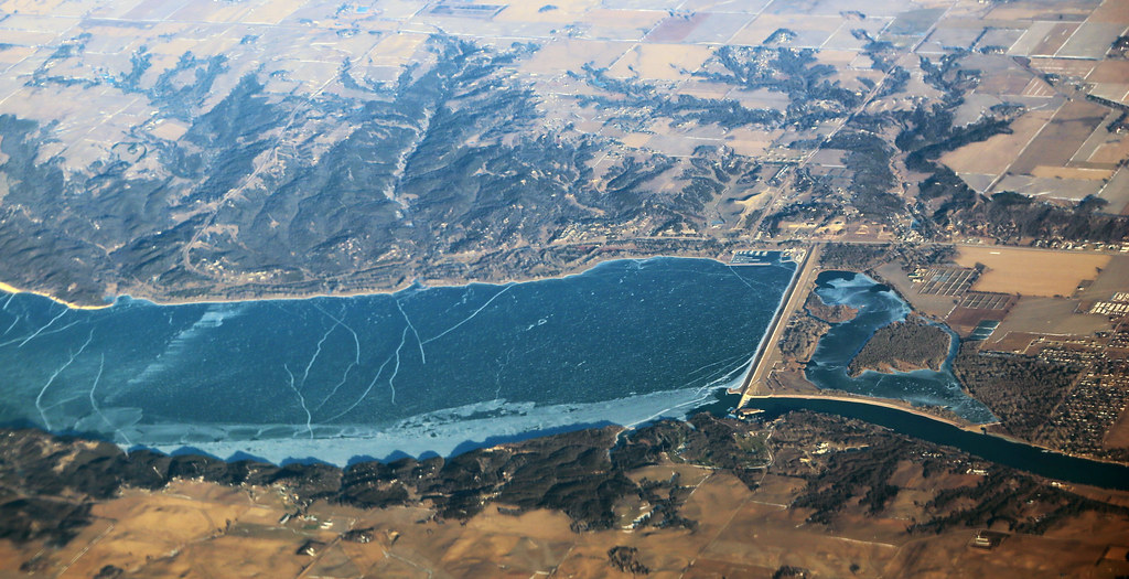
Angostura Reservoir is a 4,407-acre reservoir on the Cheyenne River in Fall River County, South Dakota, created after the construction of Angostura Dam in 1949 for irrigation by the U.S. Bureau of Reclamation.
The reservoir has a maximum depth of 75 ft and is surrounded by the Angostura Recreation Area, a popular location for boating, swimming, camping, and fishing. The lake supports populations of walleye, northern pike, smallmouth bass, and sunfish, and is also an important location for migratory birds as one of the only large bodies of water in the area.

