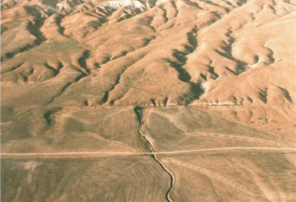
Wallace Creek offers a unique opportunity to explore one of the world’s most dramatic examples of geological displacement along the San Andreas Fault. This BLM-managed site in California‘s Carrizo Plain region features an interpretive trail that traces the 430-foot offset where tectonic forces have visibly shifted the creek’s drainage channel over thousands of years.
The area supports hiking, horseback riding, wildlife viewing, and photography along established trails. The stark, open terrain provides unobstructed views of the fault line and surrounding grasslands, making it particularly compelling for geology enthusiasts and landscape photographers.
Dispersed camping is generally permitted on BLM lands in the Carrizo Plain, though visitors should verify current regulations before arrival. No developed facilities exist at Wallace Creek itself, so pack adequate water, food, and supplies. The remote location requires high-clearance vehicles for some access roads, especially during wet conditions.
Spring brings wildflower blooms and cooler temperatures, making March through May the ideal window for visits. Summer months can be intensely hot with little shade. Winter offers solitude but occasional road closures from rain.
Explore Nearby
- Lone Pine State Park — State Park in Montana
- Inyo National Forest — National Forest in California, Nevada
- Indian Canyon Scenic Byway — Scenic Byway in Utah
- Sequoia National Forest — National Forest in California
- Eastern Sierra Scenic Byway — Scenic Byway in California


