Amid the bustling urban centers and serene shorelines of the Garden State lies a narrative often overlooked – the intricate network of rivers and lakes that carve their way through its diverse landscapes. New Jersey, celebrated for its industrial legacy and iconic coastline, cradles within its borders a hidden treasure – a tapestry of waterways that mirror its history, growth, and cultural fusion.
Like the whispered conversations in its bustling cities, New Jersey’s rivers and lakes hold tales of trade, innovation, and the ever-changing interactions between people and nature. In this article, we embark on a journey that traces the sinuous paths of New Jersey’s rivers and reflects upon the tranquil expanses of its lakes.
Join us as we unveil the significance of these aqueous narratives, uncovering their role in shaping the state’s identity, heritage, and modern endeavors, and revealing how water has sculpted the very essence of the Garden State.
Printable New Jersey Lakes and Rivers Map
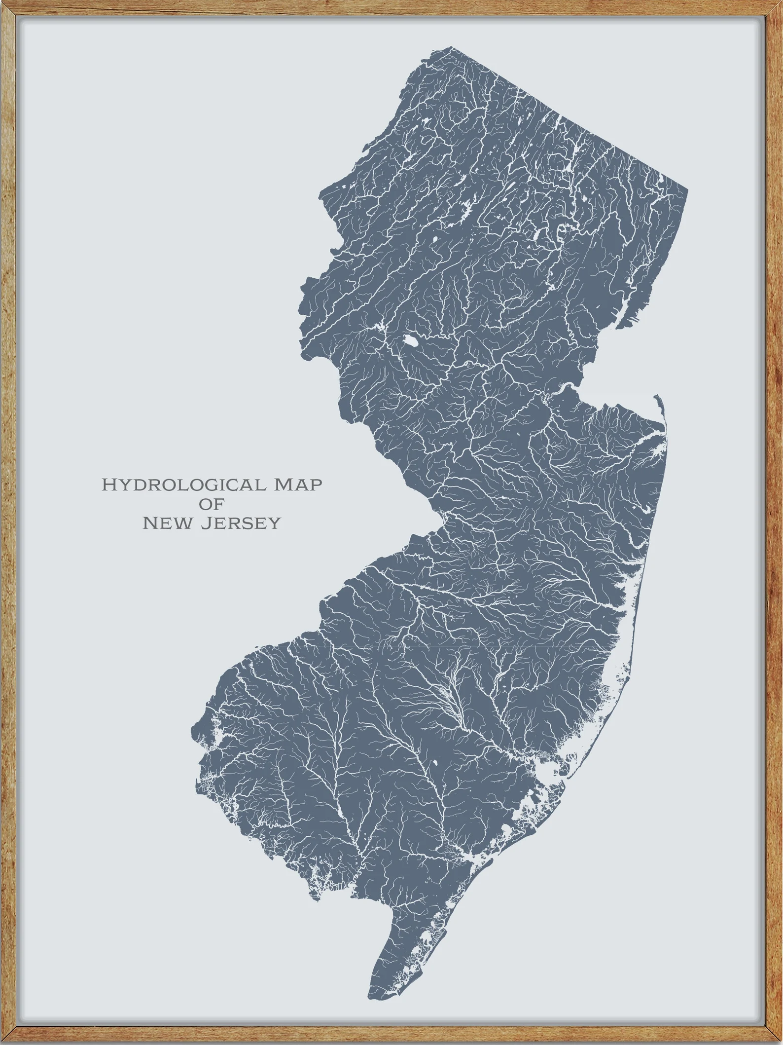
Rivers
Raritan River
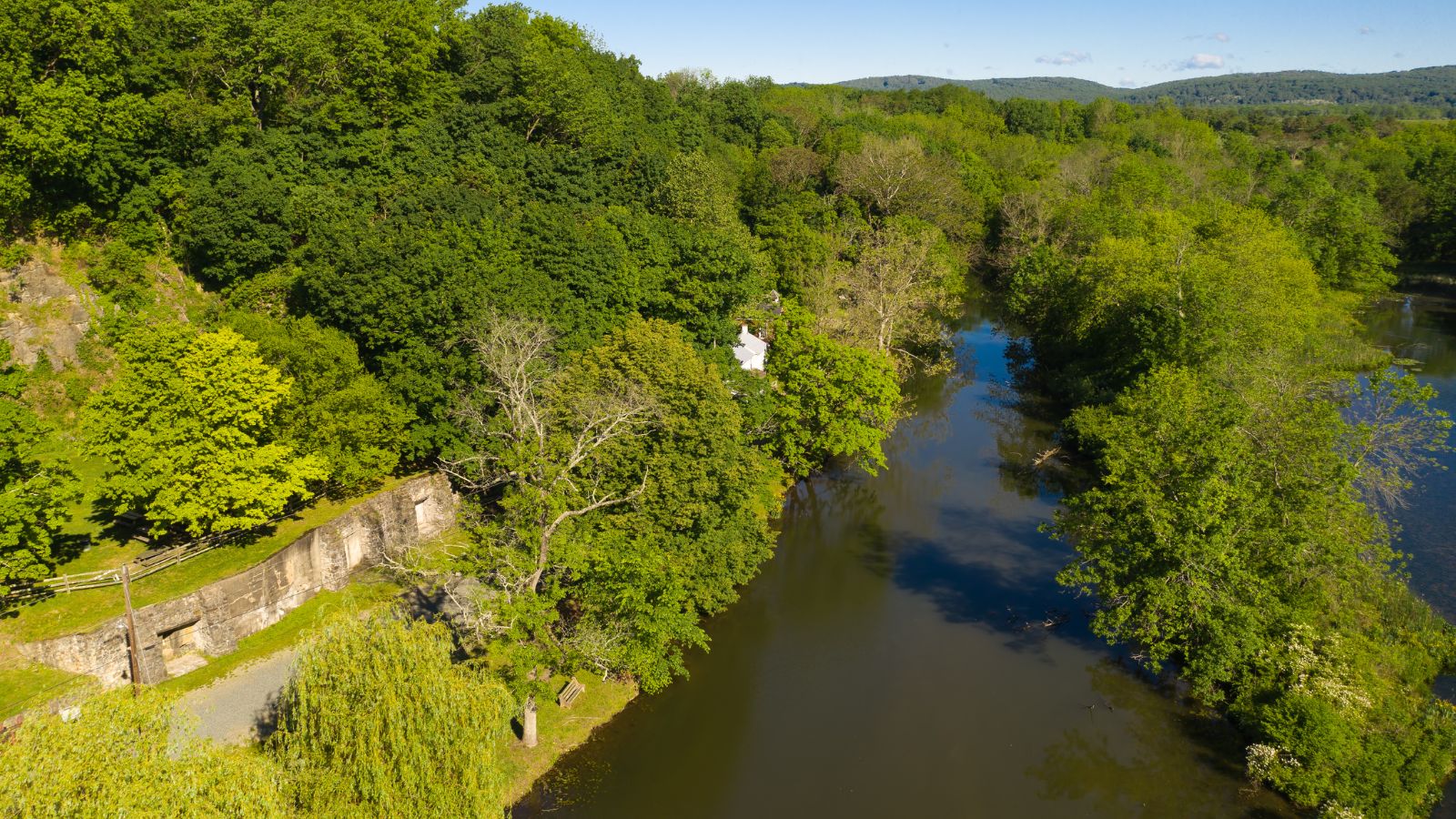
The Raritan River is a major river of New Jersey, draining much of the mountainous area of the central part of the state, and emptying into the Raritan Bay on the Atlantic Ocean. The river forms at the confluence of the North and South Branches just west of Somerville at the border of Bridgewater, Branchburg, and Hillsborough Townships.
Comprehensive measures have been taken to reduce pollution and increase water quality, benefiting the fish population, including largemouth bass, smallmouth bass, sunfish, catfish, trout, chain pickerel, American eels, carp, and yellow perch, as well as migratory saltwater species such as striped bass, fluke, winter flounder, weakfish, and bluefish.
Great Egg Harbor River
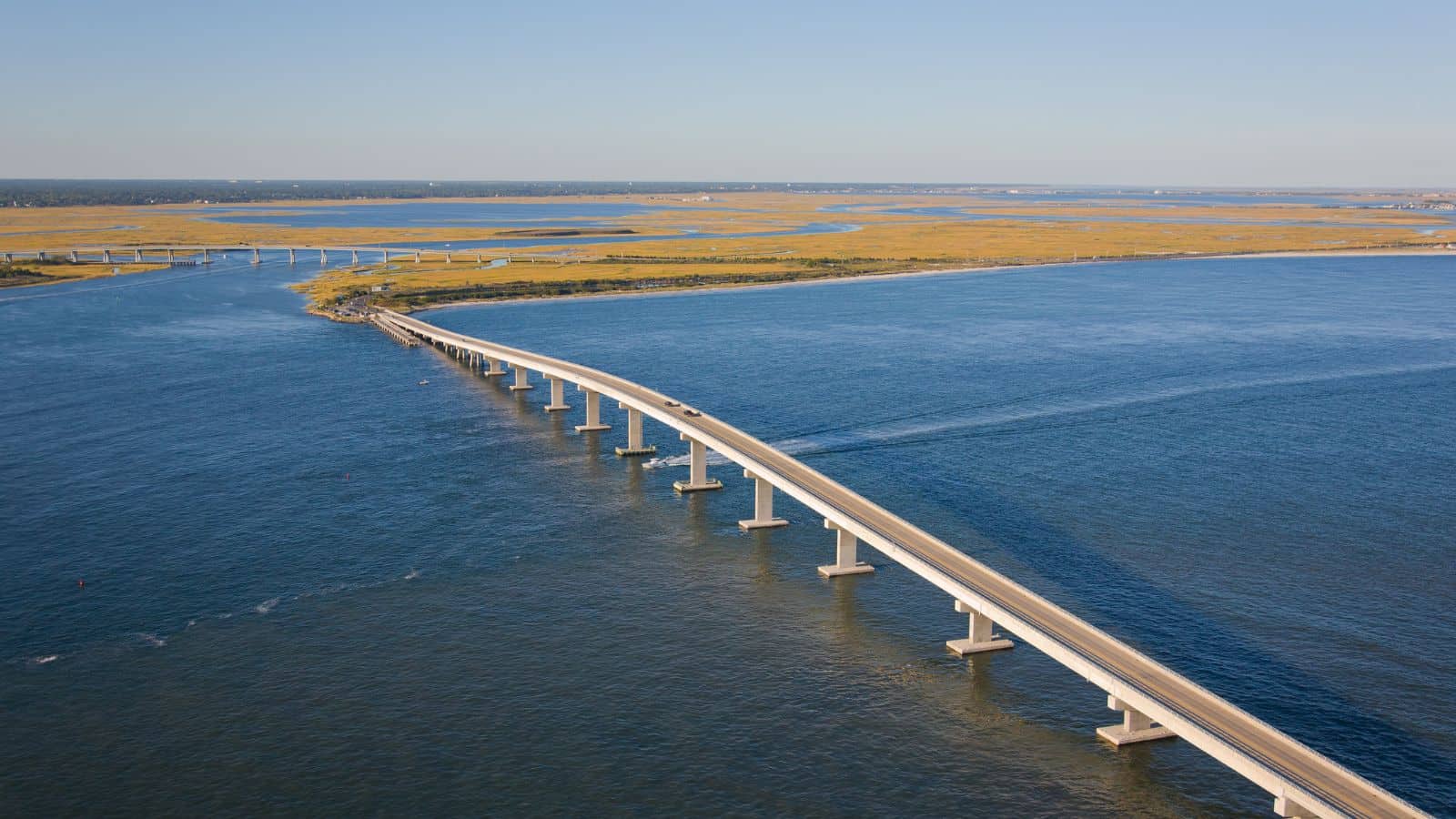
The Great Egg Harbor River is a 55.0-mile-long river in South Jersey that traverses the largely pristine Pinelands, draining 308 square miles of wetlands into the Atlantic Ocean at Great Egg Harbor, from which it takes its name. The river rises in the suburbs southeast of Camden near Berlin and flows generally southeast, entering Great Egg Harbor approximately 5 miles southwest of Atlantic City.
The lower 10 miles of the river provide a navigable estuary as far as Mays Landing, and it is noted for its tea-colored “cedar water”, the product of the iron and tannin content of the fallen cedar leaves along much of its length, providing abundant habitat for waterfowl in the region and fish populations that include striped bass and alewife herring.
Mullica River
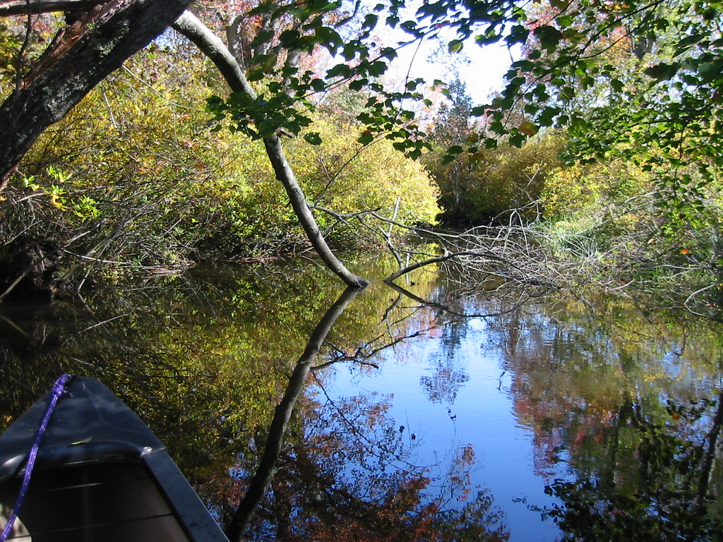
The Mullica River is a 50.6-mile-long river in southern New Jersey that was once known as the Little Egg Harbor River, providing one of the principal drainages into the Atlantic Ocean of the extensive Pinelands.
Its estuary on Great Bay is considered one of the least-disturbed marine wetlands habitats in the northeastern United States, and the lower reaches of the river form an extensive wetlands area, which is protected on its southern bank as the Edwin B. Forsythe National Wildlife Refuge. In 2022, the Mullica River Fire consumed an estimated 13,500 acres of the related Wharton State Forest.
Musconetcong River
The Musconetcong River is a 45.7-mile-long tributary of the Delaware River in northwestern New Jersey, flowing through the rural mountainous country of northwestern New Jersey, rising out of Lake Hopatcong, on the border between the borough of Hopatcong in Sussex County and the township of Roxbury in Morris County.
The river does not flow through any large population center and has been the site of relatively little industrial development throughout its history. Part of it is a National Wild and Scenic River, and human habitation in the Musconetcong Valley can be traced back approximately 12,000 years to the end of the last ice age.
Passaic River

The Passaic River is an approximately 80-mile-long river in Northern New Jersey that flows through the swamp lowlands between the ridge hills of rural and suburban northern New Jersey, called the Great Swamp, draining much of the northern portion of the state through its tributaries.
In its lower (southern) portion, it flows through the most urbanized and industrialized areas of the state, including Downtown Newark, and suffered from severe pollution and industrial abandonment in the 20th century. The lower eight miles of the river are one of the most polluted stretches of water in the nation, and the project to remove 4.3 million cubic yards of toxic mud from the bottom of the river is one of the largest toxic cleanups ever undertaken in the nation.
Maurice River
The Maurice River is a tributary of Delaware Bay in Salem County and Cumberland County, New Jersey in the United States, approximately 50 miles long with a drainage area of 386 square miles.
Its watershed includes an extensive southern portion of the coastal forested wetlands known as the Pine Barrens, and its mouth on Delaware Bay is surrounded by extensive salt marshes and has provided a historically important oystering ground. The river was named for Maurice, Prince of Orange.
Cohansey River
The Cohansey River, a 30.6-mile-long river in southern New Jersey, drains approximately 108 square miles of rural agricultural and forested lowlands on the north shore of Delaware Bay. It rises in central Salem County and flows south through rural Cumberland County, passing through Sunset Lake, which is also fed from Mary Elmer Lake.
The river becomes navigable at Bridgeton, although very shallow at low tide, widening into a tidal estuary that flows south, then west, entering Cohansey Cove on Delaware Bay, approximately 7 miles southwest of Bridgeton.
Wading River

The Wading River is a tributary of the Mullica River, approximately 10.1 miles long, in southern New Jersey in the United States. The river drains a rural forested area of the Pinelands, one of the most pristine areas along the coast of the northeastern United States, and is noted for its extensive wetlands, including large runs of striped bass.
The primary source of the Wading River is its 22.7-mile-long West Branch, which rises north of Chatsworth in central Burlington County, south of Brendan T. Byrne State Forest, and flows generally south through Wharton State Forest.
Toms River
The Toms River is a 41.7-mile-long freshwater river and estuary in Ocean County, New Jersey, in the United States. It rises in the Pine Barrens of northern Ocean County and flows southeast and east, fed by several branches, in a meandering course through area wetlands, emptying into Barnegat Bay, an inlet of the Atlantic Ocean, and the Intracoastal Waterway at Mile 14.6.
The lower 5 miles of the river is a broad tidal estuary navigable within the community of Toms River, and it is a popular location for marinas, yacht clubs, fishing, crabbing, canoeing, and kayaking.
Millstone River
The Millstone River is a 38.6-mile-long tributary of the Raritan River in central New Jersey in the United States. It begins in western Monmouth County and flows westward through northern Mercer County/southern Middlesex County, and northward through southern Somerset County, before draining into the Raritan River at Manville.
The river is paralleled by the Delaware and Raritan Canal for almost three-quarters of its length, and both the Millstone River and parallel canal provide drinking water to large portions of central New Jersey and recreational uses as well.
Wallkill River
The Wallkill River, a tributary of the Hudson, drains Lake Mohawk in Sparta, New Jersey, flowing generally northeasterly 88.3 miles to Rondout Creek in New York, just downstream of Sturgeon Pool, near Rosendale, with the combined flows reaching the Hudson at Kingston.
The river is unusual because it flows north between two major south-flowing rivers, the Hudson and the Delaware, and it has the distinction of being a river that drains into a creek, due to being impounded shortly before the Rondout confluence into a small body of water called Sturgeon Pool near Rifton.
The Wallkill River nestles between the main Appalachian Mountains and the New York-New Jersey Highlands, supporting much local agriculture, and is a part of the Great Appalachian Valley.
Hackensack River
The Hackensack River is a 45-mile-long river in the U.S. states of New York and New Jersey, emptying into Newark Bay, a back chamber of New York Harbor. The river flows through the suburban area outside New York City just west of the lower Hudson River, which it roughly parallels, separated from it by the New Jersey Palisades, and drains the New Jersey Meadowlands.
The lower river, which is navigable as far as the city of Hackensack, is heavily industrialized and forms a commercial extension of Newark Bay. It once was among the most polluted watercourses in the United States, but it staged a modest revival by the late 2000s.
Lakes
Lake Hopatcong
Lake Hopatcong, located in New Jersey’s northern highlands region, is the largest freshwater body in the state, covering about 4 square miles. The lake was formed by damming and flooding of two ponds, the Great Pond and Little Pond, and the Musconetcong River, its natural outlet.
Once a resort lake for vacationing New Yorkers, it is now a mostly suburban residential lake, situated 30 miles from the Delaware River and 40 miles from Manhattan, New York City, and forms part of the border between Sussex and Morris counties.
Greenwood Lake
Greenwood Lake is an approximately seven-mile-long interstate lake located in the Town of Warwick and the Village of Greenwood Lake, New York, and West Milford, New Jersey. The lake was originally called “Quampium” by the Munsee Native Americans who lived there and was renamed “Greenwood Lake” by European settlers who used the lake for farming and ironmaking.
The enlarged lake began to attract tourists and several steamboats operated on the lake during the resort era, and there are now numerous marinas and restaurants along Greenwood Lake.
Round Valley Reservoir
Round Valley Reservoir is a 2,350-acre reservoir in New Jersey, known for its pristine clear blue waters, reaching depths of 180 feet. The reservoir contains 55 billion US gallons of water for use in central New Jersey, making it the largest in the state, and is the southernmost body of water that contains naturally reproducing lake trout.
The park also offers camping, swimming, SCUBA diving facilities, a boat ramp, and nature hiking and biking trails, but the reservoir has been called the Bermuda Triangle of New Jersey, with over 26 people drowning there since 1971, six of whom have never been found.
Wanaque Reservoir
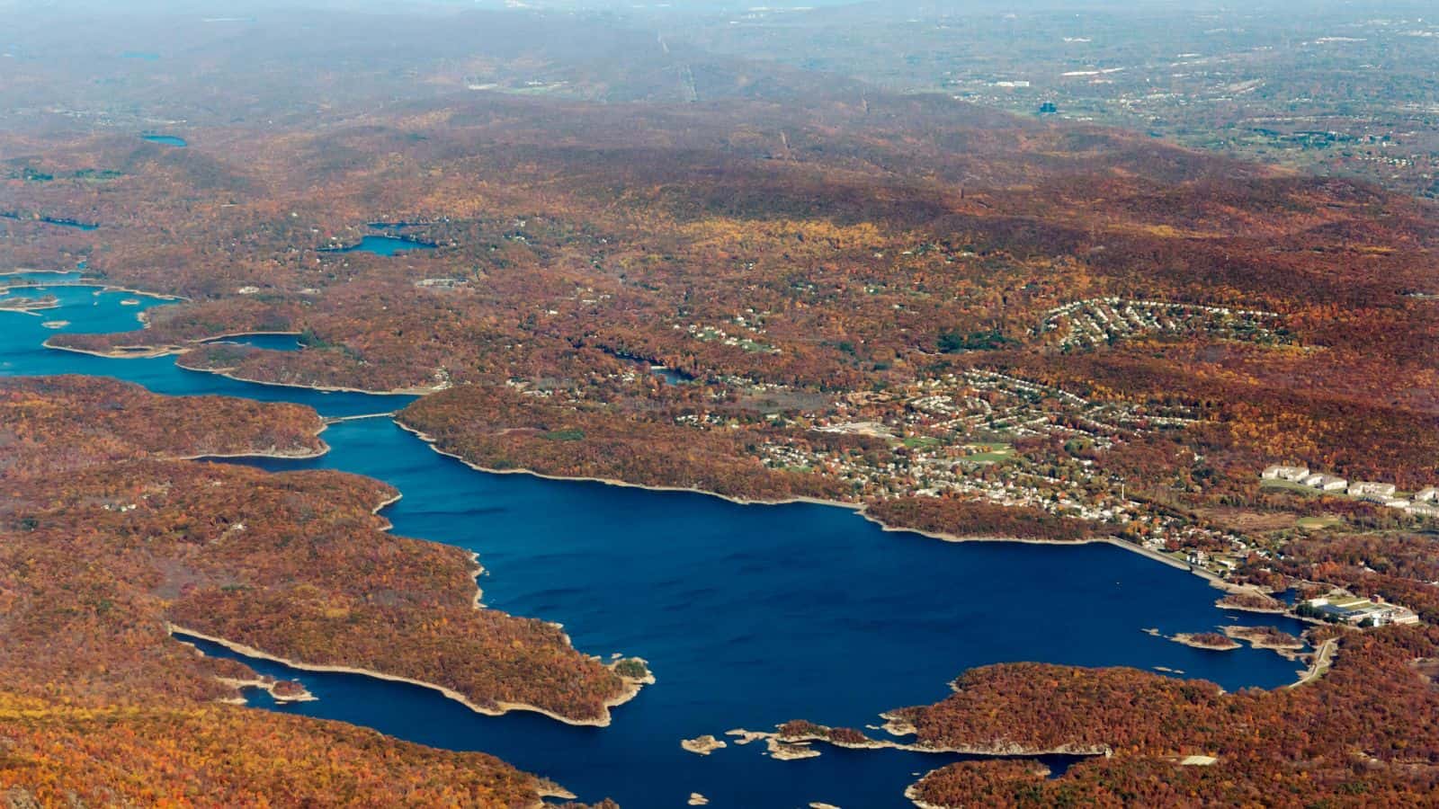
Wanaque Reservoir is a man-made lake located in Wanaque and Ringwood, New Jersey, along the Wanaque River. The reservoir was created in 1928 by the construction of the Raymond Dam along the river in Wanaque and is the second-largest reservoir in New Jersey by volume, after Round Valley Reservoir, and the second-largest body of water in New Jersey by area, after Lake Hopatcong.
The reservoir receives water from two diversions: the Pompton Lakes intake, which takes water from the Ramapo River, and the Two Bridges intake, which takes water from the Pompton River.
Atsion Lake

Atsion Lake is a man-made lake located in Wharton State Forest in the Pine Barrens, in the community of Atsion, Burlington County, New Jersey. The lake is part of the Mullica River and offers a variety of recreational activities, including boating, hiking, fishing, swimming, camping facilities, and cross-country skiing in the winter.
The area has a rich history, having been the site of an iron forge making bog iron in American Revolutionary times, producing materiel for American forces, and later becoming home to grist mills, sawmills, a paper mill, and farms growing cotton and peanuts.

