In the heart of the Midwest, where expansive prairies meet urban landscapes, Illinois stands as a living testament to the convergence of nature and human endeavor. Beneath its bustling cities and serene countryside lies a network of rivers and lakes that serve as the very veins and capillaries of the state’s vitality.
As a land shaped by the forces of water and time, Illinois weaves a unique story – one where the currents of history and the tranquility of its lakes mirror the ebb and flow of progress. In this article, we embark on a journey that navigates the intricate waters of Illinois, uncovering the cultural significance, economic importance, and ecological nuances that make these rivers and lakes an indelible part of the Prairie State’s identity.
Join us as we traverse the meandering paths and reflective surfaces that paint the portrait of Illinois, revealing a landscape shaped by the fluid embrace of its aquatic riches.
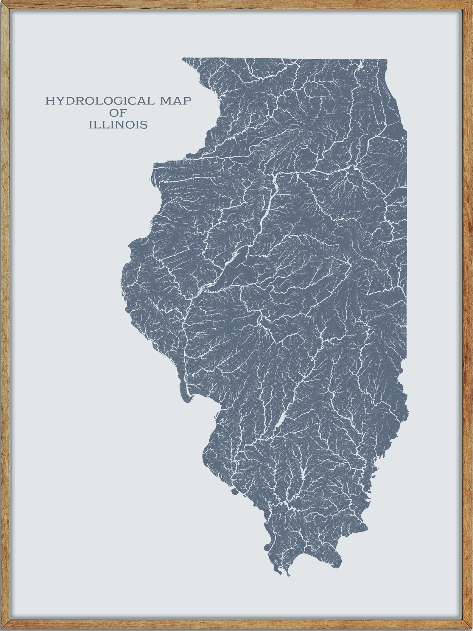
Printable Illinois Lakes and Rivers Map

Rivers
Illinois River
The Illinois River is a major tributary of the Mississippi River and is approximately 273 miles long, with a drainage basin of 28,756.6 square miles. It begins with the confluence of the Des Plaines and Kankakee rivers in the Chicago metropolitan area and flows southwest across Illinois, emptying into the Mississippi near Grafton, Illinois.
The river played an important role in the history of Native Americans and early French traders as the principal water route connecting the Great Lakes with the Mississippi, and after the construction of the Illinois and Michigan Canal and the Hennepin Canal in the 19th century, it became an important link for modern industrial shipping, forming the basis for the Illinois Waterway.
Kaskaskia River

The Kaskaskia River is a tributary of the Mississippi River and the second largest river system within Illinois, approximately 325 miles long. It drains a rural area of farms and rolling hills along river bottoms of hardwood forests in its lower reaches, and the lower reaches of the river have been canalized to allow barge traffic.
The river was named after a clan of the Illiniwek encountered by early French Jesuits and other settlers, and an alternative name for the Kaskaskia, “Okaw River,” persists in place names along the river and in a major tributary, the West Okaw River.
Ohio River

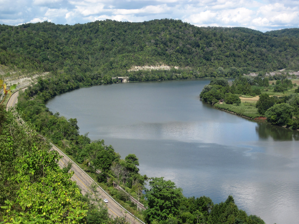
The Ohio River is a 981-mile-long river that flows in a southwesterly direction from western Pennsylvania to its mouth on the Mississippi River at the southern tip of Illinois and is the third largest river by discharge volume in the United States.
Its drainage basin includes parts of 14 states and is the source of drinking water for five million people. The river played a significant role in the westward expansion of the early U.S. as a primary transportation route for pioneers, and since the “canalization” of the river in 1929, it has been divided into 21 discrete pools or reservoirs by 20 locks and dams for navigation and power generation.
Embarras River
The Embarras River is a 195-mile-long tributary of the Wabash River in southeastern Illinois, draining a watershed of around 1,566,450 acres in an agricultural region.
The river rises in Champaign County and flows generally southward through Douglas, Coles, Cumberland, and Jasper Counties before joining the Wabash River 6 miles southwest of Vincennes, Indiana. The name Embarras comes from French explorers who used the term for river obstacles, blockages, and difficulties relating to logjams and the like.
Rock River
The Rock River is a 299-mile-long tributary of the Mississippi River, flowing through the U.S. states of Wisconsin and Illinois. The river was known as the Sinnissippi to Sauk and Fox Indians, and it begins with three separate branches that flow into the Horicon Marsh before meandering southward to the Illinois border and ending at the Quad Cities in Illinois and Iowa.
The river is used for various water and paddling sports, and the Rock River Water Trail, part of the National Water Trails System, runs from its headwaters above the Horicon National Wildlife Refuge in south central Wisconsin to the confluence with the Mississippi River at the Quad Cities of Illinois and Iowa, crossing five counties in Wisconsin, six counties in Illinois, and running through 37 municipalities.
Fox River

The Fox River is a 46.4-mile-long tributary of the Little Wabash River in southern Illinois, rising in Jasper County to the southeast of Newton and flowing south past Olney before joining the Little Wabash at the northeast corner of Edwards County, near Mt. Erie.
It should not be confused with the smaller “Fox River” which is a tributary of the Wabash River in southern Illinois, entering the Wabash near New Harmony, Indiana.
Sangamon River

The Sangamon River is a 246-mile-long principal tributary of the Illinois River, flowing through central Illinois and draining a mostly rural agricultural area between Peoria and Springfield.
The river played an important role in the early European settlement of Illinois, and the area around it was known as the “Sangamon River Country” and associated with the early career of Abraham Lincoln. The section of the Sangamon River that flows through Robert Allerton Park near Monticello was named a National Natural Landmark in 1971, highlighting its ecological significance.
Des Plaines River

The Des Plaines River is a 133-mile-long river that flows southward through southern Wisconsin and northern Illinois, eventually meeting the Kankakee River to form the Illinois River, a tributary of the Mississippi River.
Native Americans used the river as a transportation route and portage, and French explorers and missionaries named it La Rivière des Plaines (River of the Plane Tree) because the trees on the river resembled the European plane tree. Parts of the river are now part of the Illinois Waterway and the Chicago Area Waterway System.
Kankakee River
The Kankakee River is a 133-mile-long tributary of the Illinois River, flowing through the Central Corn Belt Plains of northwestern Indiana and northeastern Illinois. At one time, the river drained one of the largest wetlands in North America and furnished a significant portage between the Great Lakes and the Mississippi River.
The river rises in northwestern Indiana, flows in a straight channelized course, curves westward, and ceases to be channelized as it enters Kankakee County in northeastern Illinois, where it receives the Iroquois River from the south and turns sharply to the northwest for its lower 35 miles before joining the Des Plaines River from the south to form the Illinois River, approximately 50 miles southwest of Chicago.
Edwards River
The Edwards River is a 73.7-mile-long tributary of the Mississippi River in northwestern Illinois, rising 3 miles west of Kewanee in southeastern Henry County and flowing generally westwardly into Mercer County, where it joins the Mississippi 2 miles southeast of New Boston.
The river was once home to a grain mill near Andover, Illinois, and several sections of its course have been straightened and channelized. In Henry County, the South Edwards River flows past Bishop Hill and joins the Edwards River.
Green River
The Green River is an 89-mile-long tributary of the Rock River in northwestern Illinois, flowing through Lee, Whiteside, Bureau, and Henry Counties before joining the Rock River just west of Green Rock in the Quad Cities metropolitan area. Via the Rock, it is part of the Mississippi River watershed.
Much of the Green River’s course has been straightened and channelized, and it roughly parallels the Hennepin Canal in Henry County, passing the towns of Colona and Green Rock.
Mackinaw River

The Mackinaw River is a 130-mile-long tributary of the Illinois River in Illinois, flowing through Ford, McLean, Woodford, and Tazewell Counties. Its watershed covers approximately 1,136 square miles and contains some of the most productive agricultural land in the United States.
The river provides habitat for 60-70 native fish species and 25-30 species of mussels and maintains some of the highest quality streams in the state. The river’s name is derived from the Ojibwe word mikinaak meaning “turtle,” and it flows through three natural divisions, including the Grand Prairie, Upper Mississippi River and Illinois Bottomlands, and Illinois and Mississippi Sand Areas.
Big Muddy River
The Big Muddy River is a 156-mile-long river in southern Illinois that joins the Mississippi River just south of Grand Tower. The river has a mud bottom for most of its length and has been dammed near Benton, forming Rend Lake.
The area surrounding the Big Muddy River has a rich history, including being a key transportation route for early settlers and a hideout for outlaws such as Jesse James.
Lakes
Lake Michigan
Lake Michigan is one of the five Great Lakes of North America and is the only one located entirely within the United States. It is the world’s largest lake by area located fully in one country and is shared by the U.S. states of Wisconsin, Illinois, Indiana, and Michigan.
The lake is flanked by multiple long bays, including Green Bay in the northwest and Grand Traverse and Little Traverse bays in the northeast, and ports along its shores include Chicago in Illinois, Gary in Indiana, Milwaukee and Green Bay in Wisconsin, and Muskegon in Michigan. The word “Michigan” is believed to come from the Ojibwe word ᒥᓯᑲᒥ meaning “great water.”
Rend Lake
Rend Lake is a 13-mile long, 3-mile wide reservoir located in Southern Illinois near the town of Benton, created when the United States Army Corps of Engineers dammed the Big Muddy River.
The reservoir contains 18,900 acres of water, stores 185,000 acre-feet of water, and supplies over 15 million gallons of water per day to 300,000 persons in over 60 communities. Its shoreline extends 162 miles, part of which is preserved as Wayne Fitzgerrell State Recreation Area, and swimming beaches at North Marcum and South Sandusky are managed and maintained by the US Army Corps of Engineers.
Lake Shelbyville

Lake Shelbyville is a reservoir located in Shelby County and Moultrie County, Illinois, created by damming the Kaskaskia River at Shelbyville. The lake’s normal surface pool is 11,100 acres at an elevation of 183 meters and is managed by the United States Army Corps of Engineers, while the wildlife is managed by the Illinois Department of Natural Resources.
The lake is surrounded by the Shelbyville State Fish and Wildlife Area and is bordered by two state parks, five federal campgrounds, and several recreational areas. With full-service marinas, resorts, and campgrounds, Lake Shelbyville is a popular destination for boating and fishing during the summer.
Upper Peoria Lake

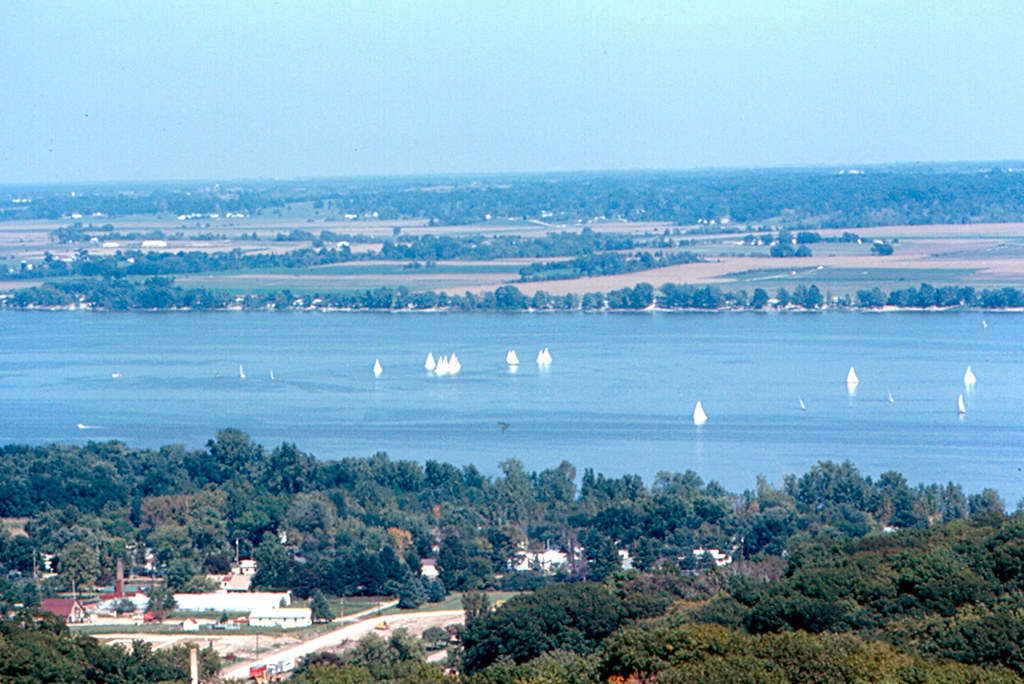
Upper Peoria Lake is a section of the Illinois River located primarily between Peoria County and Woodford County, Illinois.
The lake runs from South Rome to Peoria Heights, with Spring Bay and the Detweiller Marina area of Peoria near the middle. It empties through a narrow part of the Illinois River into the smaller Peoria Lake, also known as Lower Peoria Lake, just north of Peoria Heights.
Senachwine Lake
Senachwine Lake is a 3,324-acre riparian lake located in Putnam and Marshall counties, Illinois, forming part of the valley of the Illinois River. The lake’s elevation is 439 feet above sea level and is connected by a shallow channel to adjacent Goose Lake, also a backwater lake of the Illinois River.
Senachwine Lake offers a variety of recreational opportunities such as fishing, boating, and camping.
Lake Springfield

Lake Springfield is a 3,965-acre reservoir located on the southeast edge of the city of Springfield, Illinois. The lake was formed by building Spaulding Dam across Sugar Creek, a tributary of the Sangamon River, and is the largest municipally-owned body of water in Illinois.
The lake and the lands adjoining it are all owned by City Water, Light & Power, which operates the Dallman Power Plant at the lake’s north end. Lake Springfield has served as a source of water for Springfield, a cooling water source for the power plant, and a focus of local recreation, with high-powered motor boats allowed on much of the lake. The lake is also known for warm-water fish.
Crab Orchard Lake
Crab Orchard Lake is a 6,965-acre reservoir located in Williamson County, Illinois, and is the centerpiece of the Crab Orchard National Wildlife Refuge. The lake was created in the 1930s by damming Crab Orchard Creek, a tributary of the Big Muddy River, for recreation and flood control purposes.
The lake offers opportunities for boating, camping, fishing, and swimming, with two campgrounds operating on the northern side of the lake. Crab Orchard Lake is stocked with largemouth bass and has artificial spawning beds installed in the lake’s Grassy Bay, with the record largemouth caught in the lake weighing 10.6 pounds.
Carlyle Lake
Carlyle Lake is a 25,000-acre reservoir largely located in Clinton County, Illinois, with smaller portions of the lake within Bond and Fayette counties. It is the largest man-made lake in Illinois, and the largest lake wholly contained within the state.
The Carlyle Lake project began in 1958 and was completed in April 1967, with the damming of the Kaskaskia River at Carlyle creating the largest man-made lake in Illinois. The lake offers opportunities for boating, fishing, camping, and hunting, with over 11,000 acres of public land surrounding the lake.

