Nestled within the rugged embrace of the Rocky Mountains, Colorado’s breathtaking landscapes have long been a source of inspiration for adventure seekers and nature enthusiasts. Yet, beyond the soaring peaks and alpine meadows, another captivating world awaits exploration—the intricate network of rivers and lakes that thread their way through the state’s tapestry.
These lifelines have not only shaped the geography of Colorado but have also woven themselves into its cultural and ecological heritage. Join us as we embark on a journey of discovery, tracing the sinuous paths of Colorado’s rivers and immersing ourselves in the serene beauty of its lakes.
In this article, we dive into the rich aquatic heritage that has flowed through the heart of the Centennial State, inviting you to uncover the stories that ripple beneath the surface and appreciate the vital role these waterways play in sustaining both nature and human life.
Printable Colorado Lakes and Rivers Map
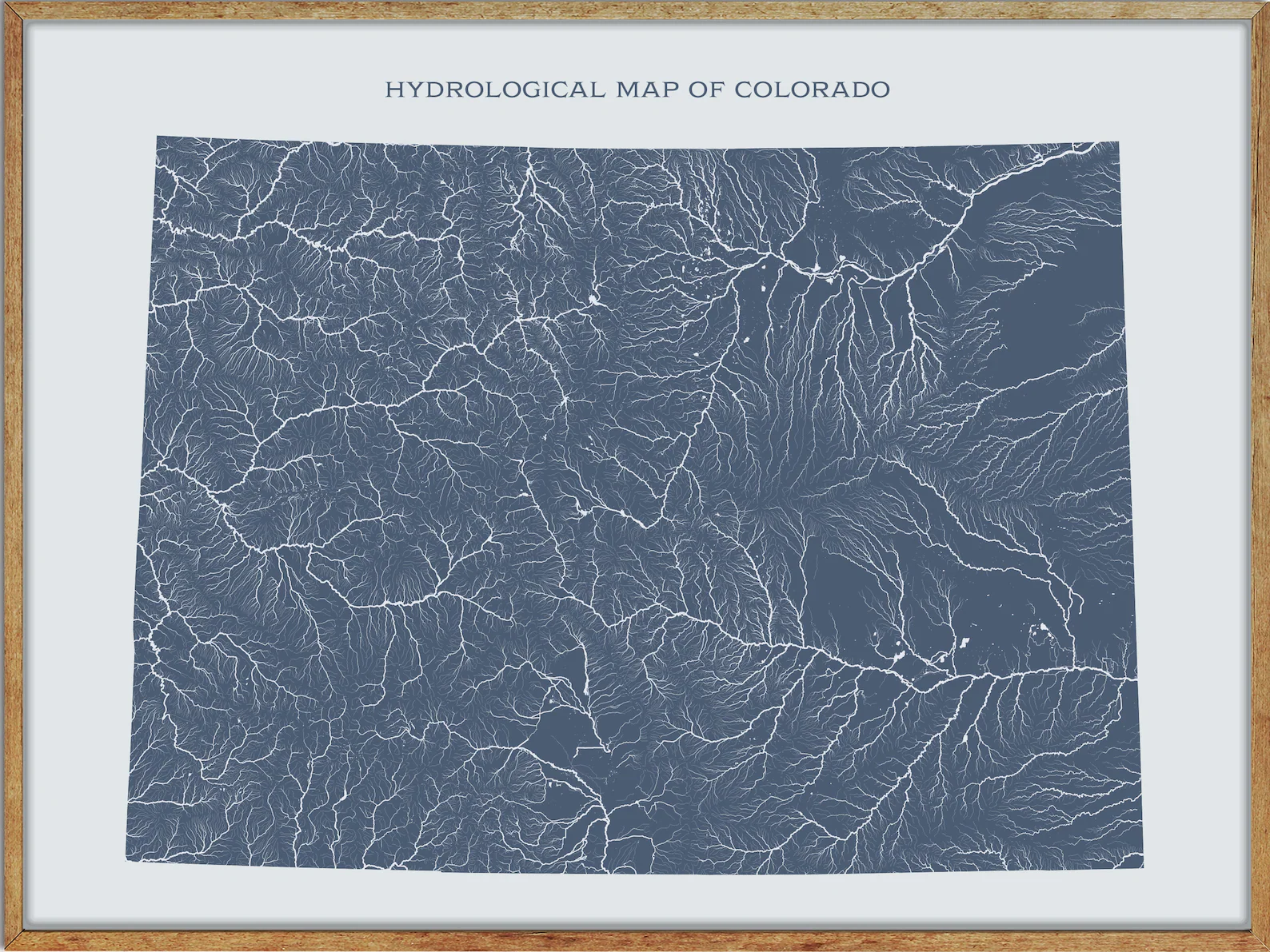
Rivers
Colorado River
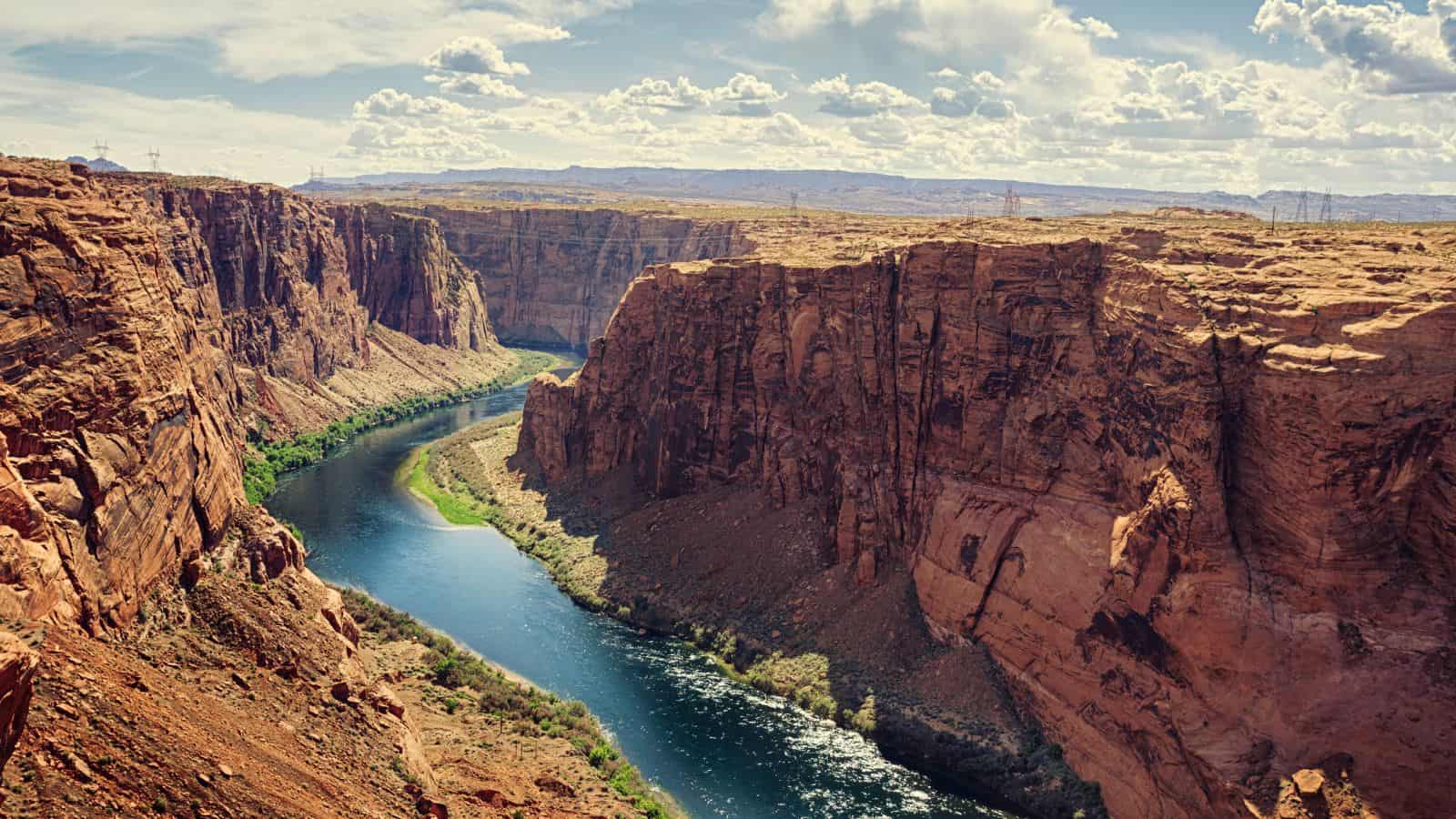
The Colorado River is one of the principal rivers in the Southwestern United States and in northern Mexico, draining an expansive, arid watershed that encompasses parts of seven U.S. states and two Mexican states.
Known for its dramatic canyons, whitewater rapids, and eleven U.S. National Parks, the Colorado River and its tributaries are a vital source of water for 40 million people. However, intensive water consumption has dried up the lower 100 miles of the river, which has rarely reached the sea since the 1960s and the level of human development and control of the river continues to generate controversy.
South Platte River

The South Platte River is one of the two principal tributaries of the Platte River, flowing through the U.S. states of Colorado and Nebraska, and serving as the principal source of water for eastern Colorado.
Its drainage basin includes much of the eastern flank of the Rocky Mountains in Colorado, much of the populated region known as the Colorado Front Range and Eastern Plains, and a portion of southeastern Wyoming in the vicinity of the city of Cheyenne. In its valley along the foothills of Colorado, it has permitted agriculture in an area of the Colorado Piedmont and Great Plains that is otherwise arid.
White River

The White River is a 195-mile-long river in the U.S. states of Colorado and Utah and is a tributary of the Green River, which flows into the Colorado River.
The river rises in two forks in northwestern Colorado in the Flat Tops Wilderness Area in the White River National Forest, and is navigable by small boats throughout most of its length, with flows varying from 400 cu ft/s in late summers of dry years to well over 3,000 cu ft/s in spring.
Yampa River

The Yampa River is a 250-mile-long river in northwestern Colorado, United States, rising in the Rocky Mountains and flowing as a tributary of the Green River and a major part of the Colorado River system. It is one of the few free-flowing rivers in the western United States, with only a few small dams and diversions.
The name “Yampa” is derived from the Snake Indians word for the Perideridia plant, which has an edible root and was found to be particularly abundant in the watershed by John C. Frémont in 1843.
Purgatoire River

The Purgatoire River, also known as the Purgatory and Picketwire River, is in southeastern Colorado, United States, originating in the high mountains of the Culebra Range. The river flows east-northeastward 196 miles to a confluence with the Arkansas River near Las Animas in Bent County, Colorado, and drains an area of 3,449 square miles, most of which is in Colorado but a small percentage of the watershed is in New Mexico.
The Purgatoire River watershed is lightly populated, with the population declining since 1920 as former coal mining and agricultural communities have become ghost towns.
Dolores River

The Dolores River is a 241-mile-long tributary of the Colorado River in the U.S. states of Colorado and Utah, draining a rugged and arid region of the Colorado Plateau west of the San Juan Mountains.
Its name derives from the Spanish El Rio de Nuestra Señora de Dolores, River of Our Lady of Sorrows, and was explored and possibly named by Juan Maria Antonio Rivera during a 1765 expedition from Santa Fe. However, due to diversions, the mean annual flow of the Dolores has been reduced from approximately 1,200 cu ft/s to about 600 cu ft/s.
Arikaree River
The Arikaree River is a 156-mile-long river that flows through the central Great Plains of North America, mostly in the American state of Colorado, draining land between the North and South Forks of the Republican River, and it flows into the North Fork in Nebraska after flowing a short distance through Kansas.
It is named after the Arikara Native Americans, whose name refers to “horn”, and is a designated area within the Colorado Natural Areas Program to protect native and uncommon species that may be endangered or threatened.
Rio Grande

The Rio Grande, one of the principal rivers in the southwestern United States and in northern Mexico, is the 4th longest river in North America by main stem, with a length of 1,896 miles, originating in south-central Colorado and flowing to the Gulf of Mexico.
Its drainage basin has an area of 182,200 square miles, and the river with its fertile valley, along with its tributaries, is a vital water source for seven US and Mexican states, flowing primarily through arid and semi-arid lands. However, since the mid-twentieth century, only 20% of the Rio Grande’s water reaches the Gulf of Mexico, due to the voluminous consumption of water required to irrigate farmland and to continually hydrate cities.
Gunnison River

The Gunnison River is one of the largest tributaries of the Colorado River, located in western Colorado, United States, and flowing 180 miles from east to west, with a drainage area of 7,923 square miles.
The river carves through the San Juan Mountains and flows into the Colorado River at Grand Junction, and is a popular spot for recreational activities such as fishing, rafting, boating, camping, hiking, and rock climbing. However, contamination of the Gunnison River with selenium and mercury is a conservation concern for several species of fish whose critical habitat includes the lower Gunnison River.
South Fork Republican River

The South Fork Republican River is a river that begins in Lincoln County, Colorado, United States and flows east-northeastward for about 171 miles through Kit Carson and Yuma Counties, Colorado, and Cheyenne County, Kansas, to a confluence with the Republican River in Dundy County, Nebraska.
Bonny Reservoir, located in Yuma County, Colorado, is situated on the South Fork Republican River. The river drains an area of 2,778 square miles, including 75.8% in eastern Colorado, 24.0% in northwestern Kansas, and 0.2% in southwestern Nebraska.
Big Sandy Creek

Big Sandy Creek is a 211-mile-long tributary of the Arkansas River in Colorado, known for being the site of the Sand Creek Massacre in Kiowa County. While long stretches of the creek are dry most of the time on the surface, water still flows underground.
The creek begins near Peyton in El Paso County and flows through several counties before joining with the Arkansas River in Prowers County east of Lamar.
Cache la Poudre River

The Cache la Poudre River, also known as the Poudre River, is a river in Colorado with its headwaters in the Front Range in Larimer County, in the northern part of Rocky Mountain National Park. The name, Cache la Poudre, refers to an incident in the 1820s when French trappers, caught by a snowstorm, were forced to bury part of their gunpowder along the banks of the river.
The river descends eastward in the mountains through the Roosevelt National Forest in Poudre Canyon, emerges from the foothills north of the city of Fort Collins, flows eastward across the plains, passing north of the city of Greeley, and flows into the South Platte River approximately 5 miles east of Greeley.
Blue River
The Blue River is a 65-mile-long tributary of the Colorado River in Colorado, rising in southern Summit County, on the western side of the continental divide in the Ten Mile Range, near Quandary Peak. It flows northwards past Blue River and Breckenridge, then through the Dillon Reservoir near Dillon, where the west portal for the “Roberts Tunnel” is located.
The river then flows north-northwest along the eastern slope of the Gore Range and joins the Colorado River at Kremmling, where the Green Mountain Dam forms the Green Mountain Reservoir, providing hydroelectric power and diversionary water for irrigation as part of the Colorado-Big Thompson Project.
Little Snake River

The Little Snake River is a 155-mile-long tributary of the Yampa River, flowing through southwestern Wyoming and northwestern Colorado. It rises near the continental divide in northern Routt County, Colorado, and flows west along the Wyoming-Colorado state line, meandering across the border several times and flowing past the Wyoming towns of Dixon and Baggs.
The river turns southwest and flows through Moffat County, Colorado, joining the Yampa approximately 45 miles west of Craig, just east of Dinosaur National Monument. However, the Little Snake is not generally navigable except seasonally in years of plentiful water.
Animas River

The Animas River, a tributary of the San Juan River and part of the Colorado River system, is a 126-mile-long river in the western United States. Spanish explorer Juan Maria de Rivera of Santa Fe recorded the name “Rio de las Animas” (in English, River of Souls) in 1765.
The Animas-La Plata Water Project, completed in 2015, pumps water over a low pass to fill a reservoir, Lake Nighthorse, in Ridges Basin to satisfy Southern Ute tribal water rights claims associated with the Colorado Ute Settlement Act amendments of 2000.
North Platte River

The North Platte River is a major tributary of the Platte River, approximately 716 miles long, flowing through the U.S. states of Colorado, Wyoming, and Nebraska. The head of the river is essentially all of Jackson County, Colorado, whose boundaries are the continental divide on the west and south and the mountain drainage peaks on the east.
From Jackson County, the river flows north out of the Routt National Forest and North Park near what is now Walden, Colorado, to Casper, Wyoming, then turns to the east-southeast and flows about 350 miles to the city of North Platte, Nebraska, where it joins the South Platte River to form the Platte River.
Uncompahgre River

The Uncompahgre River is a 75-mile-long tributary of the Gunnison River in southwestern Colorado, with its headwaters at Lake Como in the Uncompahgre National Forest in the northwestern San Juan Mountains.
The river flows northwest past Ouray, Ridgway, Montrose, and Olathe and joins the Gunnison at Confluence Park in Delta, forming Poughkeepsie Gulch and the Uncompahgre Gorge. The Uncompahgre River is used for irrigation in the Uncompahgre Valley and is unnavigable except at high water.
San Miguel River

The San Miguel River is an 81-mile-long tributary of the Dolores River in southwestern Colorado. It rises in the San Juan Mountains southeast of Telluride and flows northwest, past the towns of Placerville and Nucla, along the southern slope of the Uncompahgre Plateau before joining the Dolores in western Montrose County, approximately 15 miles east of the state line with Utah.
The river is known for its scenic beauty and recreational opportunities, including fishing, kayaking, and rafting.
Mancos River
The Mancos River is an 85.4-mile-long northeast tributary of the San Juan River, flowing from the confluence of West Mancos River and East Mancos River near Mancos, Colorado, and joining the San Juan near Four Corners Monument in New Mexico.
The river was named after an incident during which a horse rider hurt his hand while crossing, and the word Mancos is derived from Spanish, meaning “one-armed”. The Mancos River is a popular destination for fly fishing, kayaking, and hiking, with scenic views of the surrounding mountains and canyons.
Huerfano River
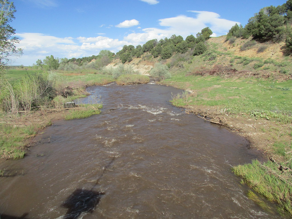
The Huerfano River is a 113-mile-long tributary of the Arkansas River in Pueblo and Huerfano counties in Colorado, flowing from a source on Blanca Peak in the Sangre de Cristo Mountains and joining the Arkansas in Pueblo County just south of the town of Boone.
The river’s major tributary is the Cucharas River. The Huerfano River was named after the nearby Huerfano Butte, which derives its name from Spanish, meaning “orphan,” due to its remote location. The river is a popular destination for fishing, hiking, and scenic drives.
Apishapa River

The Apishapa River is a 139-mile-long tributary of the Arkansas River that flows from a source near West Spanish Peak in southern Colorado and joins the Arkansas east of Fowler, Colorado.
The river’s discharge is measured by a U.S. Geological Survey (USGS) station, #07119500, located near Fowler. The level and salinity levels of the Apishapa River are monitored by gaging stations installed at three locations along the headwaters of the river in 2007, making it an important source of data for water management in the region.
Lakes
Navajo Lake

Navajo Lake is a large reservoir located in San Juan County and Rio Arriba County in northwestern New Mexico, with portions of the reservoir extending into Archuleta County in southern Colorado. The lake is part of the Colorado River Storage Project and is managed by the Navajo Dam, which stores and releases water for local irrigation and ultimately reaches the Colorado River in Utah.
The lake has smallmouth bass, black crappie, northern pike, channel catfish, and trout, and the New Mexico and Colorado shorelines are part of Navajo Lake State Park and Navajo State Park, respectively. However, the construction of the dam and the resulting lake flooded and destroyed one of the Navajos’ most sacred sites, and forced hundreds of families to leave their homes and communities.
Lake Granby

Lake Granby is the third largest body of water in Colorado, created by the Granby Dam as part of the Bureau of Reclamation’s Colorado-Big Thompson Project. The lake has approximately 40 miles of shoreline and is popular with anglers, being continually stocked with rainbow trout and kokanee salmon.
In addition, the Lake Granby Yacht Club is located on the lake, with an elevation of 8,280 feet, making it one of the highest-elevation yacht clubs in the world, slightly beating out the Grand Lake Yacht Club on nearby Grand Lake.
Blue Mesa Reservoir

Blue Mesa Reservoir is the largest lake located entirely within Colorado, an artificial reservoir created by the construction of Blue Mesa Dam on the upper reaches of the Gunnison River. The dam, constructed in 1966 by the U.S. Bureau of Reclamation for the generation of hydroelectric power, stands 390 feet tall and is the largest earthen fill dam in the United States.
Managed as part of the Curecanti National Recreation Area, Blue Mesa Reservoir is the largest lake trout and Kokanee salmon fishery in Colorado and a popular destination for fishing, boating, camping, and hiking.
Grand Lake

Grand Lake, located in Colorado, is the state’s largest and deepest natural lake and is also part of the headwaters of the Colorado River. The lake became a component in the Colorado-Big Thompson Project in 1937, serving as a conduit for C-BT project water that diverts water from the Colorado River Basin east via the Alva B. Adams Tunnel under the Continental Divide and Rocky Mountain National Park.
The lake is home to the Grand Lake Yacht Club, which hosts sailing races, as well as publicly and privately operated marinas, a public boat ramp, and public boat docks.
Hanging Lake

Hanging Lake is a popular tourist destination located in Glenwood Canyon, about 7 miles east of Glenwood Springs, Colorado. The lake is reached via a trailhead located along the Glenwood Canyon Bike and Pedestrian Path that runs along the north side of I-70 at the bottom of the canyon.
The trail follows Dead Horse Creek, a tributary of the Colorado River, and ascends some 1,000 feet in elevation for 1.2 miles from the trailhead to the lake. While open, visitors can enjoy the unique beauty of the lake, which features crystal-clear water and stunning waterfalls.
Sprague Lake

Sprague Lake is a scenic lake located in Rocky Mountain National Park, on the south side of Glacier Creek, about two miles south of the Hollowell turnoff. The lake offers a half-mile walk around the lake, which is wheelchair accessible and features boardwalks and bridges with stunning views of Flattop Mountain and Hallet Peak.
The area is named after Abner Sprague, who started a homestead there in 1874 and later opened a lodge for dude ranching, hunting, and fishing. The lake is also popular for Brook trout fishing, and the area became part of Rocky Mountain National Park in 1915, serving guests at the Sprague Hotel until 1960.
Crater Lake

Crater Lake is a stunning mountain lake located in the Elk Mountains of Pitkin County, Colorado. The lake lies just northeast of the Maroon Bells and northwest of Pyramid Peak, offering breathtaking views of the striated Maroon Bells that are among the most photographed mountain scenes in the United States.
Visitors can enjoy hiking trails and scenic overlooks around the lake, making it a popular destination for outdoor enthusiasts and photographers alike.
Lake Estes
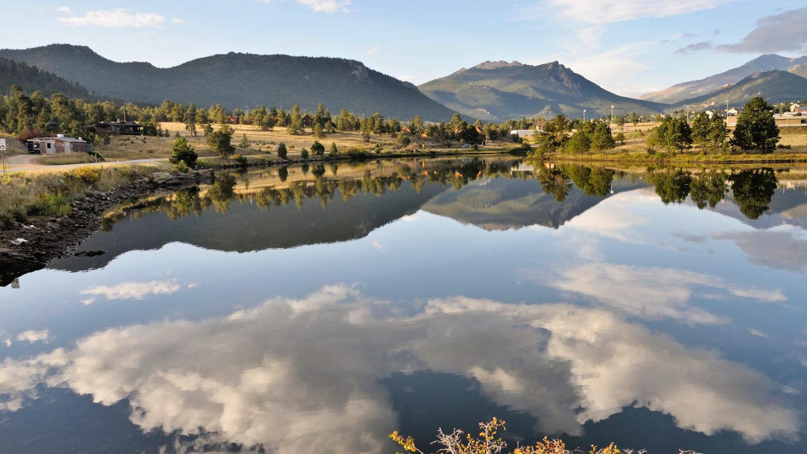
Lake Estes is a beautiful reservoir located in Estes Park, Colorado, created by Olympus Dam. With a shoreline of about 4 miles and a surface area of 185 acres, the lake is a popular destination for boating, fishing, and other outdoor activities.
The reservoir is a component of the Colorado-Big Thompson Project and sits at an elevation of 7,522 feet with approximately 4 miles of shoreline within Larimer County, offering stunning views of the surrounding mountains and natural beauty.
Bear Lake

Bear Lake is a stunning alpine lake located in Rocky Mountain National Park, sitting at an elevation of 9,450 feet beneath the sheer flanks of Hallett Peak and the Continental Divide. The lake is a popular trailhead and destination, offering several trails ranging from easy strolls to strenuous hikes that start from the lake.
The Bear Lake Road is open year-round, and an ample parking lot is provided close to the lake, while several moraines can be found downhill of Bear Lake, which was formed during the ice age by a big chunk of ice.
Lake Dillon
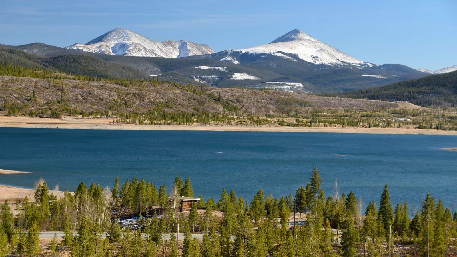
Lake Dillon, also known as Dillon Reservoir, is a large freshwater reservoir located in Summit County, Colorado, bordered by the towns of Frisco, Silverthorne, and Dillon.
The reservoir serves as a water source for the city of Denver and is under the control of Denver Water. Popular ski areas such as Copper Mountain, Keystone, Arapahoe Basin, and Breckenridge are located near the reservoir, making it a popular destination for outdoor enthusiasts year-round. Visitors can enjoy a variety of recreational activities, including boating, fishing, hiking, and skiing.
Dream Lake

Dream Lake is a stunning high alpine lake located in Rocky Mountain National Park in northern Colorado, situated east of the continental divide. The lake is nestled at the base of Hallett Peak and can be accessed via the Bear Lake trailhead, offering breathtaking views of the surrounding steep cliffs.
Dream Lake is a popular destination for casual hiking, with a relatively easy trail leading to the lake, making it an ideal spot for visitors to enjoy the natural beauty of the park.
Shadow Mountain Lake

Shadow Mountain Lake is a beautiful reservoir located in Grand County, Colorado, near the headwaters of the Colorado River. The lake is created by Shadow Mountain Dam and forms a continuous body of water with Grand Lake, the largest natural lake in Colorado. Shadow Mountain Lake is part of the Arapaho National Recreation Area and was authorized by the Colorado-Big Thompson bill in 1937, which created the Colorado-Big Thompson Project.
Water from the Grand Lake-Shadow Mountain Lake body is diverted through the Alva B. Adams tunnel into the Big Thompson River on the east side of the Continental Divide, with storage beginning in 1947. Visitors to the area can enjoy a variety of recreational activities, including boating, fishing, hiking, and camping.
Monarch Lake

Monarch Lake is a beautiful reservoir located in Grand County, Colorado, within the Arapaho National Recreation Area. The reservoir is surrounded by stunning natural beauty, with the Indian Peaks Wilderness on its north and east sides and the Continental Divide National Scenic Trail passing along its south side.
The trailhead at the west end of the lake marks the beginnings or ends of several other popular hiking trails, making it a popular destination for outdoor enthusiasts looking to explore the area’s natural beauty. Visitors can enjoy a variety of recreational activities, including hiking, fishing, and camping.

