
Maps of New Hampshire are an invaluable tool when it comes to ancestral and family history research, especially if you live far away from where your ancestor was living.
Given that New Hampshire’s political and county boundaries have sometimes changed over the years, historic maps are crucial in helping you uncover the precise location of your ancestor’s hometown, what land they owned, just who their neighbors happen to be, and much more besides.
Maps of New Hampshire are an excellent resource for getting started with your family tree because they provide valuable information and facts in an immediate and easily understandable format.
New Hampshire is an area with excellent state and city maps, making it possible to follow migration trails through the study of political divisions and geographic features. David A. Cobb, in New Hampshire Maps to 1900: An Annotated Checklist (Concord, N.H.: New Hampshire Historical Society, 1981), helps to identify and locate many maps for research purposes.
An excellent, currently published atlas for the entire state is The New Hampshire Atlas and Gazetteer, published by DeLorme Publishing in Freeport, Maine. It is continually updated and contains excellent maps of New Hampshire, including major roads (indicating the type of surface) and geological features.
Earlier versions contain markings for structures, some cemeteries, and churches. Although it is slightly too large for easy carrying, its usefulness outweighs this hindrance.
Excellent statewide nineteenth-century maps can also be found. D. H. Hurd and Co., Town and City Atlas of the State of New Hampshire (Boston, 1892) indicates occupants’ names for structures and treats each town on a separate page, with close-up maps for more populated areas. Saco Valley Publishing, 76 Main St., Fryeburg, ME 04037, has been reprinting excellent county editions of these in a handy notebook size.
As with other New England states, obtaining a copy of the town’s lotting map (the way land was divided before being granted or sold) can be extremely beneficial in solving genealogical problems. The most comprehensive collection of these can be found at the New Hampshire Records and Archives.
The layouts are cataloged by town, and include the numbering process of lots and, in many cases, the name of the original proprietor, which can help backtrack land holdings and provide a chain of title for problem-solving. Many of these are found in the New Hampshire State Papers as well.
New Hampshire is bordered by Maine, Massachusetts, Vermont, and Canada. New Hampshire’s largest cities are Manchester, Nashua, Concord, Derry, Dover, Rochester, Salem, Merrimack, Hudson, Londonderry, and Keene.
Learn more historical facts about New Hampshire counties here.
Interactive Map of New Hampshire County Formation History
AniMap Plus 3.0, with the permission of the Goldbug Company
List of Every New Hampshire County
Belknap County
Established in 1840, Belknap County is located in the central part of the state. The county seat is Laconia, and the population was 60,283 as of the 2020 census.
Carroll County
Founded in 1840, Carroll County is located in the northern part of the state. The county seat is Ossipee, and the state was home to 47,901 people as of the 2020 census.
Cheshire County
Established in 1769, Cheshire County is situated in the southwestern part of the state. The county seat is Keene, and the population was 76,301 as of the 2020 census.
Coos County
Coos County is located in the northernmost part of the state and was established in 1803. The county seat is Lancaster, and the state had 31,238 residents as of the 2020 census.
Grafton County
Established in 1769, Grafton County is situated in the western part of the state. The county seat is North Haverhill, and the population was 92,831 as of the 2020 census.
Hillsborough County
Founded in 1769, Hillsborough County is located in the southern part of the state. The county seat is Manchester, and the state was home to 417,694 people as of the 2020 census.
Merrimack County
Established in 1823, Merrimack County is located in the central part of the state. The county seat is Concord, which is also the state capital, and the population was 157,327 as of the 2020 census.
Rockingham County
Rockingham County is situated in the southeastern part of the state and was established in 1769. The county seat is Brentwood, and the state had 315,803 residents as of the 2020 census.
Strafford County
Established in 1771, Strafford County is located in the southeastern part of the state. The county seat is Dover, and the population was 132,971 as of the 2020 census.
Sullivan County
Founded in 1827, Sullivan County is situated in the western part of the state. The county seat is Newport, and the state was home to 42,312 people as of the 2020 census.
Old Antique Atlases & Maps of New Hampshire
Disclaimer: All maps are free to use for your own genealogical purposes and may not be reproduced for resale or distribution. Source: David Rumsey Historical Map Collection
-
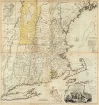
1776 New England Atlas Map
-

1776 New Hampshire Atlas Map
1776 Maine, Massachusetts and New Hampshire Atlas Map
-

1795 Map of New Hampshire
-
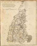
1804 New Hampshire Atlas Map
-

1814 Atlas Map of New Hampshire
-
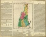
1822 Atlas Map Of New Hampshire
1822 Geographical, Historical, And Statistical Atlas Map Of New Hampshire
-
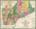
1827 New Hampshire Map
1827 Map of Maine, New Hampshire, and Vermont
-
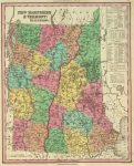
1836 Atlas Map Of New Hampshire
1836 Atlas Map Of New Hampshire & Vermont
-
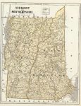
1845 New Hampshire Map
1845 New Hampshire and Vermont Atlas Map
-
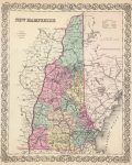
1856 New Hampshire Atlas Map
-
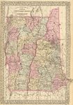
1880 New Hampshire Map
1880 County and township map of the states of New Hampshire and Vermont
New Hampshire Map Links
- New Hampshire State Park Map (mapofus.org)
- New Hampshire Lakes and Rivers Map (mapofus.org)
- New Hampshire Map With Cities and Highways (mapofus.org)
- New Hampshire Digital Map Library (usgwarchives.net)
- Old Historical Maps of New Hampshire (alabamamaps.ua.edu)
- New Hampshire Maps, Atlases & Gazetteers (ancestry.com)
- New Hampshire Maps – The Perry-Castañeda Library Map Collection (lib.utexas.edu)
- U.S., Indexed County Land Ownership Maps, 1860-1918 (ancestry.com)
- American Memory Map Collection: 1500-2004 (memory.loc.gov)
- Old Maps of New Hampshire (old-maps.com)
- NH Map Books (amazon.com)

