
Maps of Kentucky are a vital element when it comes to genealogy and family tree research, particularly in the event that you live far from where your ancestors lived.
Given that Kentucky’s political borders have sometimes changed over the years, historic maps are essential in helping you find out the exact location of your ancestor’s home, what land they owned, just who their neighbors had been, and a lot more besides.
Maps of Kentucky are an excellent way of getting started with your research since they provide you with useful information and facts right away and then present them in a clear and easily understandable format.
Kentucky’s 10 largest cities are Louisville, Lexington-Fayette, Bowling Green, Owensboro, Covington, Hopkinsville, Richmond, Florence, Georgetown, and Henderson.
Learn more about Historical Facts of Kentucky Counties.
Interactive Map of Kentucky County Formation History
AniMap Plus 3.0, with the permission of the Goldbug Company
List of Every Kentucky County
Adair County
Established in 1801, Adair County has a population of around 19,000 and is located in the south-central region of Kentucky.
Allen County
Allen County was established in 1815 and has a population of approximately 21,000. It is situated in the southern part of Kentucky.
Anderson County
Anderson County was founded in 1827 and has a population of around 22,000. It is located in the central part of the state.
Ballard County
Ballard County was established in 1842 and has a population of about 8,000. It is located in the far western part of Kentucky.
Barren County
Barren County was founded in 1798 and has a population of around 45,000. It is located in south-central Kentucky.
Bath County
Bath County was established in 1811 and has a population of approximately 12,000. It is located in the northeastern part of the state.
Bell County
Bell County was founded in 1867 and has a population of about 26,000. It is located in the southeastern part of Kentucky.
Boone County
Boone County was established in 1799 and has a population of around 135,000. It is located in the northern part of the state.
Bourbon County
Bourbon County was founded in 1786 and has a population of approximately 20,000. It is located in the northeastern part of Kentucky.
Boyd County
Boyd County was established in 1860 and has a population of about 46,000. It is located in the northeastern part of the state, along the Ohio River.
Boyle County
Boyle County was founded in 1842 and has a population of approximately 30,000. It is located in the central part of the state.
Bracken County
Bracken County was established in 1796 and has a population of around 8,000. It is located in the northeastern part of Kentucky.
Breathitt County
Breathitt County was founded in 1839 and has a population of about 12,000. It is located in the southeastern part of the state.
Breckinridge County
Breckinridge County was established in 1800 and has a population of approximately 20,000. It is located in the western part of Kentucky.
Bullitt County
Bullitt County was founded in 1796 and has a population of around 81,000. It is located in the north-central part of the state.
Butler County
Butler County was established in 1810 and has a population of about 13,000. It is located in the western part of Kentucky.
Caldwell County
Caldwell County was founded in 1809 and has a population of approximately 12,000. It is located in the southwestern part of the state.
Calloway County
Calloway County was established in 1822 and has a population of around 40,000. It is located in the southwestern part of Kentucky.
Campbell County
Campbell County was founded in 1794 and has a population of about 93,000. It is located in the northern part of the state, across the Ohio River from Cincinnati, Ohio.
Carlisle County
Carlisle County was established in 1886 and has a population of approximately 4,500. It is located in the far western part of Kentucky.
Carroll County
Carroll County was founded in 1838 and has a population of around 10,000. It is located in the northern part of Kentucky, along the Ohio River.
Carter County
Carter County was established in 1838 and has a population of approximately 27,000. It is located in the northeastern part of the state.
Casey County
Casey County was founded in 1806 and has a population of about 16,000. It is located in the south-central part of Kentucky.
Christian County
Christian County was established in 1797 and has a population of around 80,000. It is located in the southwestern part of Kentucky.
Clark County
Clark County was founded in 1792 and has a population of approximately 36,000. It is located in the northeastern part of the state.
Clay County
Clay County was established in 1807 and has a population of about 19,000. It is located in the southeastern part of Kentucky.
Clinton County
Clinton County was founded in 1835 and has a population of approximately 10,000. It is located in the south-central part of the state.
Crittenden County
Crittenden County was established in 1842 and has a population of around 9,000. It is located in the southwestern part of Kentucky.
Cumberland County
Cumberland County was founded in 1798 and has a population of about 6,500. It is located in the south-central part of Kentucky.
Daviess County
Daviess County was established in 1815 and has a population of approximately 102,000. It is located in the western part of the state.
Edmonson County
Edmonson County was founded in 1825 and has a population of around 12,000. It is located in the south-central part of Kentucky.
Elliott County
Elliott County was established in 1869 and has a population of approximately 7,500. It is located in the northeastern part of the state.
Estill County
Estill County was founded in 1808 and has a population of about 14,000. It is located in the eastern part of Kentucky.
Fayette County
Fayette County was established in 1780 and has a population of around 336,000. It is located in the north-central part of Kentucky and includes the city of Lexington.
Fleming County
Fleming County was founded in 1798 and has a population of approximately 14,500. It is located in the northeastern part of the state.
Floyd County
Floyd County was established in 1800 and has a population of about 36,000. It is located in the southeastern part of Kentucky.
Franklin County
Franklin County was founded in 1795 and has a population of around 50,000. It is located in the north-central part of Kentucky and includes the state capital of Frankfort.
Fulton County
Fulton County was established in 1845 and has a population of approximately 6,500. It is located in the far western part of Kentucky.
Gallatin County
Gallatin County was founded in 1798 and has a population of around 9,000. It is located in the northern part of Kentucky, along the Ohio River.
Garrard County
Garrard County was established in 1796 and has a population of about 18,500. It is located in the central part of Kentucky.
Grant County
Grant County was founded in 1820 and has a population of approximately 25,000. It is located in the northern part of Kentucky.
Graves County
Graves County was established in 1824 and has a population of around 36,000. It is located in the southwestern part of Kentucky.
Grayson County
Grayson County was founded in 1810 and has a population of about 27,000. It is located in the central part of Kentucky.
Green County
Green County was established in 1792 and has a population of approximately 11,000. It is located in the south-central part of Kentucky.
Greenup County
Greenup County was founded in 1803 and has a population of around 35,000. It is located in the northeastern part of the state, along the Ohio River.
Hancock County
Hancock County was established in 1829 and has a population of approximately 8,500. It is located in the western part of Kentucky, along the Ohio River.
Hardin County
Hardin County was founded in 1792 and has a population of about 110,000. It is located in the north-central part of Kentucky.
Harlan County
Harlan County was established in 1819 and has a population of around 26,000. It is located in the southeastern part of Kentucky.
Harrison County
Harrison County was founded in 1793 and has a population of approximately 19,000. It is located in the northern part of Kentucky.
Hart County
Hart County was established in 1819 and has a population of around 19,000. It is located in the south-central part of Kentucky.
Henderson County
Henderson County was founded in 1799 and has a population of approximately 45,000. It is located in the western part of Kentucky, along the Ohio River.
Henry County
Henry County was established in 1798 and has a population of around 16,000. It is located in the northern part of Kentucky.
Hickman County
Hickman County was founded in 1822 and has a population of approximately 4,500. It is located in the far southwestern part of Kentucky.
Hopkins County
Hopkins County was established in 1806 and has a population of about 45,000. It is located in the western part of Kentucky.
Jackson County
Jackson County was founded in 1858 and has a population of around 13,000. It is located in the eastern part of Kentucky.
Jefferson County
Jefferson County was established in 1780 and has a population of approximately 770,000. It is located in the north-central part of Kentucky and includes the city of Louisville.
Jessamine County
Jessamine County was founded in 1798 and has a population of about 54,000. It is located in the central part of Kentucky.
Johnson County
Johnson County was established in 1843 and has a population of around 23,000. It is located in the northeastern part of Kentucky.
Kenton County
Kenton County was founded in 1840 and has a population of approximately 170,000. It is located in the northern part of Kentucky, along the Ohio River.
Knott County
Knott County was established in 1884 and has a population of around 15,000. It is located in the southeastern part of Kentucky.
Knox County
Knox County was founded in 1799 and has a population of approximately 31,000. It is located in the southeastern part of Kentucky.
Larue County
Larue County was established in 1843 and has a population of around 15,000. It is located in the central part of Kentucky.
Laurel County
Laurel County was founded in 1825 and has a population of approximately 60,000. It is located in the southeastern part of Kentucky.
Lawrence County
Lawrence County was established in 1821 and has a population of around 16,000. It is located in the northeastern part of Kentucky.
Lee County
Lee County was founded in 1870 and has a population of approximately 7,000. It is located in the eastern part of Kentucky.
Leslie County
Leslie County was established in 1878 and has a population of around 10,000. It is located in the southeastern part of Kentucky.
Letcher County
Letcher County was founded in 1842 and has a population of approximately 22,000. It is located in the southeastern part of Kentucky.
Lewis County
Lewis County was established in 1806 and has a population of around 14,000. It is located in the northeastern part of Kentucky, along the Ohio River.
Lincoln County
Lincoln County was founded in 1780 and has a population of approximately 25,000. It is located in the central part of Kentucky.
Livingston County
Livingston County was established in 1798 and has a population of around 9,000. It is located in the western part of Kentucky, along the Ohio River.
Logan County
Logan County was founded in 1792 and has a population of around 27,000. It is located in the southwestern part of Kentucky.
Lyon County
Lyon County was established in 1854 and has a population of approximately 8,000. It is located in the western part of Kentucky, along the Kentucky Lake.
Madison County
Madison County was founded in 1785 and has a population of around 94,000. It is located in the central part of Kentucky.
Magoffin County
Magoffin County was established in 1860 and has a population of approximately 12,000. It is located in the eastern part of Kentucky.
Marion County
Marion County was founded in 1834 and has a population of around 20,000. It is located in the central part of Kentucky.
Marshall County
Marshall County was established in 1842 and has a population of approximately 31,000. It is located in the western part of Kentucky, along the Kentucky Lake.
Martin County
Martin County was founded in 1870 and has a population of around 11,000. It is located in the eastern part of Kentucky.
Mason County
Mason County was established in 1789 and has a population of approximately 17,000. It is located in the northeastern part of Kentucky, along the Ohio River.
McCracken County
McCracken County was founded in 1825 and has a population of around 65,000. It is located in the western part of Kentucky, along the Ohio River.
McCreary County
McCreary County was established in 1912 and has a population of approximately 18,000. It is located in the southeastern part of Kentucky.
McLean County
McLean County was established in 1854 and has a population of around 9,000. It is located in the western part of Kentucky, along the Green River.
Meade County
Meade County was founded in 1823 and has a population of approximately 29,000. It is located in the north-central part of Kentucky, along the Ohio River.
Menifee County
Menifee County was established in 1869 and has a population of around 6,000. It is located in the eastern part of Kentucky.
Mercer County
Mercer County was founded in 1785 and has a population of approximately 23,000. It is located in the central part of Kentucky.
Metcalfe County
Metcalfe County was established in 1860 and has a population of around 10,000. It is located in the south-central part of Kentucky.
Monroe County
Monroe County was founded in 1820 and has a population of approximately 10,000. It is located in the south-central part of Kentucky.
Montgomery County
Montgomery County was established in 1797 and has a population of around 29,000. It is located in the central part of Kentucky.
Morgan County
Morgan County was founded in 1822 and has a population of approximately 14,000. It is located in the eastern part of Kentucky.
Muhlenberg County
Muhlenberg County was established in 1798 and has a population of around 31,000. It is located in the southwestern part of Kentucky.
Nelson County
Nelson County was founded in 1784 and has a population of approximately 45,000. It is located in the central part of Kentucky.
Nicholas County
Nicholas County was established in 1800 and has a population of around 7,000. It is located in the northeastern part of Kentucky.
Ohio County
Ohio County was founded in 1798 and has a population of approximately 25,000. It is located in the western part of Kentucky, along the Green River.
Oldham County
Oldham County was established in 1823 and has a population of around 67,000. It is located in the north-central part of Kentucky.
Owen County
Owen County was founded in 1819 and has a population of approximately 10,000. It is located in the northern part of Kentucky.
Owsley County
Owsley County was established in 1843 and has a population of around 4,500. It is located in the southeastern part of Kentucky.
Pendleton County
Pendleton County was founded in 1798 and has a population of approximately 14,000. It is located in the northern part of Kentucky, along the Ohio River.
Perry County
Perry County was established in 1820 and has a population of around 26,000. It is located in the eastern part of Kentucky.
Pike County
Pike County was founded in 1821 and has a population of approximately 56,000. It is located in the eastern part of Kentucky.
Powell County
Powell County was established in 1852 and has a population of around 12,000. It is located in the eastern part of Kentucky.
Pulaski County
Pulaski County was founded in 1799 and has a population of approximately 65,000. It is located in the south-central part of Kentucky.
Robertson County
Robertson County was established in 1867 and has a population of around 2,000. It is located in the northeastern part of Kentucky.
Rockcastle County
Rockcastle County was founded in 1810 and has a population of approximately 17,000. It is located in the south-central part of Kentucky.
Rowan County
Rowan County was established in 1856 and has a population of around 24,000. It is located in the northeastern part of Kentucky.
Russell County
Russell County was founded in 1825 and has a population of approximately 18,000. It is located in the south-central part of Kentucky.
Scott County
Scott County was established in 1792 and has a population of around 60,000. It is located in the north-central part of Kentucky.
Shelby County
Shelby County was founded in 1792 and has a population of approximately 48,000. It is located in the central part of Kentucky.
Simpson County
Simpson County was established in 1819 and has a population of around 18,000. It is located in the south-central part of Kentucky.
Spencer County
Spencer County was founded in 1824 and has a population of approximately 19,000. It is located in the north-central part of Kentucky.
Taylor County
Taylor County was established in 1848 and has a population of around 26,000. It is located in the central part of Kentucky.
Todd County
Todd County was founded in 1820 and has a population of approximately 13,000. It is located in the southwestern part of Kentucky.
Trigg County
Trigg County was established in 1820 and has a population of around 14,000. It is located in the southwestern part of Kentucky.
Trimble County
Trimble County was founded in 1837 and has a population of approximately 8,500. It is located in the north-central part of Kentucky.
Union County
Union County was established in 1811 and has a population of around 15,000. It is located in the northwestern part of Kentucky.
Warren County
Warren County was founded in 1796 and has a population of approximately 133,000. It is located in the south-central part of Kentucky.
Washington County
Washington County was established in 1792 and has a population of around 12,000. It is located in the central part of Kentucky.
Wayne County
Wayne County was founded in 1800 and has a population of approximately 20,000. It is located in the southeastern part of Kentucky.
Webster County
Webster County was established in 1860 and has a population of around 13,000. It is located in the northwestern part of Kentucky.
Whitley County
Whitley County was founded in 1818 and has a population of approximately 36,000. It is located in the southeastern part of Kentucky.
Wolfe County
Wolfe County was established in 1860 and has a population of around 7,000. It is located in the eastern part of Kentucky.
Woodford County
Woodford County was founded in 1788 and has a population of approximately 26,000. It is located in the north-central part of Kentucky.
Old Antique Atlases & Maps of Kentucky
Disclaimer: All Kentucky maps are free to use for your own genealogical purposes and may not be reproduced for resale or distribution.
Source: David Rumsey Historical Map Collection
-
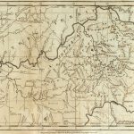
1795 Map of Kentucky
-
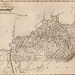
1804 State Atlas Map of Kentucky
-

1814 Atlas Map of Kentucky
-
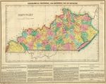
1822 Map of Kentucky
1822 Geographical, Historical, And Statistical Atlas Map Of Kentucky
-
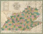
1827 Atlas Map of Kentucky and Tennessee
1827 Map of Kentucky and Tennessee, compiled for the Latest Authorities
-
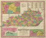
1836 Atlas Map of Kentucky
1836 A New Atlas Map Of Kentucky With Its Roads & Distances from place to place, along the Stage & Steam Boat Routes (with) three inset maps: area surrounding Lexington, Falls of Ohio, area around Williamsburg
-
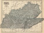
1845 Atlas Map of Kentucky & Tennessee
-
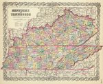
1856 Atlas Map of Kentucky & Tennessee
-
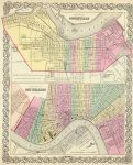
1856 Atlas Map of City Of Louisville Kentucky
1856 Atlas Map of City Of Louisville Kentucky. (with) The City Of New Orleans Louisiana
-
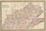
1880 County Map of Kentucky and Tennessee
D.O.T. County Road and Highway Maps of Kentucky
To View the Map: Just click the image to view the map online. In order to make the image size as small as possible, they were saved on the lowest resolution.
Kentucky Map Links
- Kentucky State Park Map (mapofus.org)
- Kentucky Lakes and Rivers Map (mapofus.org)
- Kentucky Map With Cities and Highways (mapofus.org)
- Historical Maps of Kentucky (alabamamaps.ua.edu)
- Kentucky Digital Map Library (usgwarchives.net)
- Kentucky Maps, Atlases & Gazetteers (ancestry.com)
- GIS & Maps of the Commonwealth of Kentucky (kentucky.gov)
- U.S., Indexed County Land Ownership Maps, 1860-1918 (ancestry.com)
- The Perry-Castañeda Library Kentucky Map Collection (lib.utexas.edu)
- American Memory Map Collection: 1500-2004 (memory.loc.gov)
- USGenWeb Archives Digital Map of Kentucky Library (usgwarchives.net)
- Kentucky Map Books (amazon.com)

