An illustrated town map
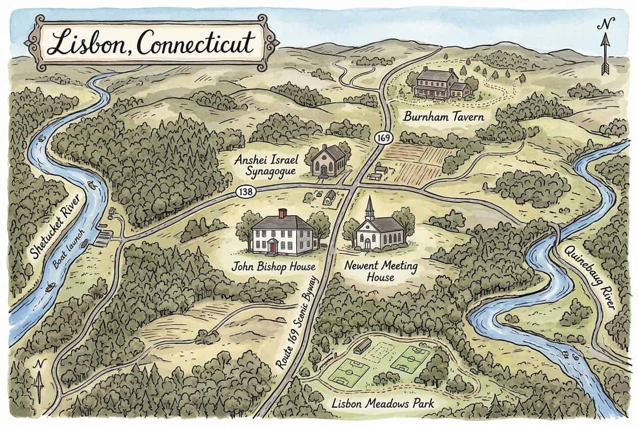
Download & use this map
This map is free to use. Towns, tourism offices, businesses, schools and bloggers are welcome to share it on websites, in newsletters or on social media. All we ask is a credit link back to this page. The easiest way to do that is the embed code below.
Embed this map on your site
About Lisbon
Lisbon is a rural town in New London County, Connecticut, incorporated in 1786, between the Quinebaug and Shetucket rivers in the Last Green Valley National Heritage Corridor. Scenic Route 169 passes the 1810 John Bishop House museum, the Newent Meeting House (est. 1723) and, nearby, the National Register-listed Anshei Israel Synagogue.
This free illustrated map pulls together the places that give Lisbon its character, including Quinebaug River, Shetucket River, John Bishop House and Newent Meeting House. Every label on the map is listed below with a short description and a link to learn more.
Lisbon at a glance
Notable places
- Quinebaug RiverRiver forming the town's east side
- Shetucket RiverRiver on the town's west side, with a boat launch
- John Bishop House1810 house museum of local history
- Newent Meeting HouseMeeting house established in 1723
- Anshei Israel Synagogue1936 synagogue on the National Register
- Burnham TavernHistoric tavern property with walking trails
- Lisbon Meadows Park59-acre park with fields and trails
- Route 169 Scenic BywayScenic road through town
- City of LisbonOfficial local government website
- ctvisit.comVisitor and tourism information for Lisbon
More maps of Connecticut
See where Lisbon sits in the state on our Connecticut county map, or browse more illustrated Connecticut town maps.
Population and area figures come from the U.S. Census Bureau; other facts from the sources linked on each card. Place links go to each place’s official website where it has one, otherwise to its Wikipedia article. The map is an artistic illustration and isn’t to scale.