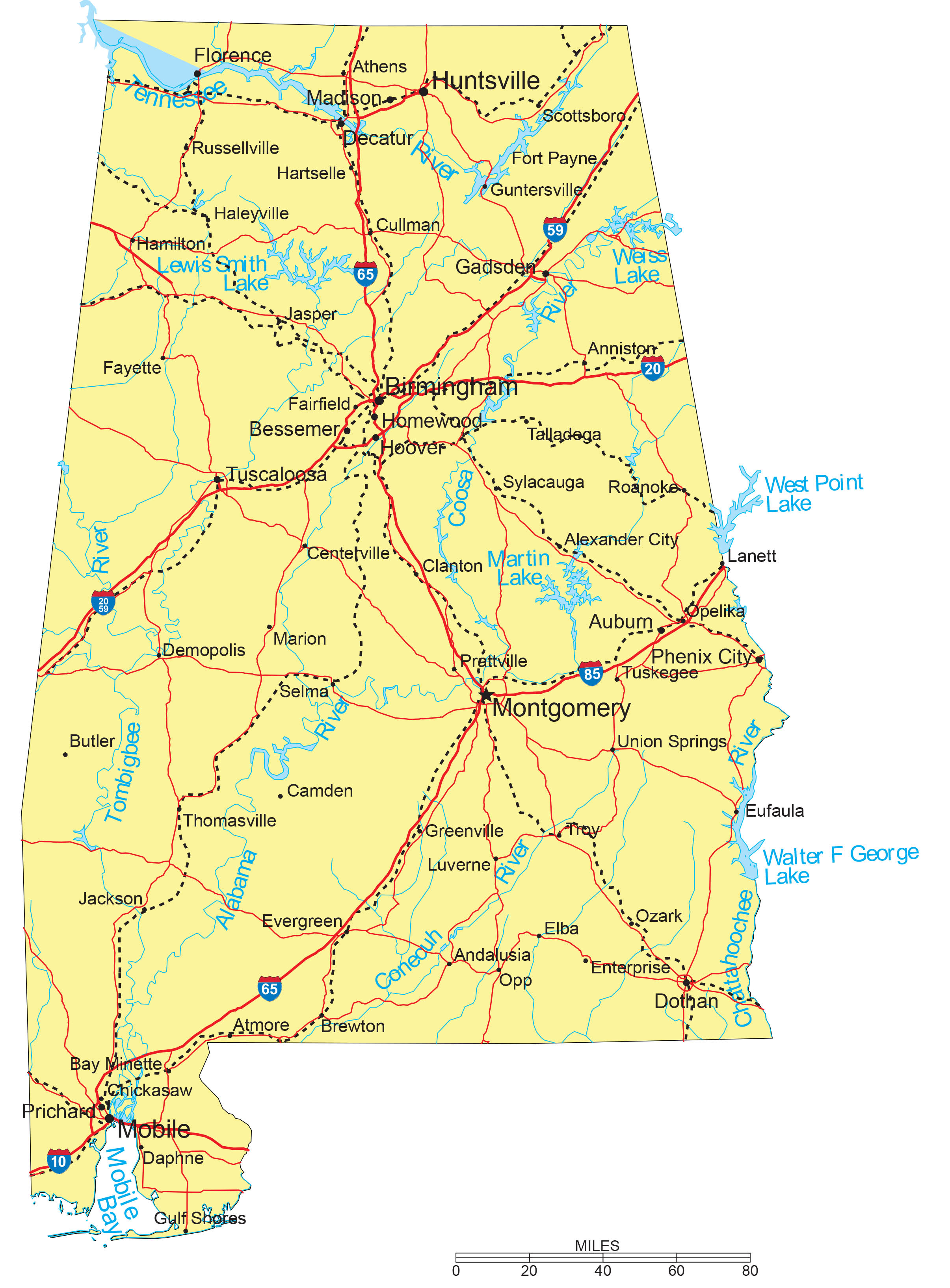
Alabama Maps are a very helpful tool for ancestral and family history research, especially in the event that you live far away from where your ancestor was residing.
Due to the fact that Alabama’s geographical features and political boundaries have frequently changed over the years, historic maps are important when it comes to helping you discover the exact location of your ancestor’s hometown, what land they owned and their property boundaries, exactly who his or her neighbors happen to be, and much more besides.
Alabama Maps are an excellent resource for starting out with your own research because they provide reliable information and facts quickly and present them in a clear and easily understandable format.
Alabama’s 10 largest cities are Birmingham, Montgomery, Mobile, Huntsville, Tuscaloosa, Hoover, Dothan, Decatur, Auburn, and Gadsden.
Learn more historical facts about Alabama counties.
Interactive Map of Alabama Counties Formation
AniMap Plus 3.0, with the permission of the Goldbug Company
List Of Every Alabama County
Autauga County
Established in 1818, Autauga County has a population of approximately 55,000. Its county seat is Prattville.
Baldwin County
Founded in 1809, Baldwin County has a population of roughly 231,000. Its county seat is Bay Minette.
Barbour County
Established in 1832, Barbour County has approximately 24,000 residents. Its county seat is Clayton.
Bibb County
Founded in 1818, Bibb County is home to approximately 22,000 people. Its county seat is Centreville.
Blount County
Established in 1818, Blount County has a population of around 58,000. Its county seat is Oneonta.
Bullock County
Established in 1866, Bullock County has a population of approximately 10,000. Its county seat is Union Springs.
Butler County
Founded in 1819, Butler County has roughly 19,000 residents. Its county seat is Greenville.
Calhoun County
Established in 1832, Calhoun County has a population of around 113,000. Its county seat is Anniston.
Chambers County
Established in 1832, Chambers County has a population of approximately 33,000. Its county seat is Lafayette.
Cherokee County
Founded in 1836, Cherokee County is home to approximately 25,000 people. Its county seat is Centre.
Chilton County
Established in 1868, Chilton County has a population of around 44,000. Its county seat is Clanton.
Choctaw County
Established in 1847, Choctaw County has approximately 12,000 residents. Its county seat is Butler.
Clarke County
Founded in 1812, Clarke County has a population of roughly 23,000. Its county seat is Grove Hill.
Clay County
Established in 1866, Clay County is home to around 13,000 people. Its county seat is Ashland.
Cleburne County
Established in 1866, Cleburne County has a population of approximately 14,000. Its county seat is Heflin.
Coffee County
Founded in 1841, Coffee County has a population of around 53,000. Its county seat is Elba.
Colbert County
Established in 1867, Colbert County has approximately 55,000 residents. Its county seat is Tuscumbia.
Conecuh County
Established in 1818, Conecuh County is home to approximately 12,000 people. Its county seat is Evergreen.
Coosa County
Established in 1832, Coosa County has a population of around 10,000. Its county seat is Rockford.
Covington County
Founded in 1821, Covington County has approximately 37,000 residents. Its county seat is Andalusia.
Crenshaw County
Established in 1866, Crenshaw County is home to roughly 13,000 people. Its county seat is Luverne.
Cullman County
Established in 1877, Cullman County has a population of around 84,000. Its county seat is Cullman.
Dale County
Founded in 1824, Dale County has a population of approximately 50,000. Its county seat is Ozark.
Dallas County
Established in 1818, Dallas County has roughly 35,000 residents. Its county seat is Selma.
DeKalb County
Established in 1836, DeKalb County has a population of around 72,000. Its county seat is Fort Payne.
Elmore County
Founded in 1866, Elmore County has a population of approximately 85,000. Its county seat is Wetumpka.
Escambia County
Established in 1868, Escambia County is home to roughly 36,000 residents. Its county seat is Brewton.
Etowah County
Established in 1866, Etowah County has a population of around 102,000 residents. Its county seat is Gadsden.
Fayette County
Founded in 1824, Fayette County has approximately 16,000 residents. Its county seat is Fayette.
Franklin County
Established in 1818, Franklin County has a population of around 31,000. Its county seat is Russellville.
Geneva County
Established in 1868, Geneva County is home to approximately 26,000 residents. Its county seat is Geneva.
Greene County
Founded in 1819, Greene County has a population of around 8,000. Its county seat is Eutaw.
Hale County
Established in 1867, Hale County has approximately 14,000 residents. Its county seat is Greensboro.
Henry County
Established in 1819, Henry County is home to roughly 17,000 residents. Its county seat is Abbeville.
Houston County
Founded in 1903, Houston County has a population of approximately 107,000. Its county seat is Dothan.
Jackson County
Established in 1819, Jackson County has a population of around 52,000. Its county seat is Scottsboro.
Jefferson County
Established in 1819, Jefferson County has approximately 660,000 residents. Its county seat is Birmingham.
Lamar County
Founded in 1867, Lamar County is home to roughly 13,000 people. Its county seat is Vernon.
Lauderdale County
Established in 1818, Lauderdale County has a population of approximately 92,000. Its county seat is Florence.
Lawrence County
Established in 1818, Lawrence County is home to approximately 33,000 people. Its county seat is Moulton.
Lee County
Founded in 1866, Lee County has a population of around 166,000 residents. Its county seat is Opelika.
Limestone County
Established in 1818, Limestone County has roughly 102,000 residents. Its county seat is Athens.
Lowndes County
Established in 1830, Lowndes County has a population of approximately 9,000. Its county seat is Hayneville.
Macon County
Founded in 1832, Macon County is home to around 18,000 people. Its county seat is Tuskegee.
Madison County
Established in 1808, Madison County has a population of roughly 380,000. Its county seat is Huntsville.
Marengo County
Established in 1818, Marengo County has approximately 18,000 residents. Its county seat is Linden.
Marion County
Founded in 1818, Marion County is home to around 29,000 people. Its county seat is Hamilton.
Marshall County
Established in 1836, Marshall County has a population of roughly 96,000 people. Its county seat is Guntersville.
Mobile County
Established in 1812, Mobile County has approximately 416,000 residents. Its county seat is Mobile.
Monroe County
Founded in 1815, Monroe County has a population of around 20,000. Its county seat is Monroeville.
Montgomery County
Established in 1816, Montgomery County is home to approximately 224,000 people. Its county seat is Montgomery.
Morgan County
Established in 1818, Morgan County has a population of around 122,000. Its county seat is Decatur.
Perry County
Founded in 1819, Perry County has approximately 9,000 residents. Its county seat is Marion.
Pickens County
Established in 1820, Pickens County is home to roughly 19,000 people. Its county seat is Carrollton.
Pike County
Established in 1821, Pike County has a population of around 33,000. Its county seat is Troy.
Randolph County
Founded in 1832, Randolph County has approximately 22,000 residents. Its county seat is Wedowee.
Russell County
Established in 1832, Russell County has a population of around 60,000. Its county seat is Phenix City.
St. Clair County
Established in 1818, St. Clair County has a population of roughly 90,000. Its county seat is Ashville.
Shelby County
Founded in 1818, Shelby County is home to approximately 221,000 people. Its county seat is Columbiana.
Sumter County
Established in 1832, Sumter County has roughly 12,000 residents. Its county seat is Livingston.
Talladega County
Established in 1832, Talladega County has a population of around 79,000. Its county seat is Talladega.
Tallapoosa County
Founded in 1832, Tallapoosa County has a population of approximately 40,000. Its county seat is Dadeville.
Tuscaloosa County
Established in 1818, Tuscaloosa County is home to around 208,000 residents. Its county seat is Tuscaloosa.
Walker County
Established in 1823, Walker County has a population of approximately 63,000. Its county seat is Jasper.
Washington County
Founded in 1800, Washington County has roughly 16,000 residents. Its county seat is Chatom.
Wilcox County
Established in 1819, Wilcox County has a population of around 10,000. Its county seat is Camden.
Winston County
Established in 1850, Winston County is home to approximately 23,000 people. Its county seat is Double Springs.
Old Antique Atlases & Maps of Alabama
Disclaimer: All Alabama maps are free to use for your own genealogical purposes and may not be reproduced for resale or distribution.
Source: David Rumsey Historical Map Collection
-

1795 Georgia
Georgia, from the latest Authorities. W. Barker, sculp. – Alabama was part of Georgia
-
1804 United States Atlas
Relief shown by hachures. Shows states, settlements, Indian tribes, rivers, etc. Prime meridians: London and Philadelphia.
-
1804 Mississippi Territory Atlas
Alabama was part of the Mississippi Territory
-
1814 Atlas Map of Mississippi Territory
Area in outline color
-
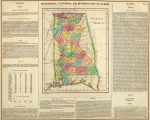
1822 Alabama
1822 Geographical, Historical, And Statistical Map Of Alabama
-
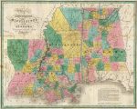
1827 Atlas Map of Alabama, Mississippi, and Louisiana
Constructed from the Latest Authorities – Relief shown by hachures. Prime meridian Washington. Statistical table for each state. Marshlands along Gulf of Mexico well.
-
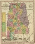
1836 Atlas Map Of Alabama
With Its Roads & Distances from place to place, along the Stage & Steam Boat Routes
-
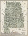
1845 Atlas Map of Alabama
Col. wax engraved map. Relief shown by hachures. Prime meridians: Greenwich and Washington.
-
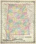
1856 Atlas Map of Alabama
-

1866 State of Alabama Map
It is noted that the whole central region in underlaid with iron ore. Also found are coal and lead ore.
-

1880 County map of the states of Georgia and Alabama
Includes Savannah, Georgia and the City of Atlanta, the capitol of Georgia. Shows settlements, railroads, rivers, etc. Prime meridians: Greenwich and Washington.
D.O.T. County Road and Highway Maps of Alabama
To View the Map: Just click the image to view the map online. In order to make the image size as small as possible, they were saved on the lowest resolution.
Alabama Map Links
- Alabama State Parks Map (mapofus.org)
- Alabama Lakes and Rivers Map (mapofus.org)
- Alabama Map With Cities and Highways (mapofus.org)
- U.S., Indexed County Land Ownership Maps, 1860-1918 (ancestry.com)
- Alabama Digital Map Library (usgwarchives.net)
- Old Historical Maps of Alabama (alabamamaps.ua.edu)
- Alabama Maps, Atlases & Gazetteers (ancestry.com)
- Alabama Civil War Maps
- Rucker Agee Map Collection (mcwetboy.net),
- Omni Gazetteer of the United States of America: National Edition (amazon.com)
- Tracing Your Alabama Past by Robert S. Davis (amazon.com)
- Alabama: Atlas of Historical County Boundaries (Atlas of Historical County Boundaries)
- Alabama Map Books
- Volume 1 of Historical Atlas of Alabama (amazon.com)
- Live Gulf Shores: Maps (al.com)
- Alabama Maps – The Perry-Castañeda Library Map Collection (lib.utexas.edu)
- Lake Martin Maps (lakemartin.com) Interactive maps of Lake Martin, including Tallapoosa Creek, Kowaliga Bay, and Big Kowaliga Creek. Map links include aerial photos, marina locations, parks, and notable landmarks.
- Alabama State Maps Collection (geology.com)
- American Memory Map Collection: 1500-2004 (memory.loc.gov)
- Alabama Dept. of Transportation maps (dot.state.al.us)
- Alabama Genealogy: Maps (alabamagenealogy.org)
- Alabama Maps (cber.cba.ua.edu)
- AL County Maps (http://www.censusfinder.com/mapal.htm)
- The History of the Black Belt (southernspaces.org)
- Panoramic Maps, 1847-1929 (memory.loc.gov)
- A list of nineteenth-century maps of the State of Alabama (amazon.com)

