An illustrated town map
Download & use this map
This map is free to use. Towns, tourism offices, businesses, schools and bloggers are welcome to share it on websites, in newsletters or on social media. All we ask is a credit link back to this page. The easiest way to do that is the embed code below.
Embed this map on your site
About Rock Springs
Rock Springs grew up around Union Pacific coal mines in southwest Wyoming, drawing miners from more than 50 countries and earning the nickname "Home of 56 Nationalities." Today the historic downtown, the Rock Springs Historical Museum and nearby wild horse loop and high desert make it a base for exploring Sweetwater County.
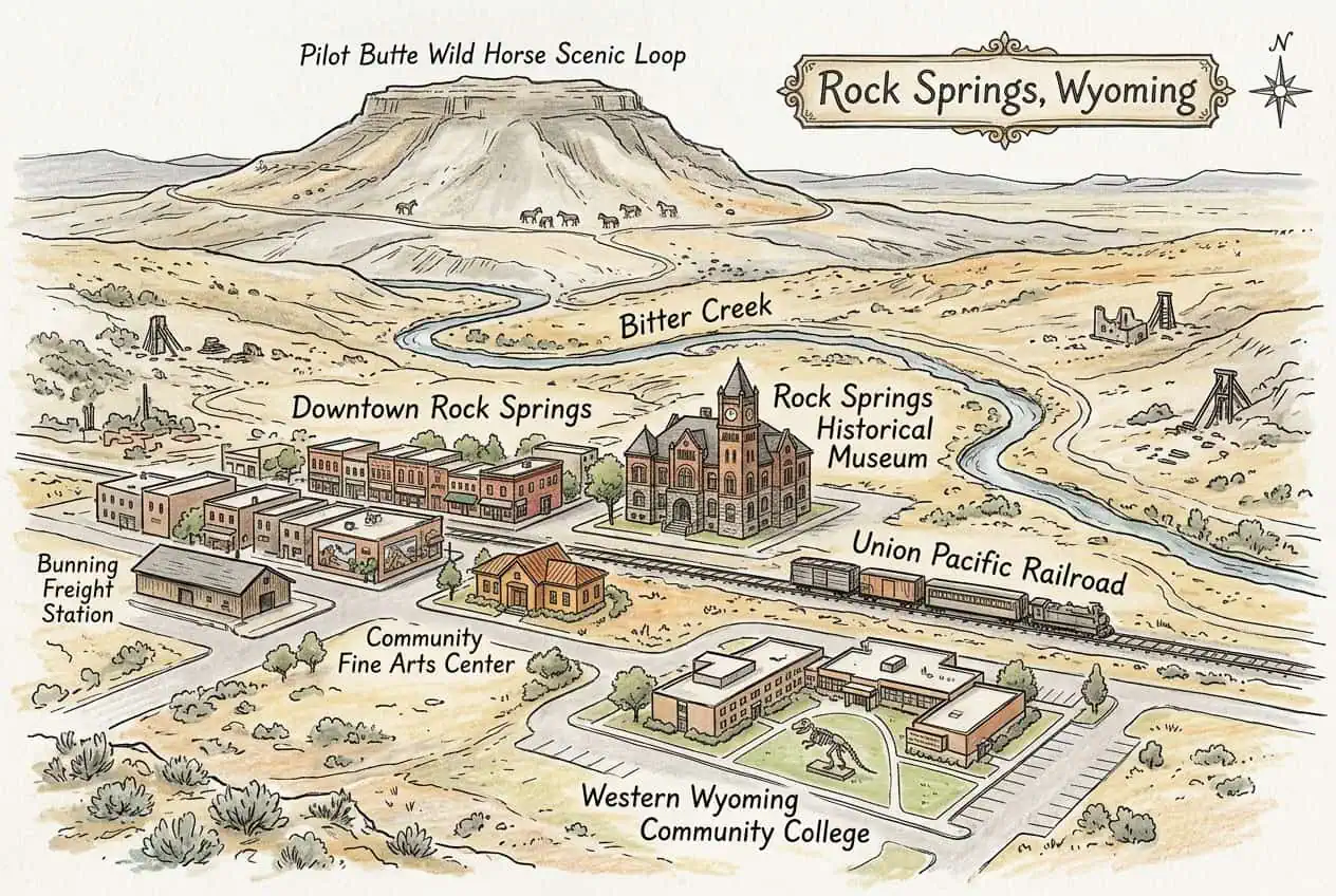
This free illustrated map pulls together the places that give Rock Springs its character, including Rock Springs Historical Museum, Downtown Rock Springs, Community Fine Arts Center and Western Wyoming Community College. Every label on the map is listed below with a short description and a link to learn more.
Rock Springs at a glance
Notable places
- Rock Springs Historical MuseumHistory museum in the 1894 Romanesque former City Hall
- Downtown Rock SpringsHistoric main street district with shops, murals and the Bunning Freight Station
- Community Fine Arts CenterArt museum with one of the region's notable collections
- Western Wyoming Community CollegeCollege campus with a natural history museum and dinosaur casts
- Pilot Butte Wild Horse Scenic LoopScenic drive where wild horses roam the high desert
- Bitter CreekCreek that runs through the center of town
- Union Pacific RailroadRail line that founded the town, running along downtown
- City of Rock SpringsOfficial local government website
- explorewy.comVisitor and tourism information for Rock Springs
More maps of Wyoming
See where Rock Springs sits in the state on our Wyoming county map, or browse more illustrated Wyoming town maps.
Population and area figures come from the U.S. Census Bureau; other facts from the sources linked on each card. Place links go to each place’s official website where it has one, otherwise to its Wikipedia article. The map is an artistic illustration and isn’t to scale.