Hawaii, located in the Pacific Ocean, is a state known for its stunning natural beauty, rich culture, and warm hospitality. With its pristine beaches, lush rainforests, and active volcanoes, Hawaii offers a unique blend of adventure and relaxation. To help visitors and residents navigate this beautiful state, we have created a detailed map of Hawaii with cities and highways.
This map highlights Hawaii’s major cities, including Honolulu, Hilo, Kailua-Kona, and Lahaina, as well as its primary highways and roads. Whether you’re planning a road trip or simply want to explore Hawaii’s unique landscape and culture, this map is an essential tool. So, grab your map and get ready to discover all that Hawaii has to offer, from its world-famous beaches to its breathtaking natural landmarks and everything in between.
Printable Hawaii Map With Cities and Highways

Cities
Captain Cook
Captain Cook is a charming census-designated place (CDP) located in the District of South Kona in Hawaiʻi County, Hawaiʻi, in the United States. The community, situated within the land division of Kealakekua, is named after the Captain Cook Coffee Co., where the post office for the area was located during the early 1900s.
As of the 2010 census, the CDP population was 3,429, which was an increase from 3,206 at the 2000 census. The town is a popular destination for tourists, thanks to its beautiful beaches, stunning natural scenery, and rich cultural heritage. However, as of March 2022, a resolution was under consideration to rename the town to “Kawa’aloa,” which means “long landing place.”
Regardless of its name, Captain Cook remains an important part of Hawaiʻi’s history and culture, attracting visitors from all over the world who come to experience the town’s unique beauty and charm.
Halawa
Halawa is a picturesque census-designated place (CDP) located in the ‘Ewa District of Honolulu County, Hawaii, United States. The town is named after the Halawa Stream, which branches into two valleys: North and South Halawa. The North Halawa is the larger stream and a significant fluvial feature.
The confluence of the two valleys is within the H-3/H-201 highways exchange. Most of Halawa Valley remains undeveloped, making it a popular destination for nature enthusiasts who come to experience the stunning beauty of the area. As of the 2020 census, the CDP had a population of 15,016, making it one of the most populous areas in the region.
Halawa is a culturally rich town, with a unique blend of Hawaiian and Asian influences that can be seen in its art, architecture, and cuisine. Visitors to the town can enjoy a range of activities, from hiking and camping to shopping and dining in the local markets and restaurants.
Hilo

Hilo is a vibrant and bustling settlement in Hawaii County, Hawaii, United States, which encompasses the Island of Hawaii. It is also a census-designated place (CDP) and the largest settlement in the state outside of Oahu, with a population of 44,186 according to the 2020 census.
As the county seat of the County of Hawaiʻi, Hilo is a hub of activity and culture. The city overlooks Hilo Bay and offers stunning views of two shield volcanoes, Mauna Loa, an active volcano, and Mauna Kea, a dormant volcano. The Hilo bay-front has been destroyed by tsunamis twice. The majority of human settlement in Hilo stretches from Hilo Bay to Waiākea-Uka, on the flanks of the volcanoes.
Hilo is home to the University of Hawaiʻi at Hilo, ʻImiloa Astronomy Center, and the Merrie Monarch Festival, a week-long celebration of ancient and modern hula that takes place annually after Easter. The town is also home to the Mauna Loa Macadamia Nut Corporation, one of the world’s leading producers of macadamia nuts. Hilo is served by Hilo International Airport, making it easily accessible to visitors from around the world.
Honolulu
Honolulu is a bustling and vibrant city that serves as the capital and most populous city of the U.S. state of Hawaii, which is in the Pacific Ocean. It is the unincorporated county seat of the consolidated City and County of Honolulu, situated along the southeast coast of the island of Oʻahu, and is the westernmost and southernmost major U.S. city. Honolulu serves as Hawaii’s main gateway to the world and is a major hub for business, finance, hospitality, and military defense in both the state and Oceania.
The city is a melting pot of various Asian, Western, and Pacific cultures, reflected in its diverse demography, cuisine, and traditions. The name “Honolulu” means “sheltered harbor” or “calm port” in Hawaiian and reflects the city’s importance as a port in the Hawaiian archipelago and the broader Pacific region. Honolulu has been the capital of the Hawaiian Islands since 1845.
The city gained worldwide recognition following the Empire of Japan’s attack on nearby Pearl Harbor on December 7, 1941, which prompted the entry of the U.S. into World War II. The harbor remains a major U.S. Navy base, hosting the United States Pacific Fleet, the world’s largest naval command.
Kahului
Kahului is a vibrant and bustling unincorporated community and census-designated place (CDP) located in Maui County in the U.S. state of Hawaii. The town is home to the county’s main airport, Kahului Airport, a deep-draft harbor, light industrial areas, and commercial shopping centers. With a population of 28,219 according to the 2020 census, Kahului is an important hub for commerce and industry in the region.
The town is part of the Kahului-Wailuku-Lahaina Metropolitan Statistical Area, which comprises all of Maui County, including nearby Wailuku and the town and former whaling village of Lahaina. Kahului is the retail center for Maui County residents, with several malls and major stores, including department stores in the Queen Kaahumanu Center.
The town is also home to a range of cultural and natural attractions, including the Alexander & Baldwin Sugar Museum, Kanaha Pond State Wildlife Sanctuary, Kanaha Beach County Park, and the Maui Arts and Cultural Center.
Kalaoa

Kalaoa is a charming census-designated place (CDP) located in Hawaiʻi County, Hawaiʻi, United States. The town has a population of 9,644 as of the 2010 census, which is an increase from 6,794 residents at the 2000 census. Kalaoa is a popular destination for visitors to Hawaii, thanks to its stunning natural beauty and rich cultural heritage.
The town is known for its beautiful beaches, crystal-clear waters, and lush tropical vegetation. Visitors to the area can enjoy a range of activities, from hiking and camping to swimming and snorkeling. The town is also home to a range of cultural attractions, including museums, art galleries, and historic sites. With its warm climate, friendly locals, and breathtaking scenery, Kalaoa is a must-visit destination for anyone traveling to Hawaii.
Kalaupapa

Kalaupapa is a small unincorporated community and Hawaiian homeland located on the island of Molokaʻi, within Kalawao County in the U.S. state of Hawaii. The town has a rich and fascinating history, having been designated as the site for a leper colony in 1866 during the reign of Kamehameha V.
The purpose of the colony was to quarantine patients who were seriously affected by leprosy (also known as Hansen’s disease) and prevent them from infecting others. At the time, the disease was little understood, and it was believed to be highly contagious and incurable until the advent of antibiotics. The communities where people with leprosy lived were under the administration of the Board of Health, which appointed superintendents on the island.
Today, Kalaupapa is a living testament to the strength and resilience of those who were affected by this devastating disease. The town is a popular destination for visitors to Hawaii, who come to learn about the history of the colony and pay their respects to those who lived and died there.
Kapaa
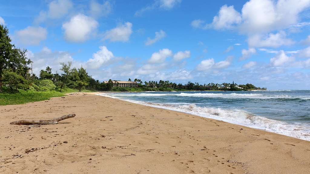
Kapaʻa is a charming and vibrant unincorporated community and census-designated place (CDP) located in Kauaʻi County, Hawaiʻi, United States. The town is the most populous on the island of Kauai, with a population of 11,652 as of the 2020 census, which is an increase from 9,471 at the 2000 census.
Kapaʻa is a picturesque town that offers visitors a glimpse into the rich cultural heritage of Hawaii. The town is known for its stunning beaches, crystal-clear waters, and lush tropical vegetation. Visitors to the area can enjoy a range of activities, from hiking and camping to swimming and snorkeling.
The town is also home to a range of cultural attractions, including museums, art galleries, and historic sites. The name “Kapaʻa” is a Hawaiian adjective meaning “solid,” which reflects the town’s strong sense of community and cultural identity. With its warm climate, friendly locals, and breathtaking scenery, Kapaʻa is a must-visit destination for anyone traveling to Hawaii.
Kaumalapau

Kaumalapau is a small and picturesque unincorporated community located in Maui County on the island of Lanai in the state of Hawaii. The town is known for its stunning natural beauty and rich cultural heritage, which draws visitors from around the world. The name “Kaumalapau” is derived from the Hawaiian language and means “soot placed in gardens,” which reflects the town’s history as an agricultural center.
Interestingly, Kaumalapau was declared the “most difficult to pronounce” place name in the state of Hawaii by Reader’s Digest. Despite its tongue-twisting name, the town is a popular destination for visitors to Hawaii, who come to enjoy its beautiful beaches, crystal-clear waters, and lush tropical vegetation. With its warm climate, friendly locals, and gorgeous scenery, Kaumalapau simply must be visited if you’re traveling to Hawaii.
Kekaha
Kekaha is a picturesque census-designated place (CDP) located in Kauaʻi County, Hawaiʻi, United States. The town’s name, “Kekaha,” literally means “the place” in Hawaiian, which reflects the town’s importance as a cultural and historical center.
With a population of 3,715 as of the 2020 census, which is an increase from 3,175 at the 2000 census, Kekaha is a small and close-knit community that offers visitors a glimpse into the rich cultural heritage of Hawaii. The town is known for its stunning beaches, crystal-clear waters, and lush tropical vegetation.
Visitors to the area can enjoy a range of activities, from hiking and camping to swimming and snorkeling. The town is also home to a range of cultural attractions, including museums, art galleries, and historic sites. With its warm climate, friendly locals, and breathtaking scenery, Kekaha is a rewarding location for anyone traveling to Hawaii.
Lanai City
Lāna‘i City is a charming census-designated place (CDP) located on the island of Lāna‘i, in Maui County, Hawai‘i, United States. The town has a population of 3,332 as of the 2020 census and is the island’s commercial center. Lāna‘i City is a popular destination for visitors to Hawaii, thanks to its astonishing natural beauty and rich cultural heritage.
The town square surrounding Dole Park is home to many of the island’s restaurants and shops, making it a hub of activity for locals and tourists alike. The only hospital on the island, Lāna‘i Community Hospital, is located near the park, providing essential medical care to residents and visitors.
Lāna‘i City is also served by Lāna‘i Airport (LNY), which offers convenient access to the island for travelers. With its warm climate, friendly locals, and breathtaking scenery, Lāna‘i City is a must-visit site for anyone traveling to Hawaii.
Lihue
Lihue is a charming unincorporated community and census-designated place (CDP) located in Kauai County, Hawaii, United States. The town is the county seat of Kauai County and is the second-largest on the island of Kauaʻi after Kapaʻa. With a population of 6,455 as of the 2010 census, which is an increase from 5,694 at the 2000 census, Lihue is a bustling and vibrant community that offers visitors a range of attractions and activities.
The town is known for its stunning beaches, crystal-clear waters, and lush tropical vegetation. Visitors to the area can enjoy a range of activities, from hiking and camping to swimming and snorkeling. The town is also home to a range of cultural attractions, including museums, art galleries, and historic sites.
As the county seat, Lihue is an important hub for government and commerce in the region. With its warm climate, friendly locals, and breathtaking scenery, Lihue is a fascinating destination for anyone traveling to Hawaii.
Maili

Māʻili is a charming census-designated place (CDP) located in the Waiʻanae District on the island of Oʻahu, City & County of Honolulu, Hawaiʻi, United States. The town’s name, “Māʻili,” means “pebbly” in Hawaiian, referring to the rounded stones found along the shore. Māʻili is situated along Farrington Highway on Oʻahu’s Leeward Coast, between Māʻili Beach Park to the west and Lualualei Valley to the east.
The town has a population of 11,535 as of the 2020 census and is a small and close-knit community. Māʻili is known for its amazing beaches, crystal-clear waters, and lush tropical vegetation. Visitors to the area can enjoy a range of activities, from hiking and camping to swimming and snorkeling. The town is also home to several dairy farms and vegetable plots, which add to its rural charm.
Two tall, red antennae near the mouth of the Lualualei Valley are parts of the Navcom Radio Transmitting Facility and were the tallest man-made structures in the Western Hemisphere at 1,503 feet when they were built in 1972. With its warm climate, friendly locals, and breathtaking scenery, Māʻili is an attractive location for anyone traveling to Hawaii.
Mountain View
Mountain View is a charming census-designated place (CDP) located in Hawaii County, Hawaii, United States, in the District of Puna. The town has a population of 3,924 as of the 2010 census, which is an increase from 2,799 at the 2000 census. Mountain View is known for its stunning natural beauty and rich cultural heritage, which draws visitors from around the world.
The town is situated in a lush and verdant area, surrounded by towering trees and rolling hills. Visitors to the area can enjoy a range of activities, from hiking and camping to swimming and snorkeling. Mountain View is also home to a range of cultural attractions, including museums, art galleries, and historic sites. With its warm climate, friendly locals, and astounding scenery, Mountain View is a marvelous site for anyone traveling to Hawaii.
Pearl City
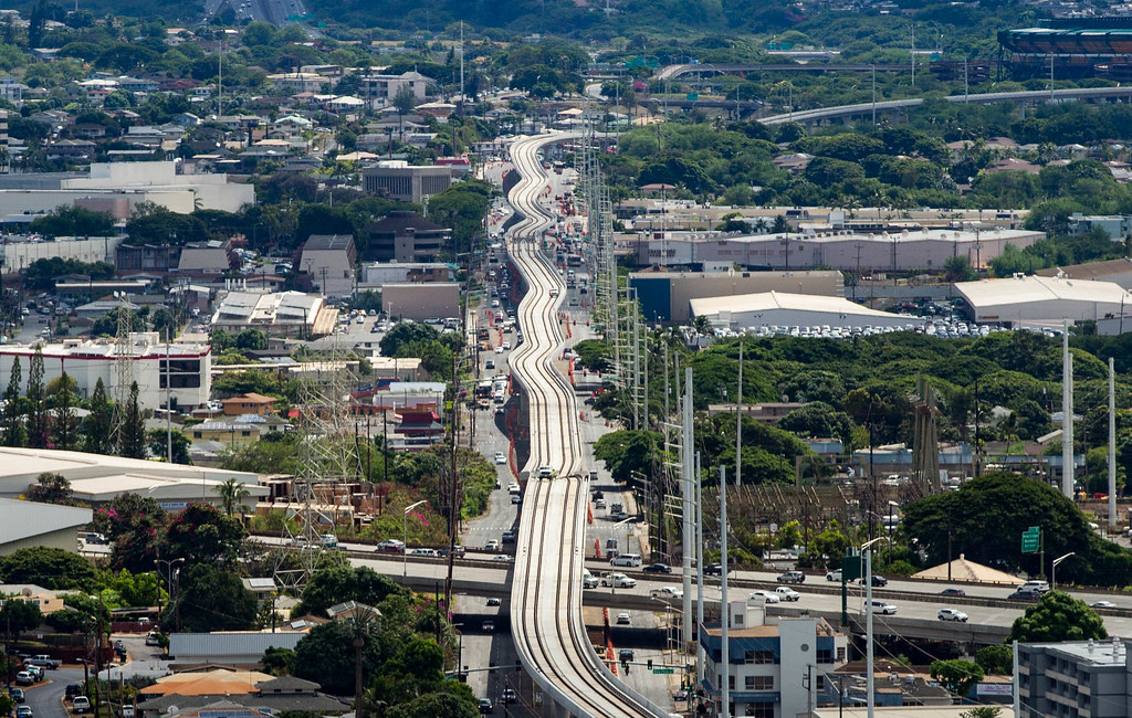
Pearl City is a bustling unincorporated community and census-designated place (CDP) located in the ʻEwa District and City & County of Honolulu on the Island of Oʻahu. The town has a population of 47,698 as of the 2010 census and is a hub of activity for locals and tourists alike.
Pearl City is situated along the north shore of Pearl Harbor, which offers visitors stunning views and a glimpse into the area’s rich naval history. The town is bordered by Waimalu to the east and Waipahu to the west, providing easy access to a range of attractions and activities. Visitors to the area can enjoy a range of activities, from hiking and camping to swimming and snorkeling.
Pearl City is also home to a range of cultural attractions, including museums, art galleries, and historic sites. The U.S. postal code for Pearl City is 96782. With its warm climate, friendly locals, and breathtaking scenery, Pearl City is a richly rewarding spot for anyone traveling to Hawaii.
Puuwai
Puuwai is a unique and charming unincorporated community located in Kauai County, Hawaii, United States, and the only settlement on the island of Niʻihau. The town’s name, “Puuwai,” means “heart” in Hawaiian, reflecting the deep connection of the Native Hawaiians who live in this village to their land and culture. The community is situated on the western coast of the small island and is home to residents who speak the Niihau dialect of the Hawaiian language.
Puuwai’s residents live as they did hundreds of years ago, and the modern amenities of life are extremely limited. Access to the town, as well as the whole island, is limited to Niʻihau residents, and only official visitors and invited guests are permitted.
Puuwai has a one-room schoolhouse, which reflects the town’s commitment to preserving its cultural heritage and passing it on to future generations. With its warm climate, friendly locals, and breathtaking scenery, Puuwai is a great choice for anyone traveling to Hawaii who wants to experience the rich cultural heritage of the Native Hawaiians.
Wahiawa
Wahiawa is a picturesque census-designated place (CDP) located in Honolulu County, Hawaii, United States, on the island of Oahu. The town is situated in the Wahiawā District, on the plateau or “central valley” between the two volcanic mountains that bookend the island. In Hawaiian, wahi a wā means “place of the wa people,” reflecting the town’s rich cultural heritage.
The population of Wahiawa was 18,658 as of the 2020 census, making it a small and close-knit community that offers visitors a glimpse into the beguiling character of Hawaii. The town is known for its stunning natural beauty, with lush vegetation and breathtaking views of the surrounding mountains.
Visitors to the area can enjoy a range of activities, from hiking and camping to swimming and snorkeling. Wahiawa is also home to a range of cultural attractions, including museums, art galleries, and historic sites. With its warm climate, friendly locals, and rich cultural heritage, Wahiawa is a must-visit destination for anyone traveling to Hawaii.
Waialua
Waialua is a charming census-designated place and North Shore community located in the Waialua District on the island of Oʻahu, City & County of Honolulu, Hawaii, United States. The town has a population of 4,062 as of the 2020 census and is a small and peaceful community that offers visitors a glimpse into the rich history and culture of Hawaii.
Waialua was one of the six original districts of ancient Hawaii on the island, known as moku. The town is a former sugar mill town and residential area, quite different in its quiet ambiance from nearby Haleʻiwa, which is more commercial and tourist-oriented. The Waialua Sugar Mill is the center of this town and the historical base of its plantation history.
Visitors to the area can enjoy a plethora of activities, from hiking and camping to swimming and snorkeling. The town is also home to a range of cultural attractions, including museums, art galleries, and historic sites. With its warm climate, friendly locals, and rich cultural heritage, Waialua is an essential area to visit in Hawaii.
Wailuku
Wailuku is a charming census-designated place (CDP) and the county seat of Maui Island, Maui County, Hawaii, United States. The town has a population of 17,697 as of the 2020 census and is a hub of activity for locals and tourists alike. Wailuku is located just west of Kahului, at the mouth of the Iao Valley, which offers visitors stunning views and a glimpse into the area’s rich natural history.
In the early 20th century, Wailuku was the main tourist destination on Maui, though it has since been eclipsed with the rise of the resort towns such as Kaanapali. Today, the town is known for its charming downtown area, which is home to a range of cultural attractions, including museums, art galleries, and historic sites.
Visitors to the area can enjoy a range of activities, from hiking and camping to swimming and snorkeling. With its warm climate, friendly locals, and breathtaking scenery, Wailuku is a must-visit destination for anyone traveling to Hawaii.
Waimanalo
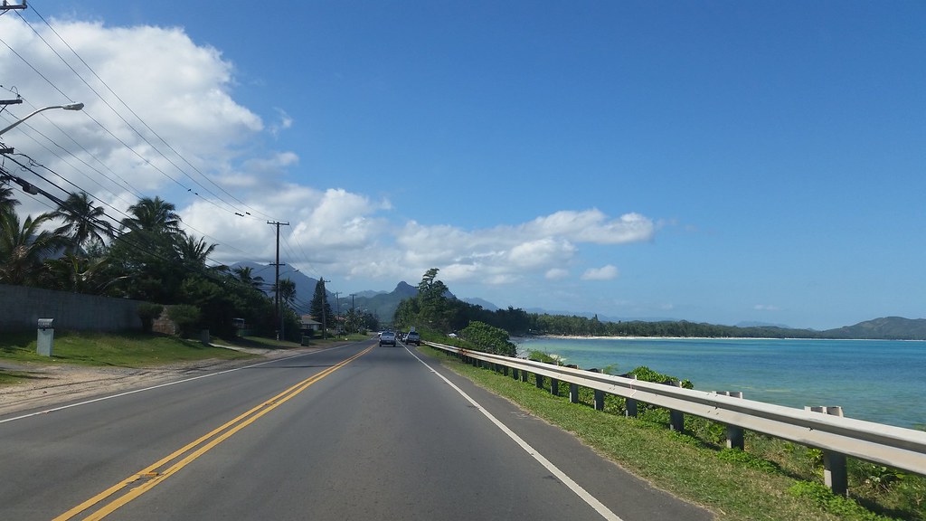
Waimānalo is a small and picturesque census-designated place (CDP) located in the District of Koʻolaupoko, in the City & County of Honolulu, on the island of Oʻahu, Hawaii, United States. The town has a population of 6,057 as of the 2020 census and is known for its rich cultural heritage and stunning natural beauty.
In the Hawaiian language, Waimānalo means “potable water,” reflecting the many brackish ponds in the area that were used for irrigation. About 1000 meters east of Waimānalo is the neighborhood of Waimānalo Beach, which is separated from the town by Bellows Air Force Station. Waimānalo is noteworthy for its local flavor and large agricultural lots in the valley that extend back towards the Koʻolau from the center of town.
Visitors to the area can enjoy a variety of activities, from hiking and camping to swimming and snorkeling. The town is also home to numerous plant nurseries, which reflect the area’s rich agricultural heritage. With its warm climate, friendly locals, and breathtaking scenery, Waimānalo is a wonderful choice for anyone traveling to Hawaii who wants to experience the authentic local flavor of the island.
Waimea

Waimea is a charming census-designated place (CDP) located in Hawaii County, Hawaii, United States. The town has a population of 9,212 as of the 2010 census and is known for its rich cultural heritage and amazing natural beauty. The name Waimea means reddish water, reflecting the area’s unique geological features. Since each U.S. state cannot have more than one post office of the same name, the official U.S. Post Office designation for Waimea is Kamuela, although this name is only used by the post office, not by locals or the local government.
Waimea is the center for ranching activities and paniolo culture. The Parker Ranch in and around Waimea is the largest privately owned cattle ranch in the United States, and the annual Fourth of July rodeo is a major event. The town is also home to a range of cultural attractions, including the Isaacs Art Center, the Wishard Gallery, the Paniolo Heritage Center at Pukalani Stables, and the Gallery of Great Things, all featuring Hawaiian art.
Visitors to the area can enjoy a range of activities, from hiking and camping to swimming and snorkeling. The Waimea Cherry Blossom Heritage Festival, held annually in the first week of February, has recently become another major event in the town. With its warm climate, friendly locals, and breathtaking scenery, Waimea is a tremendous destination for anyone traveling to Hawaii who wants to experience the distinctive paniolo culture and rich cultural heritage of the area.
Highways
Hawaii Route 11
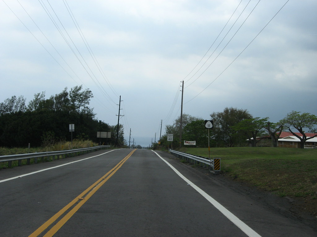
Hawaii Route 11, commonly known as the Hawaiʻi Belt Road, is a modern name for the Māmalahoa Highway and consists of Hawaiʻi state Routes 11, 19, and 190 that encircle the Island of Hawaiʻi. The southern section, between Hilo and Kailua-Kona, is numbered as Route 11.
The section between Hilo and Waimea is Route 19. Between Waimea and Kailua-Kona, the road is split in two: the original “mauka” route (now Route 190) and a “makai” Route 19, completed in 1975, which serves as access to the Kona and Kohala Coast resorts. In the Hawaiian language, mauka means “towards the mountain” and makai means “towards the sea”. These terms are commonly used in travel directions.
Parts of the southern half of the Hawaiʻi Belt Road were known during the Territorial days as the Kaʻū Belt Road. The names “Hawaiʻi Belt Road” and “Māmalahoa Highway” refer to the road system that encircles the entire island; many sections are also referenced by local names. The Hawaiʻi Belt Road is a popular route for tourists and locals alike, offering stunning views of the island’s diverse landscapes and cultural heritage.
Hawaii Route 19
Hawaii Route 19 in Hawaii is a picturesque and historic highway that stretches from Hilo to Kailua-Kona, offering stunning views of the island’s diverse landscapes and cultural heritage. The mile 0 marker for Route 19 is tucked away at the gates to Hilo Wharf on Kūhiō Street, and the highway continues along Kamehameha Avenue, paralleling a closed section of Bayfront Highway.
Past the intersection with Waiānuenue Avenue (Route 200, known as the Saddle Road), Route 19 crosses over the Wailuku River via a converted railroad plate girder bridge with a metal grate roadway that causes tires to “sing” as vehicles pass over it. Leaving Hilo, the route assumes the name Hawaiʻi Belt Road, leaving Māmalahoa Highway to the older decommissioned portions of the original thoroughfare.
Many former sugarcane plantation towns dot the highway, including Wainaku, Paukaʻa, and Pāpaʻikou. One notable landmark along Route 19 is the 1960 Tsunami Memorial Clock, located near the Wailoa River Bridge, which serves as a poignant reminder of the devastating impact of natural disasters on the island.
Visitors to the area can also explore the Onomea Scenic Drive, a 4-mile loop road that crosses several one-lane wooden bridges and past the Hawaiʻi Tropical Botanical Garden overlooking Onomea Bay before returning to Hawaiʻi Belt Road at mile 10 in Pepeʻekeō.
Hawaii Route 30
Hawaii Route 30 in Hawaii, also known as the Honoapiʻilani Highway, is a 35-mile-long road on West Maui that offers expansive views of the island’s diverse landscapes and cultural heritage. It begins in downtown Wailuku, extending south through Waikapu and Maalaea. The Olowalu Tunnel, located at mile 10.4, is a notable landmark along the route, measuring 318 feet long.
Following the terrain of the island, the highway circumvents the West Maui Forest Reserve, connecting Olowalu, Launiupoko, Lahaina, and Kahana, through the regions of Kapalua and Honolua, and ending in Honokohau Bay. At this point, the road continues as the Kahekili Highway, a “notoriously narrow and twisty” county-maintained road covering the northern coastline of West Maui and eventually terminating back in Wailuku.
The eastern part of Kahekili Highway is signed as Hawaii Route 340. Together, the two highways, plus a short stretch of Hawaii Route 32, complete the circular journey around West Maui, offering visitors a unique opportunity to explore the island’s rich cultural heritage and stunning natural beauty.
Hawaii Route 31
Hawaii Route 31 in Hawaii, also known as the Pi’ilani Highway, is a 38-mile road on the island of Maui in Maui County, Hawaii, United States. The highway begins in the town of Ma’alaea and extends southward along the eastern coast of the island, passing through the towns of Kihei, Wailea, and Makena.
The Pi’ilani Highway offers stunning views of the island’s breathtaking coastline and is a popular route for tourists and locals alike. Along the way, visitors can explore a range of cultural attractions, including ancient Hawaiian ruins, beautiful beaches, and scenic overlooks.
The highway is also home to a range of outdoor activities, from hiking and camping to swimming and snorkeling. With its warm climate, friendly locals, and breathtaking scenery, State Road 31 is a wonderful destination for anyone traveling to Maui who wants to experience the distinctive cultural heritage and natural beauty of the island.
Hawaii Route 50
Hawaii Route 50 in Hawaii, also known as Kaumualiʻi Highway, is the longest numbered road on the island of Kauaʻi, stretching 33 miles from Route 56 at the junction of Rice Street in Lihue to a point approximately 1/5 mile north of the northernmost entrance of the Pacific Missile Range Facility on the western shore of Kauai.
The highway offers stunning views of the island’s diverse landscapes, from its beautiful beaches and lush rainforests to its rugged mountains and stunning coastline. Along the way, visitors can explore a range of cultural attractions, including historic Hawaiian sites, charming towns, and beautiful parks.
The highway is also home to a range of outdoor activities, from hiking and camping to swimming and surfing. With its warm climate, friendly locals, and breathtaking scenery, Kaumualiʻi Highway is a must-visit place for anyone traveling to Kauaʻi who wants to experience the spectacular cultural heritage and natural grace of the island.
Hawaii Route 56
Hawaii Route 56 in Hawaii, also known as Kuhio Highway, is the main highway on the north and east shore of Kauaʻi island in Kauai County, Hawaii, United States. The highway stretches for 28 miles from Līhuʻe to the northernmost point of the island at Haʻena State Park.
Along the way, visitors can explore a range of cultural attractions, including historic Hawaiian sites, charming towns, and beautiful beaches. The Kuhio Highway offers stunning views of the island’s diverse landscapes, from its towering mountains and lush rainforests to its pristine coastline and crystal-clear waters.
The highway is also home to a range of outdoor activities, from hiking and camping to swimming and snorkeling. With its warm climate, friendly locals, and breathtaking scenery, Kuhio Highway is an essential destination for anyone traveling to Kauaʻi who wants to experience the amazing cultural heritage and natural landscapes of the island.
Hawaii Route 72
Hawaii Route 72, commonly known as Kalanianaʻole Highway, is the main highway serving southeast Oʻahu. The east-west highway begins at the eastern terminus of Interstate H-1 (H-1) and travels along the southeastern shore of Oʻahu through various residential neighborhoods, including Hawaiʻi Kai.
The highway offers stunning views of the island’s beautiful coastline, with its crystal-clear waters and pristine beaches. It then turns northwest at Makapuʻu and runs through Waimānalo before terminating in Maunawili at an intersection with Kamehameha Highway and Pali Highway. The highway is named for Jonah Kūhiō Kalanianaʻole, a former prince of the Kingdom of Hawaiʻi, who was instrumental in the fight for Native Hawaiian rights and played a significant role in the development of Hawaii as a territory and later as a state.
With its rich cultural heritage, stunning natural beauty, and vibrant communities, Kalanianaʻole Highway is a must-visit destination for anyone traveling to Oʻahu.
Hawaii Route 83
Hawaii Route 83, also known as Kamehameha Highway, is one of the main highways serving suburban and rural O‘ahu in the U.S. state of Hawai‘i. The highway begins at Nimitz Highway near Pearl Harbor and Hickam Air Force Base in Honolulu, serving the island’s older western suburbs, before turning north across the O‘ahu Central Valley to the North Shore.
Along the way, visitors can explore a range of cultural attractions, including historic Hawaiian sites, charming towns, and beautiful beaches. At the North Shore, Kamehameha Highway heads northeast around the northern tip of O‘ahu, offering gorgeous views of the island’s rugged coastline and crystal-clear waters.
The highway then turns southeast to and just beyond Kāne‘ohe Bay on the windward coast, where visitors can enjoy a range of outdoor activities, from hiking and camping to swimming and snorkeling. The road was named after King Kamehameha I, who is considered one of the most important figures in Hawaiian history and played a significant role in the unification of the Hawaiian Islands. With its rich cultural heritage and stunning natural beauty, Kamehameha Highway simply must be visited by anyone traveling to O‘ahu.
Hawaii Route 93
Hawaii Route 93, also known as Farrington Highway, is a major east-west highway on the island of Oahu. The highway begins as Interstate H-1 (H-1) terminates in Kapolei and extends westward, offering incredible views of the island’s beautiful coastline and crystal-clear waters.
Along the way, visitors can explore a range of cultural attractions, including historic Hawaiian sites and charming towns. The highway ends at Kaena Point on the extreme northwest end of Oahu, just past Makaha. At this point, visitors can enjoy a range of outdoor activities, from hiking and camping to swimming and surfing.
With its warm climate, friendly locals, and astonishing scenery, Farrington Highway is a must-visit destination for anyone traveling to Oahu who wants to experience the amazing cultural heritage and beauty of the island.
Hawaii Route 130
Hawaii Route 130 is a state highway located in Hawaii County, Hawaii, United States. The highway runs from Route 11 at Ke’aau and extends through the Puna District to Kaimū. Along the way, visitors can explore a range of cultural attractions, including historic Hawaiian sites, charming towns, and beautiful beaches.
The highway offers stunning views of the island’s diverse landscapes, from its lush rainforests and rugged mountains to its pristine coastline and crystal-clear waters. At Kaimū, visitors can explore the site of the former village that was destroyed by a volcanic eruption in 1990.
Despite the destruction, the area has since become a popular tourist destination, with visitors coming to see the black sand beach and the new lava formations. With its warm climate, friendly locals, and breathtaking scenery, Hawaii Route 130 is a must-visit destination for anyone traveling to Hawaii County who wants to experience the distinctive cultural and geographical heritage of the island.
Hawaii Route 190
Hawaii Route 190, also known as Māmalahoa Highway, begins at the Lindsey Road (Route 19) intersection and runs through the South Kohala District, offering stunning views of the island’s rolling pasturelands and lava fields. The highway was originally the Hilo-to-Kona link and served as Highway 19 until the route was reassigned in 1975 to the newly opened Queen Kaʻahumanu Highway along the coast.
Along the way, visitors can explore a range of cultural attractions, including historic Hawaiian sites, charming towns, and beautiful beaches. The highway passes through Camp Tarawa, the Parker Ranch headquarters, and the Waimea-Kohala Airport before traversing the rolling pasturelands of the South Kohala District.
Few intersections are found along the next 20 miles, with Saddle Road (Route 200) coming to its western terminus near mile 6 and Waikōloa Road ending its 12-mile climb from Queen Kaʻahumanu Highway at Māmalahoa Highway’s mile 11 marker. At a 3-way intersection, the Māmalahoa Highway turns left and becomes Route 180, while Route 190 continues straight, becoming Palani Road.
Palani descends steeply towards Kailua-Kona, making many quick turns and narrow curves before meeting Queen Kaʻahumanu Highway, marking the end of the route. With its warm climate, friendly locals, and breathtaking scenery, Hawaii Route 190 is a must-visit destination for anyone traveling to the Big Island of Hawaii who wants to experience the amazing cultural background and natural geography of the island.
Hawaii Route 200
Hawaii Route 200, also known as Saddle Road, traverses the width of the Island of Hawaiʻi, from downtown Hilo to its junction with Hawaii Route 190 near Waimea. The road was once considered one of the most dangerous paved roads in the state, with many one-lane bridges and areas of marginally maintained pavement. However, most of the road has now been repaved, and major parts have new re-alignments to modern standards.
The highway is mostly one lane in each direction, but there are two lanes on the uphill portions. The highway reaches a maximum elevation of 6,632 feet (2,021 m) and is subject to fog and low visibility. Despite its challenges, Saddle Road experiences heavy use as it provides the shortest driving route from Hilo to Kailua-Kona and access to the slopes of Mauna Loa and the Mauna Kea Observatories.
Visitors can enjoy expansive views of the island’s diverse landscapes, from its lush rainforests and rugged mountains to its vast lava fields and crystal-clear waters. With its warm climate, friendly locals, and astounding scenery, Hawaii Route 200 is a must-visit destination for anyone traveling to the Big Island of Hawaii who wants to experience the cultural heritage and natural attractions of the island.
Hawaii Route 270
Hawaii Route 270, also known as the ʻAkoni Pule Highway, is a state highway located in Hawaii County, Hawaii, United States. The highway is the main road along the North Kohala Coast on the Island of Hawaiʻi, running from Kawaihae to ʻUpolu Point and then on to Pololū Valley Lookout.
The entire route is 27.0 miles (43.5 km) long, offering stunning views of the island’s rugged coastline, pristine beaches, and crystal-clear waters. Along the way, visitors can explore a range of cultural attractions, including historic Hawaiian sites, charming towns, and beautiful natural landmarks.
The highway is named after ʻAkoni Pule, a Hawaiian chief who played a significant role in the history of the North Kohala region. With its warm climate, friendly locals, and breathtaking scenery, Hawaii Route 270 is a fulfilling destination for anyone traveling to Hawaii County who wants to enjoy the special culture and beauty of the island.
Hawaii Route 360
Hawaii Route 360, also known as the Hana Highway or The Road to Hana, is a 64.4-mile-long stretch of Hawaii Routes 36 and 360 that connects Kahului to the town of Hana in east Maui. To the east of Kalepa Bridge, the highway continues to Kipahulu as Hawaii Route 31 (the Piilani Highway). The road is famous for its winding, narrow, and scenic route that passes over 59 bridges, of which 46 are only one lane wide.
The highway is surrounded by lush, tropical rainforest, with approximately 620 curves along Route 360 from just east of Kahului to Hana. Many of the concrete and steel bridges date back to 1910 and all but one are still in use. The one bridge that was badly damaged by erosion has been replaced by a portable steel ACROW or Bailey bridge erected by the United States Army Corps of Engineers.
Despite the challenging driving conditions, the Hana Highway is a brilliant destination for anyone traveling to Maui who wants to experience the island’s natural beauty and unique cultural heritage. Visitors can explore a range of cultural attractions, including historic Hawaiian sites, charming towns, and beautiful natural landmarks along the way.
Hawaii Route 440
Hawaii Route 440 is a 13.2-mile-long state highway on the island of Lanai in Hawaii. The highway offers stunning views of the island’s natural beauty, from its pristine beaches and crystal-clear waters to its rugged mountains and lush forests. Along the way, visitors can explore a range of cultural attractions, including historic Hawaiian sites, charming towns, and beautiful natural landmarks.
Despite its relatively short length, Hawaii Route 440 is a must-visit destination for anyone traveling to Lanai who wants to experience the unique cultural heritage and landscapes of the island. Visitors can enjoy a range of outdoor activities, from hiking and camping to swimming and surfing, and can explore the island’s diverse landscapes and rich cultural history. With its warm climate, friendly locals, and breathtaking scenery, Hawaii Route 440 is a true gem of Hawaii’s state highway system.
Hawaii Route 450
Hawaii Route 450 is a secondary state highway located in Hawaii County, Hawaii, United States. It is part of the smallest state-maintained system of state highways in the country, maintained by the Hawaii Department of Transportation (HDOT). The state’s system of highways consists of Interstates, state highways, and secondary state highways, totaling approximately 1,013 miles (1,630 km).
The state’s four Interstates, all located on O‘ahu, are built to mainland standards, unlike their counterparts in Alaska and Puerto Rico. The first three routes (H-1, H-2, and H-3) were approved in 1960, while an auxiliary route (H-201) was added in 1989.
Despite its relatively small size, the state’s highway system offers stunning views of the island’s natural beauty, from its pristine beaches and crystal-clear waters to its rugged mountains and lush forests. With its warm climate, friendly locals, and astonishing scenery, Hawaii Route 450 is a great spot for anyone traveling to Hawaii County who wants to savor the unique cultural heritage and natural beauty of the island.
Interstates
H1
Interstate H-1, also known as the Lunalilo Freeway and the Queen Liliʻuokalani Freeway, is the longest and busiest Interstate Highway in Hawaii. The highway runs from Route 93 (Farrington Highway) in Kapolei to Route 72 (Kalanianaole Highway) in Kāhala, covering a distance of approximately 27 miles. Despite its number, H-1 is an east-west highway, with the ‘H’-series numbering reflecting the order in which routes were funded and built.
The highway is both the southernmost and westernmost signed Interstate Highway located in the US, and offers stunning views of the island’s natural beauty, from its pristine beaches and crystal-clear waters to its rugged mountains and lush forests. With its warm climate, friendly locals, and breathtaking scenery, H-1 is a brilliant choice for anyone traveling to Oʻahu who wants to experience the impressive culture and beauty of the island.
H2
Interstate H-2, also known as the Veterans Memorial Freeway, is an intrastate Interstate Highway located on the island of Oʻahu in Hawaii. The north-south freeway connects H-1 in Pearl City to Mililani and Wahiawa, terminating at Route 99 near Schofield Barracks. The highway was assigned to the north-south connection between the Honolulu area and Wahiawa in 1960 as part of the expansion of the Interstate System to Hawaii.
Construction began in 1971, and the first section opened to traffic on October 3, 1974. The rest of H-2 was completed on February 21, 1977. The highway offers stunning views of the island’s natural beauty, from its pristine beaches and crystal-clear waters to its rugged mountains and lush forests. With its warm climate, friendly locals, and dazzling scenery, H-2 is a must-visit destination for anyone traveling to Oʻahu who wants to see the unique cultural heritage and geographic beauty of the island.
H3
Interstate H-3, also known as the John A. Burns Freeway, is an Interstate Highway located entirely within the US state of Hawaii on the island of Oʻahu. The highway crosses the Koʻolau Range along several viaducts and through the 5,165-foot-long Tetsuo Harano Tunnels as well as the much smaller Hospital Rock Tunnels. Despite its number, the signage is that of an east-west highway. Its western terminus is at an interchange with H-1 at Halawa near Pearl Harbor, while its eastern end is at the main gate of Marine Corps Base Hawaii (MCBH).
H-3 satisfies the national defense purpose of connecting MCBH with the US Navy port at Pearl Harbor off H-1. The orders for the freeway were granted in 1960, followed by planning stages. Construction, amid enormous community protest, was begun in the late 1980s, although the road did not open until December 12, 1997. H-3 was one of the most expensive Interstate Highways ever built, costing $1.3 billion, or approximately $80 million per mile.
Despite the challenges, H-3 offers stunning views of the island’s natural beauty, from its rugged mountains and lush forests to its pristine beaches and crystal-clear waters. With its warm climate, friendly locals, and impressive scenery, H-3 is an essential location for anyone traveling to Oʻahu who wants to experience the natural beauty of the island.
H201
Interstate H-201, also known as the Moanalua Freeway, is the only auxiliary Interstate Highway located outside the contiguous United States, serving the island of Oʻahu in Hawaii. The 4.1-mile-long loop route connects exits 13 and 19 on H-1, passing Fort Shafter, Tripler Army Medical Center, and the Red Hill Underground Fuel Storage Facility.
Despite being designated an Interstate in 1989, the route was unsigned until mid-2004 signed only as Route 78. The section of the Moanalua Freeway between Route 99 (Kamehameha Highway) and the western H-1 interchange remains designated as Route 78.
The highway offers stunning views of the island’s natural beauty, from its rugged mountains and lush forests to its pristine beaches and crystal-clear waters. With its warm climate, friendly locals, and spectacular scenery, H-201 is a perfect destination for anyone traveling to Oʻahu who wants to experience the special culture and beauty of the island.

