An illustrated town map
Download & use this map
This map is free to use. Towns, tourism offices, businesses, schools and bloggers are welcome to share it on websites, in newsletters or on social media. All we ask is a credit link back to this page. The easiest way to do that is the embed code below.
Embed this map on your site
About Cheyenne
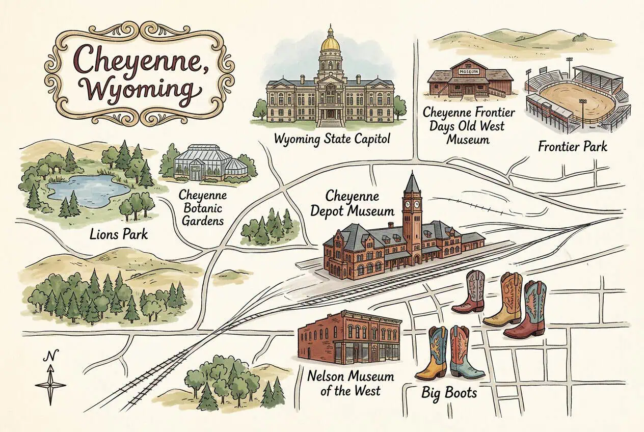
Cheyenne is Wyoming's capital and largest city, founded in 1867 when the Union Pacific reached the high plains. The gold-domed Capitol, the 1887 Cheyenne Depot and the Cheyenne Frontier Days rodeo, the world's largest outdoor rodeo, define the city.
This free illustrated map pulls together the places that give Cheyenne its character, including Wyoming State Capitol, Cheyenne Depot Museum, Cheyenne Frontier Days Old West Museum and Frontier Park. Every label on the map is listed below with a short description and a link to learn more.
Cheyenne at a glance
Notable places
- Wyoming State CapitolRestored 1880s Capitol with a gold-leaf dome
- Cheyenne Depot MuseumMuseum in the 1887 Union Pacific depot
- Cheyenne Frontier Days Old West MuseumMuseum of the world's largest outdoor rodeo
- Frontier ParkRodeo grounds of Cheyenne Frontier Days
- Cheyenne Botanic GardensGardens and conservatory in Lions Park
- Lions ParkLarge park with Sloans Lake
- Nelson Museum of the WestWestern art and artifacts museum
- Big BootsPainted 8-foot cowboy boot sculptures around town
- City of CheyenneOfficial local government website
- cheyenne.orgVisitor and tourism information for Cheyenne
More maps of Wyoming
See where Cheyenne sits in the state on our Wyoming county map, or browse more illustrated Wyoming town maps.
Population and area figures come from the U.S. Census Bureau; other facts from the sources linked on each card. Place links go to each place’s official website where it has one, otherwise to its Wikipedia article. The map is an artistic illustration and isn’t to scale.