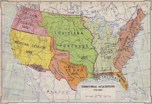
Maps are a critical part of any research. When it comes to determining family history, ancestral lines and immigration/migration patterns, a US map can make a big difference. As boundaries have changed throughout history, it can be difficult to find death certificates or burial sites. Using historical US maps is a great way to accurately learn about your family’s past. They are an invaluable tool for both historians and genealogical researchers.
At critical times in US history, State boundaries have undergone significant changes. Since the founding of America, major events such as the Civil War have contributed to shifting boundary lines. This is important to know when tracing the migration of a particular family – especially during times of slavery. Historical US maps will display original boundaries which when combined with family journals or diaries, can help you pinpoint a person’s true location at the time. As boundaries shift, things like centuries, that were once considered part of one township, may now in fact be belong to another township or county.
The Benefit of the Internet
Depending on exactly what you are trying to research, a combination of both modern and historical US maps could be incredibly useful. In the era of online tools and the internet, it’s also particularly convenient to discover that many of these maps are available online. Now that you know longer have to sift through libraries, archives and dozens of ancient maps, the process is that much easier. Online US maps make it easy to view multiple maps and compare them without having to leave the house.
They Have a Variety of Uses
US maps are also a great resource for school papers and assignments. Credible historical sources make any argument stronger and can help students understand their assignment better – not to mention honing their thesis. You can find US maps for individual States and even towns, and the online format often makes it possible to search via the year. This can make a significant difference because information can change in the blink of an eye. Compare your map with census info, birth, marriage and death records, and you are on your way to building a complete picture.
Why We are Different
Never underestimate the value of good maps. Here at MapsofUS.org, we make it easy to discover US maps, tons of records and other important data. We have cataloged everything from military maps to maps of the British Empire. You will find everything you need to complete or begin your research, with us.
Whether you are an experienced genealogist, a student or just curious, https://www.mapofus.org/ will be a useful tool. Browse our large catalogue of online US maps and historical data to help you better understand your family, and the changing political landscapes of the United States. With us you can discover your family history, where they migrated to over the centuries, and where it all began – it’s only a few clicks away. Our animated US maps will make all the difference and will become an important part of your research, especially if you no longer reside in the area where your family originated. Take advantage of these great maps today.


