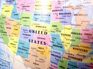
No matter what part of the United States you reside from, everyone is interested in their roots and family tree. If you are thinking about taking on a project of this magnitude, the first task at hand is reviewing a US Map. Why a map? Maps are an essential part of genealogical research for many reasons. A US Map can immediately provide valuable information and facts that can help launch your ancestry project and provide key information points to pursue.

Maps can show you where and when boundaries changed. Some maps offer a bird’s eye view of the city, your family once lived in. They can help you recreate your ancestor’s community and their migration route, leading you to additional resources. Whether the US Map you use is paper or virtual, a map will assist you as you determine the records that may have existed and the places your family lived.
As you begin a research project make sure that you start by finding some historical and modern day maps of the cities, regions, and states your family once lived in to help guide your research. A good historical US Map can be a great first step. Historical maps will show the area for the time period you are researching in. Note, “historical” refers to the time period, not necessarily the age of the maps. They can be of many different types of maps, which reveal different information such as:
A map might show the landowners in a town or who occupied which farms.
A seafront village may have had a very different shape 200 years ago depending on whether the sea is depositing land or taking away.
In areas where large amounts of land were distributed at once, such as New York or Spanish land grants in California, a historical US Map to these early grants gives an entirely different perspective.
A map of early cemeteries can be invaluable in helping you locate family graves.
While the US Map has significantly over the last 200 years, comparing older maps to newer maps of the same area can often provide excellent information about changes in names of different towns and places over time. Such comparisons can also show changes in borders between countries, counties, towns, and other political borders.
With the US Map now going digital, the ability to discover your family history has now become considerably easier. Instead of traveling across the country, tracking down old, frail copies of maps in libraries, this information is available at your fingertips and online. And with that, new avenues of research and historical preservation are opened up. Maps and atlases that were degrading over time are preserved electronically. From Arkansas to Utah, from Colorado to Washington, maps from all over the continental United States are accessible for all who wish to view them. You can find them to at Maps of US. From 1643 to the present, there is a US Map preserved in all its glory. For more information, visit us online today.

